In the developed world, with its developed mapping providers and its developed satellite coverage, GPS is becoming ever more popular amongst automobile drivers. This is happening to the extent that I often wonder if the whole world is now running on autopilot. "In two hundred metres, take the second exit at the roundabout, then take the third left." Call me a luddite and a dinosaur if you must, all ye GPS faithful… but I refuse to use a GPS. I really can't stand the things. They're annoying to listen to. I can usually find a route just fine without them. And using them makes you navigationally illiterate. Join me in boycotting GPS!
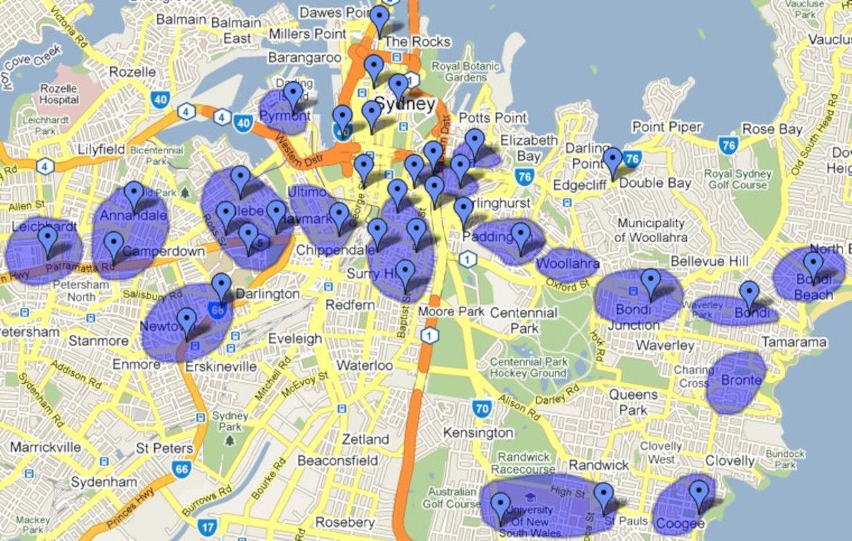
A work colleague of mine recently made a colourful remark to someone. "You live in [boring outer suburb]?", she gasped. "That's so Shelbyville!" Interesting term, "Shelbyville". Otherwise known as "the 'burbs", or "not where the hip-hop folks live". Got me thinking. Where in Sydney is a trendy place for young 20-somethings to live, and where is Shelbyville?
I've lived in Sydney all my life. I've almost always lived quite squarely in Shelbyville myself. However, since the age of 18, I've gotten to know most of the popular nightlife haunts pretty well. And since entering the world of student share-houses, I've also become pretty familiar with the city's accommodation hotspots. So, having this background, and being a fan of online mapping funkiness, I decided to sit down and make a map of the trendiest spots in Sydney to live and play.
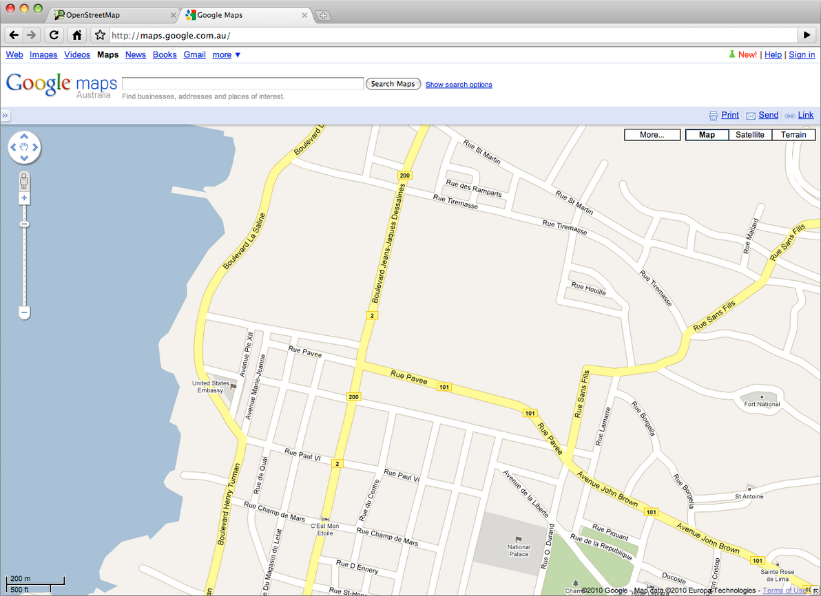
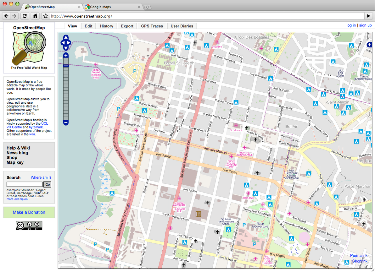
To see just how effective this volunteer mapping effort has been, I decided to do a quick visual comparison experiment. As of today, here's what downtown Port-au-Prince looks like in Google Maps: