Mapping localities of London and surrounds
England is the latest area of the globe that I've been focusing on, as part of my ongoing hobby project, the World Locality Transit Graph. How to carve up Pommyland into areas such that, when a local is asked "where in England are you from?", they'd say "I'm from X".
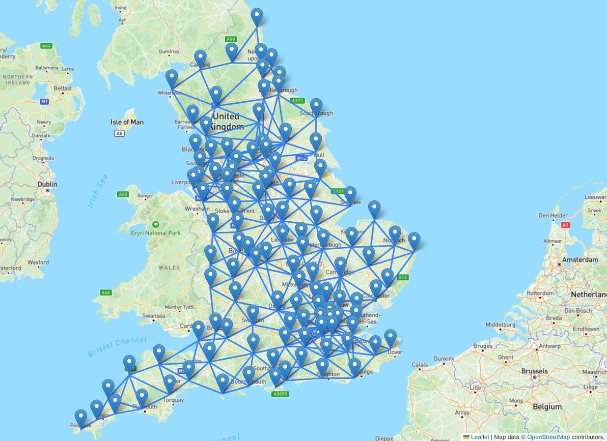
I was originally planning on waiting until I had finished graphing the whole of the British Isles, before penning any thoughts. However, there's more than enough to discuss just within the confines of England (and, from the modest start I've made so far, there will be plenty more to discuss just relating to Wales, Scotland, Northern Ireland and Ireland).
In fact, just a rundown of London and its surrounds is quite the essay, so that's what the scope of this article is limited to (I'd like to pen my thoughts on localities in the rest of England at some point, but not sure when or if that will happen, see how we go).
Plus, I'm keen to start reaching out for feedback sooner rather than later – even though I've researched geographical minutiae quite extensively for this mapping endeavour, I've never lived in England myself, and locals will no doubt be horrified at the abomination that I've created, and will have a plethora of suggestions. This is all an ongoing work in progress! Anyway, here goes.
London and surrounds
The World Locality Transit Graph is all about where people live and move around, and so the London metropolitan area – accounting for about a quarter of England's population – is where I began, and where I focused quite a lot of my effort.
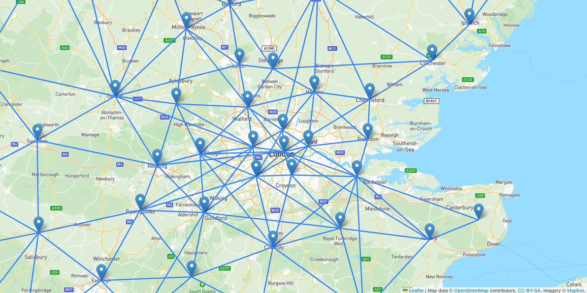
Greater London is far too big, both geographically and population-wise, to lump into just one locality. But it's a complicated beast to divvy up! Administratively it's divided into 32+1 boroughs, but that's too many divisions for my purposes (and the boroughs are pretty arbitrarily defined, and don't reflect cultural or geographic boundaries all that well).
And unlike some big cities (for example my own home town of Sydney, and also New York, where big bays and rivers quite starkly divide the playing field), there aren't a whole lot of clear geographical barriers within London and the Home Counties, and everything kind of just sprawls everywhere.
The only really clear boundary is the River Thames, cutting through the entire area from west to east; and, therefore, the only division that all locals seem able to agree on, is that of North vs South London; and that North London is considered more affluent, whereas South London is rougher around the edges.
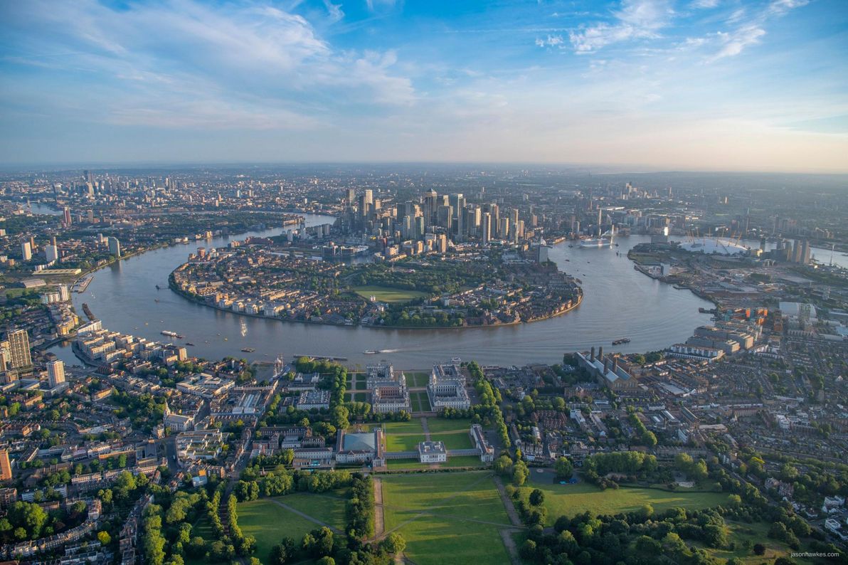
Image source: BBC.
So, I figured I had to at the least include a "North London" and a "South London" locality, plus one for "Central London". For example, I believe that someone from Crouch End would most comfortably identify as being from "North London"; someone from Croydon would have trouble denying they're from "South London"; and someone from Marylebone would identify as being from "Central London".
I had originally divided Greater London further, into eight compass bearings (i.e. N, NE, E, SE, S, SW, W, NW); but, upon further consideration, I decided that that was going overboard. For example, does Walthamstow really need its own locality of "North East London", or will lumping it in with "East London" do? Same with Lewisham and "South East London" vs "South London"; and with Brent Cross and "North West London" vs "North London".
I eventually settled on reducing it to the cardinal directions, plus one – i.e (above-mentioned localities plus): "East London" (for neighbourhoods such as Barking); "West London" (for neighbourhoods such as Ealing); and "South West London" (for neighbourhoods such as Kingston), which seems to be quite distinct from either West London or South London, owing to how extensively the leafy Surrey countryside encroaches in there, and to its containing the ultra-wealthy "Stockbroker Belt" around Esher.
Moving out beyond the M25 belt, I'll circle around counter-clockwise, starting in Essex. I should also note that I've labelled all localities in England with their (ceremonial) count(ies), and I'm referring to them here by county, because counties are an important part of local cultural identity. However (as with many things in the UK!) the situation is incredibly messy / unclear: counties have officially been "replaced" by councils / unitary authorities these days; and ceremonial counties are different to historic counties (and in numerous parts of the UK, the locals hate the modern ceremonial counties and culturally identify much more with the historic counties); and counties can't be considered to be authoritative divisions within the (modern-day) UK the way e.g. states in Australia / the USA, or provinces / regions in many other countries, can be. Anyway – I could write a whole 'nother article about what's up with UK counties (although I doubt I ever will) – I digress!
As with pretty much all the home counties, the sprawl of London bleeds into Essex, making it hard to separate the two. So, rather than try and define a "sorta London sorta Essex" locality right on the border, I've deliberately left the border area as a no-man's-land, thus leaving it up to the locals in question, whether they would identify more with "East London", or more with one of the Essex localities.
Much like London itself, there is apparently a reasonably strong cultural divide in Essex between north and south. Plus there are several population centres – so, I figured, can't realistically get away with just a single "Essex" locality.
In the south, I had originally defined two localities, namely "Southend-Basildon" and "Thurrock"; however, upon further consideration, I decided to group them together under the banner of "South Essex". Moving further up, I settled on just "Chelmsford" for mid Essex, and on just "Colchester" for North Essex (also note that Colchester is pretty well beyond the outer limits of London).
I leave it up to the respective locals, whether Braintree identifies more with Colchester or with Chelmsford. I felt a teeny bit bad about omitting Burnham-on-Crouch, as it's flung out by itself fairly far east – but that area is so sparsely populated, it'll do letting South Essex or Chelmsford cover it.
Next… Hertfordshire! Bloody Herts! Trying to carve up this county really did my head in. I think, more than anywhere else in the London area, there are just mid- to large-sized towns everywhere in Herts, and they bleed into London / Essex / Bedfordshire, and it's really hard, whatever groupings I tried just seemed arbitrary and forced.
Anyway, after much pontificating, I settled on the localities of: "Stort Valley" to cover East Herts and bits of Essex (I had originally called this locality "Epping-Harlow-Stortford", but I prefer to focus on a physical geographical feature if possible); "Stevenage-Welwyn" to cover the middle of Herts; and "Watford-St Albans" to cover the south-west corner of Herts (a bit contentious listing Watford at this point, because it's within the M25 belt and even within the London tube network, however the locals apparently identify fairly staunchly with Herts rather than with London). I leave it to the locals of Hertford / Ware, Letchworth, Hatfield, Hemel, and elsewhere, to determine where their allegiances lie, within this framework!
Next comes Bedfordshire. This was much more straightforward, there are only two big population centres in this county, so I just whacked a "Bedford" locality in the north (note: Bedford is kinda taking us outside the London area), and a "Luton" locality in the south. I also thought long and hard about the possibility of a combined "Luton-Stevenage" locality, owing mainly to how geographically close these two towns are; however, their cultural identities appear to be distinct enough to warrant my not doing this.
Next, Buckinghamshire. Milton Keynes is by far the biggest population centre of the county, and it really dominates the northern half of Bucks, so bam, "Milton Keynes" locality it is (note: Milton Keynes is arguably beyond the limits of the London area due to geographic distance, however the consensus appears to be that it's more in than out these days, owing to its fast frequent rail service to central London and its large commuter population). For southern Bucks, I feel that the defining geographical and cultural "thing" is the Chilterns, so I grouped it all under the "Chilterns" locality.
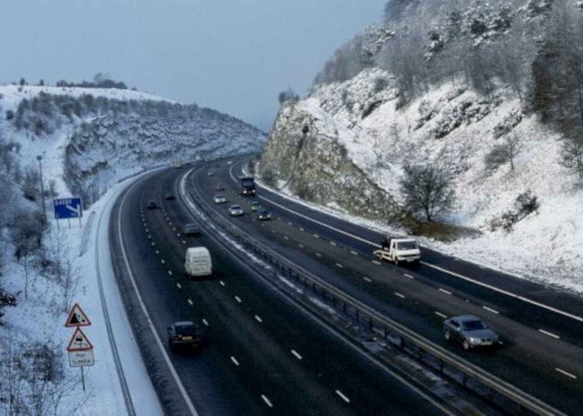
Image source: Wikimedia Commons

I'm chucking in the "Oxfordshire" locality here, because even though it's outside the London area as such (and even though it's not a home county): it's closer and better-connected to London than it is to anywhere else; and there isn't much there besides Oxford itself, so just one locality for the whole county will do; and hey, it's Oxford (the latter point could also be made for Cambridgeshire – i.e. hey, it's Cambridge – but the former two points I feel don't apply to Cambridgeshire to the same extent).
Next, Berkshire. I've grouped this county into east (basically an integral part of London) and west (out in the countryside but still heavily linked to London). The eastern locality I've labelled "Windsor-Slough-Maidenhead", for these three towns that are adjacent to each other (although extremely different to each other in character!); and the western locality I've simply labelled "Reading" (I know, there's more stuff west of Reading… but whatever). I was tempted to put "Thames Valley" into one or both of those labels – because it's the dominant geographic feature of Berkshire – but I ultimately decided against that, mainly because most people would identify the Thames Valley as covering more than just Berkshire.
Chucking in the "Swindon" locality here, because even though it's geographically further from central London than any other locality in this section, it's culturally (commuter workers) and physically (fast frequent rail service) more connected to London, than it is to the rest of its actual county of Wiltshire (e.g. to Salisbury in southern Wiltshire).
And chucking in the "Basingstoke" locality for the same reason: another London commuter town; happens to be in Hampshire, but that doesn't feel a whole lot of affinity with the rest of its county (i.e. Southampton / Winchester on or near the coast).
Next, Surrey (and a bit of Hampshire). Surrey is the only county that I've also deigned to include on one of the London locality labels (i.e. "South West London"), so a fair bit of Surrey is already covered. I chucked various neighbouring towns in south-west Surrey and north-east Hampshire under the label "Guildford-Woking-Blackwater" (I wanted to focus more on physical geography for this label, but I feel that the area has too many things right next to each other, e.g. Surrey Hills / Wey and Blackwater valleys). Then, for eastern Surrey, I lumped it in with the north-east of West Sussex under the label "Crawley".
Finally, completing our circular tour, there's Kent. In the heavily-populated north, I originally had two localities – "Dartford-Gravesend" and "Medway-Maidstone" – but I ultimately decided to amalgamate them into "Medway-Dartford-Gravesend". In south-west Kent (getting into East Sussex), I settled on the label "Tunbridge-Sevenoaks". And heading further out (arguably beyond the farthest reaches of London) "Ashford" and "Canterbury-Dover". I considered renaming these to be consistent with the names of the upcoming four new unitary councils – i.e. North Kent, West Kent, Mid Kent, and East Kent – but I've decided to leave them as-is for now.
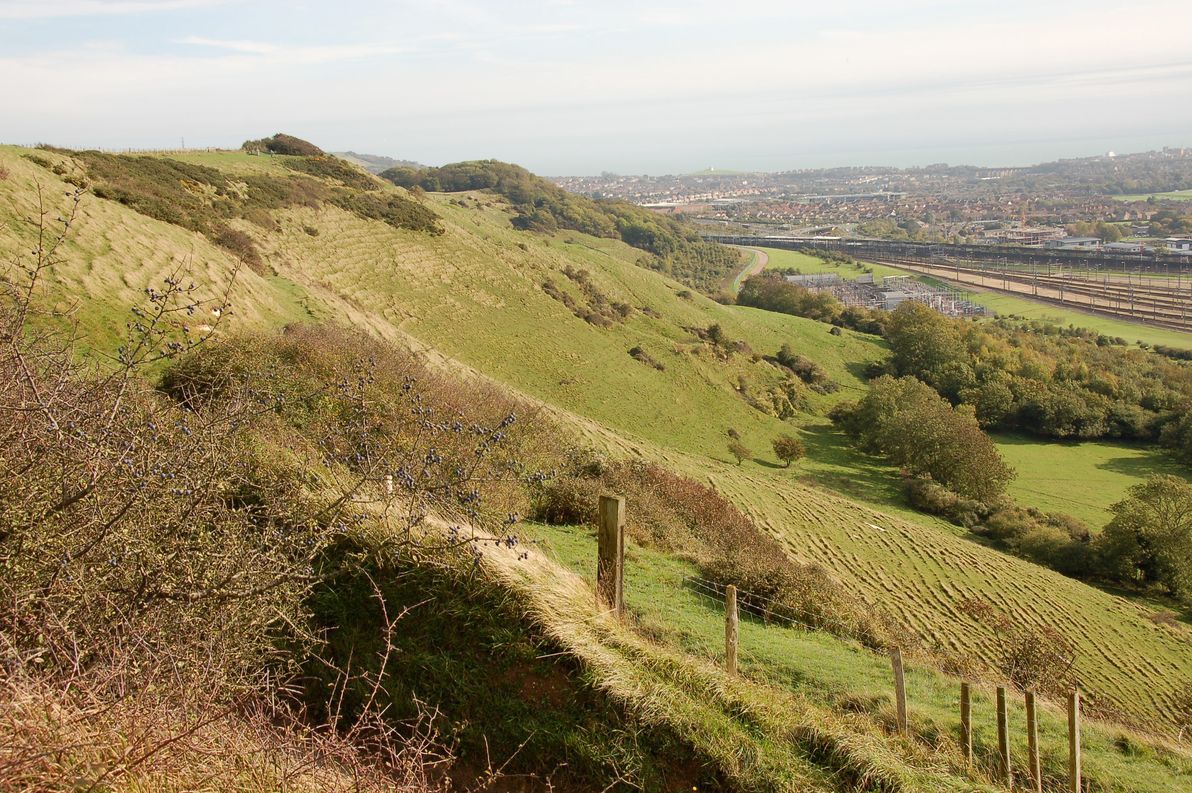
Image source: Wikimedia Commons

I also would have liked to have included some physical geography in the Kentish locality names, however the main geographic features that I had in mind – the Kent Downs and the High Weald – are rather sparsely populated areas, so I didn't feel that it would work for my purposes.
That's all
Well, there you go: my humble attempt at breaking up London and surrounds into localities, such that each locality embodies its own cultural / geographic identity. I'd love to hear your feedback, especially if you're a local. This data is all up on GitHub, contributions are welcome.