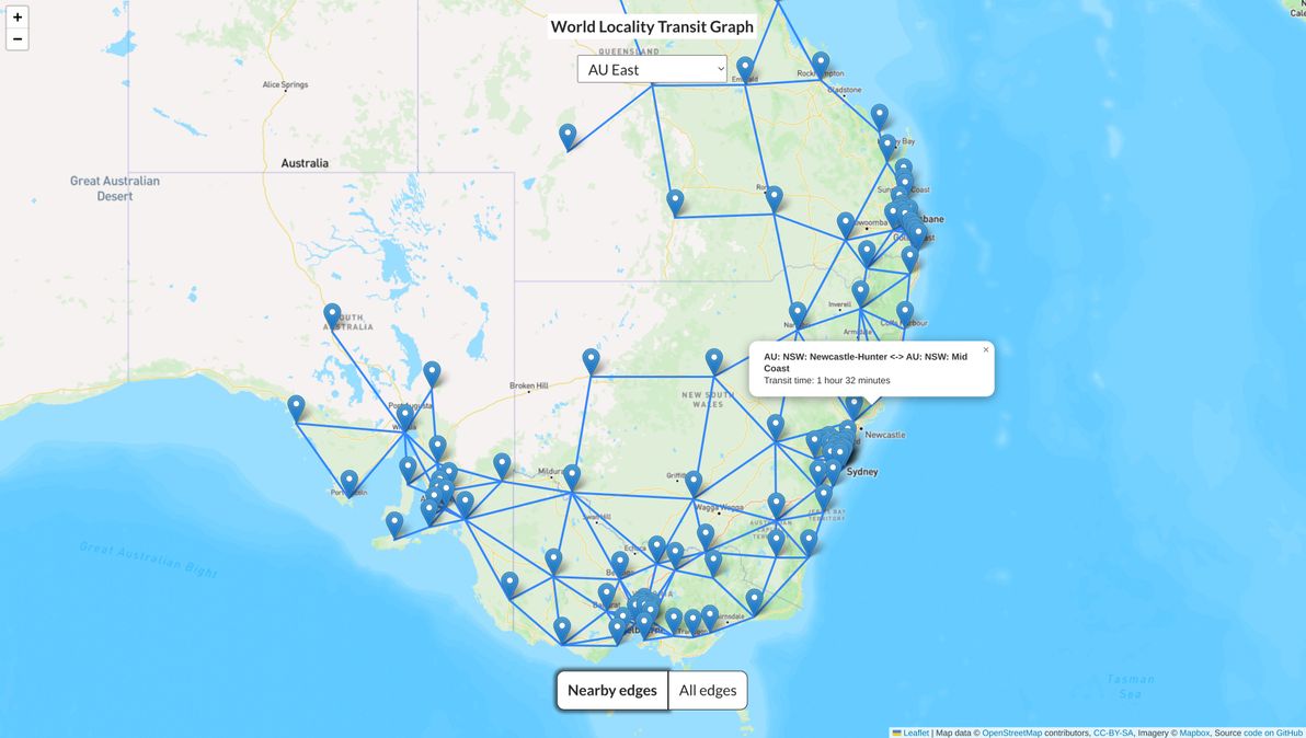
About the graph
(Note: this section is copied from the README that can be seen on GitHub.)
A "locality", for the purposes of the graph, is:
- In a large metropolitan area: a group of neighbourhoods / suburbs, e.g. "inner city", "southern suburbs"; such a locality should (as a rough guide) be 15-30 minutes transit time from its adjacent metropolitan localities
- In a (small urban area or) semi-rural area: the whole main town / city, and usually also neighbouring towns / countryside, e.g. "foobar valley", "fizzbuzz peninsula"; such a locality should (as a rough guide) be 1-2 hours transit time from its adjacent semi-rural localities
- In a remote rural area: all of the towns / countryside within a large area, e.g. "far north", "highlands"; such a locality should (as a rough guide) be 3-5 hours transit time from all adjacent localities
Additionally, regardless of whether it's big-city or middle-of-nowhere:
- Someone who lives in one locality, should consider anyone living in the same locality as being "in my area" (folks in a city of several million people have quite a different definition of "in my area", compared to folks whose next-door neighbour is over the horizon!)
- Each locality should have its own identity, both geographical and cultural; a person who lives in a locality should feel some connection (could be positive or negative!) to their locality's identity
Each locality is represented as a node in the graph. Two localities should be connected as "nearby edges" (i.e. there should be an edge connecting their nodes in the graph) if and only if:
- They are geographically adjacent
- It's possible to travel between them using one or more spontaneous transport modes, e.g. private car, some trains / buses / ferries, walking, bicycle, taxi (not non-spontaneous transport, i.e. not transport that has to be booked in advance, that may have infrequent service, and that may not be available 24/7, e.g. flights, some trains / buses / ferries)
- Travel between them using the fastest available spontaneous transport mode is no more than approximately 5 hours (under ideal conditions, i.e. very low traffic, no adverse weather, no roadwork / trackwork)
There is also an edge for every single possible pair of localities (in each connected graph), with a transit time of up to 5.5 hours, which can be seen in the "all edges" map view. These edges are calculated and generated in advance, using the Floyd-Warshall CSV Generator.
Due to the "5-hour max transit time" rule, and due to the "only spontaneous transport modes" rule, it's actually multiple graphs, not just one graph. This is because there is often no way to travel between two localities while adhering to those rules, usually due to a body of water being in the way, but sometimes due to a land route being extremely long and desolate (e.g. crossing the Nullarbor Plain between South Australia and Western Australia takes at least 12 hours of non-stop driving).
Why these rules? Because, being a "transit graph", the idea is that it only models "local" travel, i.e. travel that someone would undertake with little or no notice, at little or no financial cost, ideally (for metropolitan localities) local enough that one could still make it back home for the night, or (for rural and semi-rural localities) at least local enough that one could easily complete the journey one-way in a single day.
So, the aim of this graph is to model, for each locality, all of the other nearby localities that are "close enough", in terms of transit time, for casual travel - perhaps to catch up with friends / family, perhaps for local tourism, perhaps for shopping - to be feasible on a regular basis.
Built as a static site, using Leaflet as the map engine, OpenStreetMap for map data, and Mapbox for map tiles. Graph nodes and edges are stored in CSV files in the csv/ directory of the repo.
So far, there is only data for Australia and New Zealand. More world regions coming soon. If you're keen to help out with expanding the dataset, contributions are welcome! Ideally in the form of GitHub pull requests, but otherwise, just get in touch and send me data.
Cool, but why?
I built it primarily because I have another project in mind, that I may or may not build to completion, and which I may or may not be blogging about in future, for which the dataset in this graph would be really useful.
Also: fun!
Also: as far as I'm aware, nothing like this currently exists.
Also: I'd say it's a good thing to have a free, open, and dead-simple dataset like this, that provides a good alternative / good fallback to, for example, Google Maps's route travel time estimates.
Hope you like the World Locality Transit Graph. Feedback welcome.
]]>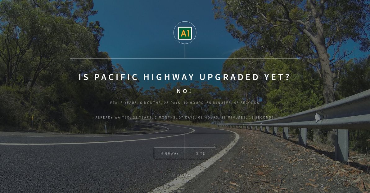
I got thinking about this, in light of the government's announcement at the end of 2020 that the Pacific Highway upgrade is finished. I was like, hang on, no it's not! How about a web site to tell people how long we've already been waiting for this (spoiler alert: ages!), and how much longer we'll probably be waiting?
Complete with a countdown timer, which is currently set to 1 Jan 2030, a date that I arbitrarily and fairly optimistically picked as the target completion date of the Hexham bypass (but that project is still in the planning stage, no construction dates have currently been announced).
Fellow Australians, enjoy!
]]>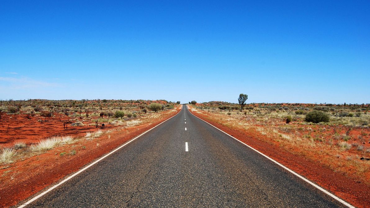
Image source: Australian Outback Buffalo Safaris.
Over the past century or so, much has been achieved in combating the famous Tyranny of Distance that naturally afflicts this land. High-quality road, rail, and air links now traverse the length and breadth of Oz, making journeys between most of her far-flung corners relatively easy.
Nevertheless, there remain a few key missing pieces, in the grand puzzle of a modern, well-connected Australian infrastructure system. This article presents five such missing pieces, that I personally would like to see built in my lifetime. Some of these are already in their early stages of development, while others are pure fantasies that may not even be possible with today's technology and engineering. All of them, however, would provide a new long-distance connection between regions of Australia, where there is presently only an inferior connection in place, or none at all.
Tunnel to Tasmania
Let me begin with the most nut-brained idea of all: a tunnel from Victoria to Tasmania!
As the sole major region of Australia that's not on the continental landmass, currently the only options for reaching Tasmania are by sea or by air. The idea of a tunnel (or bridge) to Tasmania is not new, it has been sporadically postulated for over a century (although never all that seriously). There's a long and colourful discussion of routes, cost estimates, and geographical hurdles at the Bass Strait Tunnel thread on Railpage. There's even a Facebook page promoting a Tassie Tunnel.
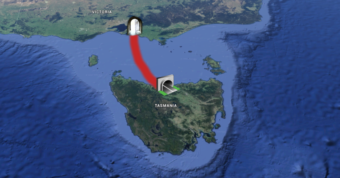
Image sources: Wikimedia Commons: Light on door at the end of tunnel; Wikimedia Commons: Tunnel icon2; satellite imagery courtesy of Google Earth.
Although it would be a highly beneficial piece of infrastructure, that would in the long-term (among other things) provide a welcome boost to Tasmania's (and Australia's) economy, sadly the Tassie Tunnel is probably never going to happen. The world's longest undersea tunnel to date (under the Tsugaru Strait in Japan) spans only 54km. A tunnel under the Bass Strait, directly from Victoria to Tasmania, would be at least 200km long; although if it went via King Island (to the northwest of Tas), it could be done as two tunnels, each one just under 100km. Both the length and the depth of such a tunnel make it beyond the limits of contemporary engineering.
Aside from the engineering hurdle – and of course the monumental cost – it also turns out that the Bass Strait is Australia's main seismic hotspot (just our luck, what with the rest of Australia being seismically dead as a doornail). The area hasn't seen any significant undersea volcanic activity in the past few centuries, but experts warn that it could start letting off steam in the near future. This makes it hardly an ideal area for building a colossal tunnel.
Railway from Mt Isa to Tennant Creek
Great strides have been made in connecting almost all the major population centres of Australia by rail. The first significant long-distance rail link in Oz was the line from Sydney to Melbourne, which was completed in 1883 (although a change-of-gauge was required until 1962). The Indian Pacific (Sydney to Perth), a spectacular trans-continental achievement and the nation's longest train line – not to mention one of the great railways of the world – is the real backbone on the map, and has been operational since 1970. The newest and most long-awaited addition, The Ghan (Adelaide to Darwin), opened for business in 2004.
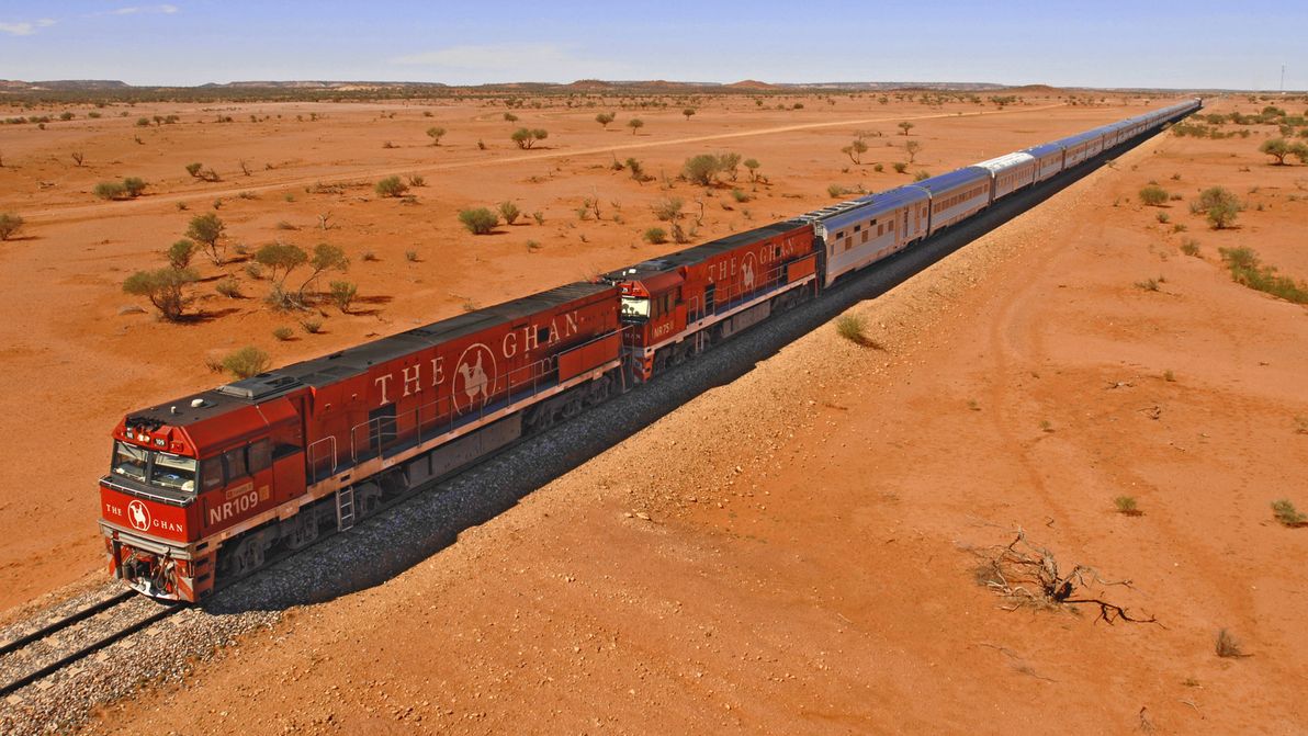
Image source: Fly With Me.
Today's nation-wide rail network (with regular passenger service) is, therefore, at an impressive all-time high. Every state and territory capital is connected (except for Hobart – a Tassie Tunnel would fix that!), and numerous regional centres are in the mix too. Despite the fact that many of the lines / trains are old and clunky, they continue (often stubbornly) to plod along.
If you look at the map, however, you might notice one particularly glaring gap in the network, particularly now that The Ghan has been established. And that is between Mt Isa in Queensland (the terminus of The Inlander service from Townsville), and Tennant Creek in the Northern Territory (which The Ghan passes through). At the moment, travelling continuously by rail from Townsville to Darwin would involve a colossal horse-shoe journey via Sydney and Adelaide, which only an utter nutter would consider embarking upon. Whereas with the addition of this relatively small (1,000km or so) extra line, the journey would be much shorter, and perfectly feasible. Although still long; there's no silver bullet through the outback.
A railway from Mt Isa to Tennant Creek – even though it would traverse some of the most remote and desolate land in Australia – is not a pipe dream. It's been suggested several times over the past few years. As with the development of the Townsville to Mt Isa railway a century ago, it will need the investment of the mining industry in order to actually happen. Unfortunately, the current economic situation means that mining companies are unlikely to invest in such a project at this time; what's more, The Inlander is a seriously decrepit service (at risk of being decommissioned) on an ageing line, making it somewhat unsuitable for joining up with a more modern line to the west.
Nonetheless, I have high hopes that we will see this railway connection built in the not-too-distant future, when the stars are next aligned.
Highway to Cape York
Australia's northernmost region, the Cape York Peninsula, is also one of the country's last truly wild frontiers. There is now a sealed all-weather highway all the way around the Australian mainland, and there's good or average road access to the key towns in almost all regional areas. Cape York is the only place left in Oz that lacks such roads, and that's also home to a non-trivial population (albeit a small 20,000-ish people, the majority Aborigines, in an area half the size of Victoria). Other areas in Oz with no road access whatsoever, such as south-west Tasmania, and most of the east of Western Australia, are lacking even a trivial population.
The biggest challenge to reliable transport in the Cape is the wet season: between December and April, there's so much rainfall that all the rivers become flooded, making roads everywhere impassable. Aside from that, the Cape also presents other obstacles, such as being seriously infested with crocodiles.
There are two main roads that provide access to the Cape: the Peninsula Developmental Road (PDR) from Lakeland to Weipa, and the Northern Peninsula Road (NPR), from the junction north of Coen on to Bamaga. The PDR is slowly improving, but the majority of it is still unsealed and is closed for much of the wet season. The NPR is worse: little (if any) of the route is sealed, and a ferry is required to cross the Jardine River (approaching the road's northern terminus), even at the height of the dry season.
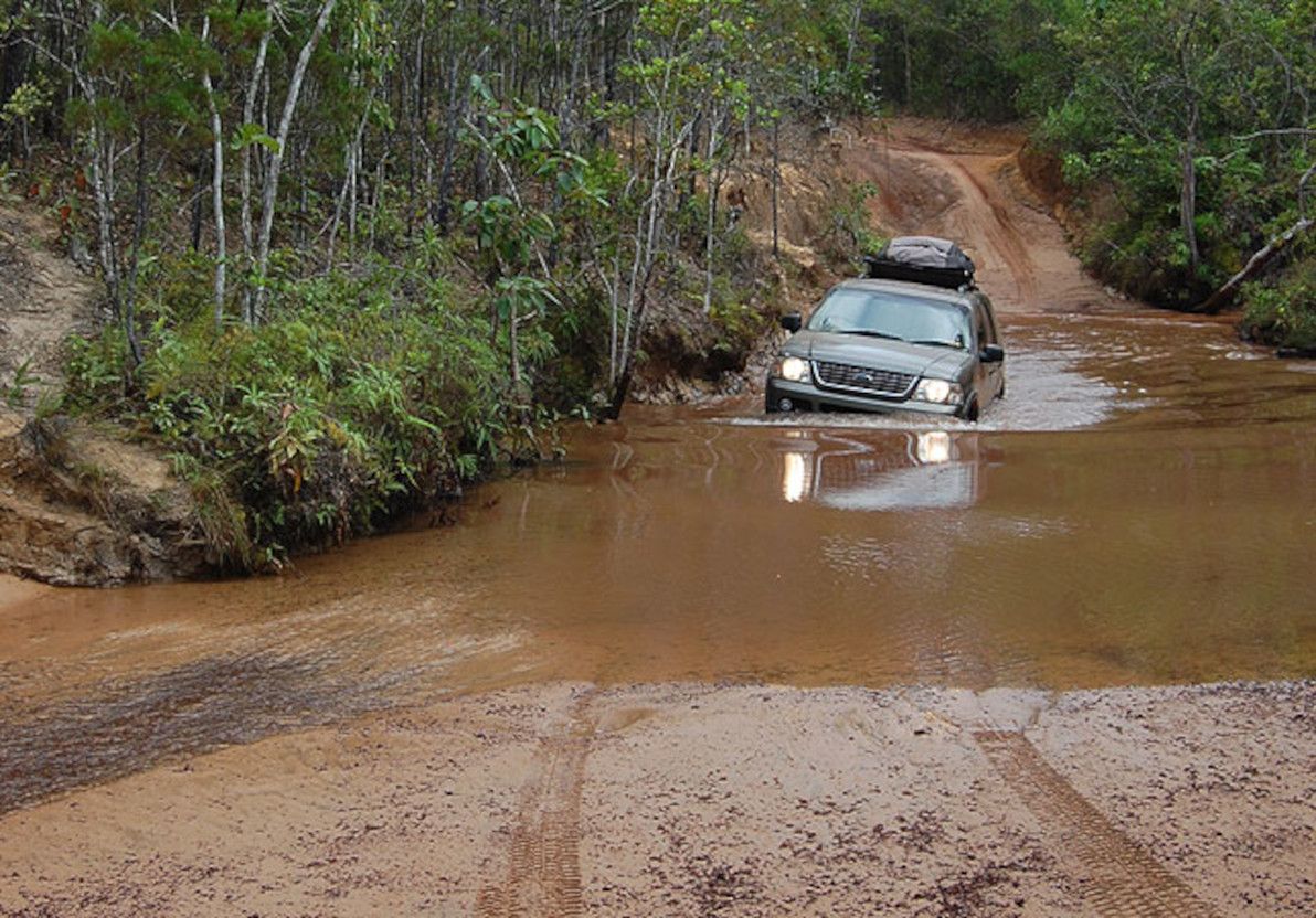
Image source: Eco Citizen Australia.
A proper Cape York Highway, all the way from Lakeland to The Tip, is in my opinion bound to get built eventually. I've seen mention of a prediction that we should expect it done by 2050; if that estimate can be met, I'd call it a great achievement. To bring the Cape's main roads up to highway standard, they'd need to be sealed all the way, and there would need to be reasonably high bridges over all the rivers. Considering the very extreme weather patterns up that way, the route will never be completely flood-proof (much as the fully-sealed Barkly Highway through the Gulf of Carpentaria, south of the Cape, isn't flood-proof either); but if a journey all the way to The Tip were possible in a 2WD vehicle for most of the year, that would be a grand accomplishment.
High-speed rail on the Eastern seaboard
Of all the proposals being put forward here, this is by far the most well-known and the most oft talked about. Many Australians are in agreement with me, on the fact that a high-speed rail link along the east coast is sorely needed. Sydney to Canberra is generally touted as an appropriate first step, Sydney to Melbourne is acknowledged as the key component, and Sydney to Brisbane is seen as a very important extension.
There's a dearth of commentary out there regarding this idea, so I'll refrain from going into too much detail. In particular, the topic has been flooded with conversation since the fairly recent (2013) government-funded feasibility study (to the tune of AUD$20 million) into the matter.
Sadly, despite all the good news – the glowing recommendations of the government study; the enthusiasm of countless Australians; and some valiant attempts to stave off inertia – Australia has been waiting for high-speed rail an awfully long time, and it's probably going to have to keep on waiting. Because, with the cost of a complete Brisbane-Sydney-Canberra-Melbourne network estimated at around AUD$100 billion, neither the government nor anyone else is in a hurry to cough up the requisite cash.
This is the only proposal in this article, about an infrastructure link to complement another one (of the same mode) that already exists. I've tried to focus on links that are needed where currently there is nothing at all. However, I feel that this propoal belongs here, because despite its proud and important history, the ageing eastern seaboard rail network is rapidly becoming an embarrassment to the nation.

Image source: Adam Bandt MP.
The corner of Australia where 90% of the population live, deserves (and needs) a train service for the future, not one that belongs in a museum. The east coast interstate trains still run on diesel, as the lines aren't even electrified outside of the greater metropolitan areas. The network's few (remaining) passenger services share the line with numerous freight trains. There are still a plethora of old-fashioned level crossings. And the majority of the route is still single-track, causing regular delays and seriously limiting the line's capacity. And all this on two of the world's busiest air routes, with the road routes also struggling under the load.
Come on, Aussie – let's join the 21st century!
Self-sustaining desert towns
My final idea, some may consider a little kookoo, but I truly believe that it would be of benefit to our great sunburnt country. As should be clear by now, immense swathes of Australia are empty desert. There are many dusty roads and 4WD tracks traversing the country's arid centre, and it's not uncommon for some of the towns along these routes to be 1,000km's or more distant from their nearest neighbour. This results in communities (many of them indigenous) that are dangerously isolated from each other and from critical services; it makes for treacherous vehicle journeys, where travellers must bring extra necessities such as petrol and water, just to last the distance; and it means that Australia as a whole suffers from more physical disconnects, robbing contiguity from our otherwise unified land.
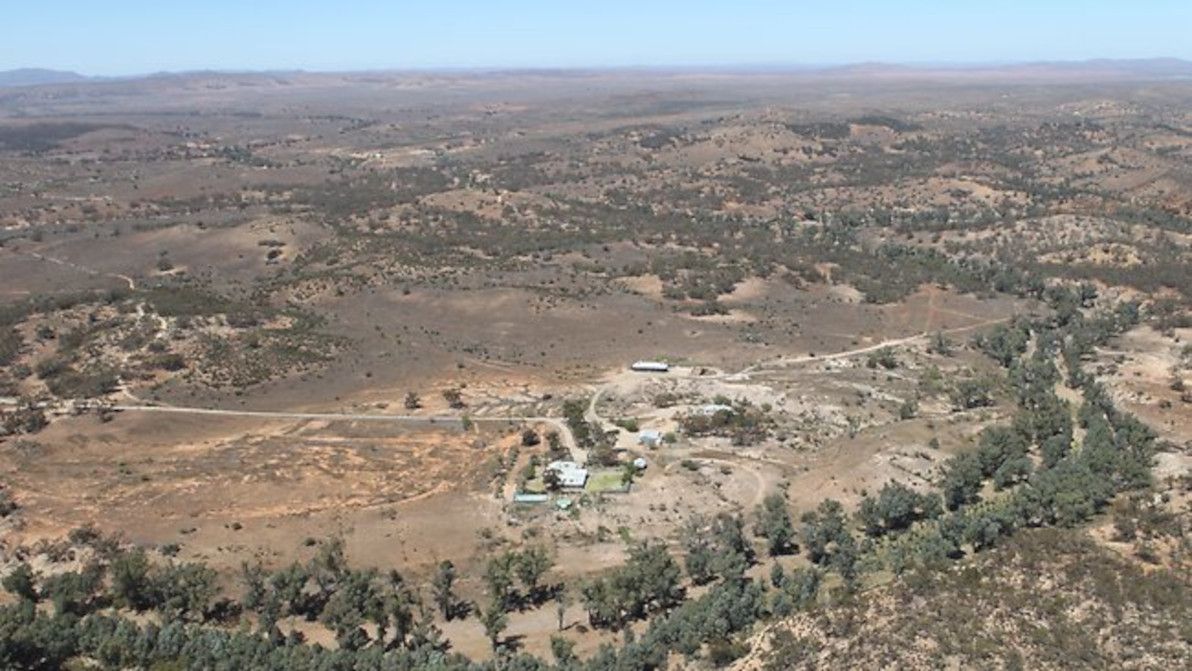
Image source: news.com.au.
Good transport networks (road and rail) across the country are one thing, but they're not enough. In my opinion, what we need to do is to string out more desert towns along our outback routes, in order to reduce the distances of no human contact, and of no basic services.
But how to support such towns, when most outback communities are struggling to survive as it is? And how to attract more people to these towns, when nobody wants to live out in the bush? In my opinion, with the help of modern technology and of alternative agricultural methods, it could be made to work.
Towns need a number of resources in order to thrive. First and foremost, they need water. Securing sufficient water in the outback is a challenge, but with comprehensive conservation rules, and modern water reuse systems, having at least enough water for a small population's residential use becomes feasible, even in the driest areas of Australia. They also need electricity, in order to use modern tools and appliances. Fortunately, making outback towns energy self-sufficient is easier than it's ever been before, thanks to recent breakthroughs in solar technology. A number of these new technologies have even been pilot-tested in the outback.
In order to be self-sustaining, towns also need to be able to cultivate their own food in the surrounding area. This is a challenge in most outback areas, where water is scarce and soil conditions are poor. Many remote communities rely on food and other basic necessities being trucked in. However, a number of recent initiatives related to desert greening may help to solve this thorny (as an outback spinifex) problem.
Most promising is the global movement (largely founded and based in Australia) known as permaculture. A permaculture-based approach to desert greening has enjoyed a vivid and well-publicised success on several occasions; most notably, Geoff Lawton's project in the Dead Sea Valley of Jordan about ten years ago. There has been some debate regarding the potential ability of permaculture projects to green the desert in Australia. Personally, I think that the pilot projects to date have been very promising, and that similar projects in Australia would be, at the least, a most worthwhile endeavour. There are also various other projects in Australia that aim to create or nurture green corridors in arid areas.
There are also crazy futuristic plans for metropolis-size desert habitats, although these fail to explain in detail how such habitats could become self-sustaining. And there are some interesting projects in place around the world already, focused on building self-sustaining communities.
As for where to build a new corridor of desert towns, my preference would be to target an area as remote and as spread-out as possible. For example, along the Great Central Road (which is part of the "Outback Highway"). This might be an overly-ambitious route, but it would certainly be one of the most suitable.
And regarding the "tough nut" of how to attract people to come and live in new outback towns – when it's hard enough already just to maintain the precarious existing population levels – I have no easy answer. It has been suggested that, with the growing number of telecommuters in modern industries (such as IT), and with other factors such as the high real estate prices in major cities, people will become increasingly likely to move to the bush, assuming there's adequately good-quality internet access in the respective towns. Personally, as an IT professional who has worked remotely on many occasions, I don't find this to be a convincing enough argument.
I don't think that there's any silver bullet to incentivising a move to new desert towns. "Candy dangling" approaches such as giving away free houses in the towns, equipping buildings with modern sustainable technologies, or even giving cash gifts to early pioneers – these may be effective in getting a critical mass of people out there, but it's unlikely to be sufficient to keep them there in the long-term. Really, such towns would have to develop a local economy and a healthy local business ecosystem in order to maintain their residents; and that would be a struggle for newly-built towns, the same as it's been a struggle for existing outback towns since day one.
In summary
Love 'em or hate 'em, admire 'em or attack 'em, there's my list of five infrastructure projects that I think would be of benefit to Australia. Some are more likely to happen than others; unfortunately, it appears that none of them is going to be fully realised any time soon. Feedback welcome!
]]>