mapping - GreenAshPoignant wit and hippie ramblings that are pertinent to mappinghttps://greenash.net.au/thoughts/topics/mapping/2021-11-15T00:00:00ZThe lost Armidale to Wallangarra railway2021-11-15T00:00:00Z2021-11-15T00:00:00ZJazahttps://greenash.net.au/thoughts/2021/11/the-lost-armidale-to-wallangarra-railway/
Running more-or-less alongside the most remote section of the New England Highway, through the Northern Tablelands region of NSW, can be found the remnants of a once-proud train line. The Great Northern Railway, as it was known in its heyday, provided the only railway service linking Sydney and Brisbane, between 1889 and 1930. Regular passenger services continued until 1972, and the line has been completely closed since 1988.
Metro map style illustration of the old Armidale to Wallangarra passenger service Thanks to:Metro Map Maker
Although I once drove through most of the Northern Tablelands, I wasn't aware of this railway, nor of its sad recent history, at the time. I just stumbled across it a few days ago, browsing maps online. I decided to pen this here wee thought, mainly because I was surprised at how scant information there is about the old line and its stations.
Great Northern Railway as shown in the 1933 official NSW government map Image source:NSWrail.net
You may notice that some of the stops shown in the 1933 map, are missing from my metro map style illustration. I have omitted all of the stops that are listed as something other than "station" in this long list of facilities on the Main North Line. As far as I can tell, all of the stops listed as "unknown" or "loop", were at best very frugal platform sidings that barely qualified as stations, and their locations were never really populated towns (even going by the generous Aussie bush definition of "populated town", that is, "two people, three pubs").
All that remains of Bungulla, just south of Tenterfield Image source:NSWrail.net
Although some people haven't forgotten about it – particularly many of the locals – the railway is clearly disappearing from the collective consciousness, just as it's slowly but surely eroding and rotting away out there in the New England countryside.
Stonehenge station, just south of Glen Innes, has seen better days Image source:NSWrail.net
Some of the stations along the old line were (apparently) once decent-sized towns, but it's not just the railway that's now long gone, it's the towns too! For example, Bolivia (the place that first caught my eye on the map, and that got me started researching all this – who would have imagined that there's a Bolivia in NSW?!), which legend has it was a bustling place at the turn of the 20th century, is nothing but a handful of derelict buildings now.
Bolivia ain't even a one-horse town no more Image source:NSWrail.net
Other stations – and other towns, for that matter – along the old railway, appear to be faring better. In particular, Black Mountain station is being most admirably maintained by a local group, and Black Mountain village is also alive and well.
The main platform at Black Mountain station Image source:NSWrail.net
These days, on the NSW side, the Main North Line remains open up to Armidale, and a passenger train service continues to operate daily between Sydney and Armidale. On the Queensland side, the Southern line between Toowoomba and Wallangarra is officially still open to this day, and is maintained by Queensland Rail, however my understanding is that there's only a train actually on the tracks, all the way down to Wallangarra, once in a blue moon. On the Main line, a passenger service currently operates twice a week between Brisbane and Toowoomba (it's the Westlander service, which continues from Toowoomba all the way to Charleville).
The unique Wallangarra station, with its standard-guage NSW side, and its narrow-guage Qld side Image source:Wikimedia Commons
The chances of the Armidale to Wallangarra railway ever re-opening are – to use the historically appropriate Aussie vernacular – Buckley's and none. The main idea that the local councils have been bandying about for the past few years, has been to convert the abandoned line into a rail trail for cycling. It looks like that plan is on the verge of going ahead, even though a number of local citizens are vehemently opposed to it. Personally, I don't think a rail trail is such a bad idea: the route will at least get more use, and will receive more maintenance, than it has for the past several decades; and it would bring a welcome trickle of tourists and adventurers to the region.
The Armidale to Wallangarra railway isn't completely lost nor forgotten. But it's a woeful echo of its long-gone glory days (it isn't even properly marked on Google Maps – although it's pretty well-marked on OpenStreetMap, and it's still quite visible on Google Maps satellite imagery). And, regretfully, it's one of countless many derelict train lines scattered across NSW: others include the Bombala line (which I've seen numerous times, running adjacent to the Monaro Highway, while driving down to Cooma from Sydney), the Nyngan to Bourke line, and the Murwillumbah line.
May this article, if nothing else, at least help to document what exactly the stations were on the old line, and how they're looking in this day and age. And, whether it's a rail trail or just an old relic by the time I get around to it, I'll have to head up there and see the old line for myself. I don't know exactly what future lies ahead for the Armidale to Wallangarra railway, but I sincerely hope that, both literally and figuratively, it doesn't simply fade into oblivion.
]]>
Ten rival national top cities of the world2016-12-09T00:00:00Z2016-12-09T00:00:00ZJazahttps://greenash.net.au/thoughts/2016/12/ten-rival-national-top-cities-of-the-world/
Most countries have one city which is clearly top of the pops. In particular, one city (which may not necessarily be the national capital) is usually the largest population centre and the main economic powerhouse of a given country. Humbly presented here is a quick and not-overly-scientific list of ten countries that are an exception to this rule. That is, countries where two cities (or more!) vie neck-and-neck for the coveted top spot.
Note: all population statistics are the latest numbers on relevant country- or city-level Wikipedia pages, as of writing, and all are for the cities' metropolitan area or closest available equivalent. The list is presented in alphabetical order by country.
As all my fellow Aussies can attest, Sydney (pop: 4.9m) and Melbourne (pop: 4.5m) well and truly deserve to be at the top of this list. Arguably, no other two cities in the world are such closely-matched rivals. As well as their similarity in population size and economic prowess, Sydney and Melbourne have also been ruthlessly competing for cultural, political and touristic dominance, for most of Australia's (admittedly short) history.
Both cities have hosted the Summer Olympics (Melbourne in 1956, Sydney in 2000). Sydney narrowly leads in population and economic terms, but Melbourne proudly boasts being "the cultural capital of Australia". The national capital, Canberra, was built roughly halfway between Sydney and Melbourne, precisely because the two cities couldn't agree on which one should be the capital.
In the world's most populous country, the port city Shanghai (pop: 24.5m) and the capital Beijing (pop: 21.1m) compete to be Number One. These days, Shanghai is marginally winning on the population and economic fronts, but Beijing undoubtedly takes the lead in the political, cultural and historic spheres.
It should also be noted that China's third-most populous city, Guangzhou (pop: 20.8m), and its (arguably) fourth-most populous city, Shenzhen (pop: 18m), are close runners-up to Shanghai and Beijing in population and economic terms. The neighbouring cities of Guangzhou and Shenzhen, together with other adjacent towns and cities, make up what is now the world's most populous urban area, the Pearl River Delta Megacity. This area has a population of 44m, which can even jump to 54m if the nearby islands of Hong Kong are included.
Ecuador's port city Guayaquil (pop: 5.0m) and its capital Quito (pop: 4.2m) are the only pair of cities from Latin America to feature on the list. Most Latin American countries are well and truly dominated by one big urban area. In Ecuador, Guayaquil is the economic powerhouse, while Quito is the nation's political and cultural heart.
The urban areas of the capital Berlin (pop: 6.0m) and the port city Hamburg (pop: 5.1m) are (arguably) the two largest in the Bundesrepublik Deutschland. These cities vie closely for economic muscle, and both are also rich historic and cultural centres of Germany.
However, Germany is truly one of the most balanced countries in the world, in terms of having numerous cities that contend for being the top population and economic centre of the land. There are also Munich (pop: 4.5m) and Stuttgart (pop: 4.0m), the southernmost of the nation's big cities. Plus there are the "urban mega-regions" of the Ruhr (pop: 8.5m), and Frankfurt Rhine-Main (pop: 5.8m), which are too spread-out to be considered single metropolitan areas (and which lack a single metro area with the large population of the big cities), but which are key centres nonetheless. Unsurprisingly, the very geographical layout of the nation's cities are yet another testament to German planning and efficiency.
In La Bella Italia, Rome (pop: 4.3m) and Milan (pop: 4.2m) are the two most populous cities by a fair stretch. With its formidable fashion and finance industries (among many others), Milan is quite clearly the top economic centre of Italy.
In terms of culture, few other pairs of cities can boast such a grand and glorious rivalry as that of Rome and Milan. Naturally, with its Roman Empire legacy, and as the home of the Vatican (making Rome virtually unique globally in being a city with another country inside it!), Rome wins hands-down on the historical, political and touristic fronts. But in terms of art, cuisine, and media (to name a few), Milan packs a good punch. However, most everywhere in Italy pulls ahead of its weight in those areas, including the next-largest urban areas of Naples, Turin, Venice and Florence.
In the world's second-most-populous country, the mega-cities of Delhi (pop: 21.8m) and Mumbai (pop: 20.8m) compete for people, business, and chaos. Delhi takes the cake politically, culturally, historically, and (as I can attest from personal experience) chaotically. Mumbai, a much newer city – only really having come into existence since the days of the British Raj – is the winner economically.
The next most populous cities of India – Kolkata, Bangalore, and Chennai – are also massive population centres in their own right, and they're not far behind Delhi and Mumbai in terms of national importance.
South Africa is the only African nation to make this list. Its two chief cities are the sprawling metropolis of Johannesburg (pop: 4.4m), and the picturesque port city of Cape Town (pop: 3.7m). Johannesburg is not only the economic powerhouse of South Africa, but indeed of all Africa. Cape Town, on the other hand, is the historic centre of the land, and with the sea hugging its shores and the distinctive Table Mountain looming big behind, it's also a place of great natural beauty.
El Reino de España is dominated by the two big cities of Madrid (pop: 6.3m) and Barcelona (pop: 5.4m). Few other pairs of cities in the world fight so bitterly for economic and cultural superiority, and on those fronts, in Spain there is no clear winner. Having spent much of its history as the head of its own independent kingdom of Catalonia, Barcelona has a rich culture of its own. And while Madrid is the political capital of modern Spain, Barcelona is considered the more modern metropolis, and has established itself as the "cosmopolitan capital" of the land.
Madrid and Barcelona are not the only twin cities in this list where different languages are spoken, and where historically the cities were part of different nations or kingdoms. However, they are the only ones where open hostility exists and is a major issue to this day: a large faction within Catalonia (including within Barcelona) is engaged in an ongoing struggle to secede from Spain, and the animosity resulting from this struggle is both real and unfortunate.
The two biggest urban areas in Uncle Sam, New York (pop: 23.7m) and Los Angeles (pop: 18.7m), differ in many ways apart from just being on opposite coasts. Both are economic and cultural powerhouses: NYC with its high finance and its music / theatre prowess; LA with Hollywood and show biz. The City That Never Sleeps likes to think of itself as the beating heart of the USA (and indeed the world!), while the City of Angels doesn't take itself too seriously, in true California style.
These are the two biggest, but they are by no means the only big boys in town. The nation's next-biggest urban areas – Chicago, Washington-Baltimore, San Francisco Bay Area, Boston, Dallas, Philadelphia, Houston, Miami, and Atlanta (all with populations between 6m and 10m) – are spread out all across the continental United States, and they're all vibrant cities and key economic hubs.
Finally, in the long and thin nation of Vietnam, the two river delta cities of Ho Chi Minh (pop: 8.2m) in the south, and Hanoi (pop: 7.6m) in the north, have for a long time been the country's key twin hubs. During the Vietnam War, these cities became the respective national capitals of the independent Democratic South and Communist North Vietnam; but these days, Vietnam is well and truly unified, and north and south fly under the same flag.
Conclusion
That's it, my non-authoritative list of rival top cities in various countries around the world. I originally included more pairs of cities in the list, but I culled it down to only include cities that were very closely matched in population size. Numerous other contenders for this list consist of a City A that's bigger, and a City B that's smaller but is more famous or more historic than its twin. Anyway, hope you like my selection, feedback welcome.
]]>
Where is the official centre of Sydney?2016-03-28T00:00:00Z2016-03-28T00:00:00ZJazahttps://greenash.net.au/thoughts/2016/03/where-is-the-official-centre-of-sydney/
There are several different ways of commonly identifying the "official centre point" of a city. However, there's little international consensus as to the definition of such a point, and in many countries and cities the definition is quite vague.
Most reliable and most common, is to declare a Kilometre Zero marker as a city's (and often a region's or even a country's) official centre. Also popular is the use of a central post office for this purpose. Other traditional centre points include a city's cathedral, its main railway station, its main clock tower (which may be atop the post office / cathedral / railway station), its tallest building, its central square, its seat of government, its main park, its most famous tourist landmark, or the historical spot at which the city was founded.
Satellite photo of Sydney CBD, annotated with locations of "official centre" candidates. Image source:Satellite Imaging Corp.
My home town of Sydney, Australia, is one of a number of cities worldwide that boasts most of the above landmarks, but all in different locations, and without any mandated rule as to which of them constitutes the official city centre. So, where exactly in Sydney does X mark the spot?
Martin Place
I'll start with the spot that most people – Sydneysiders and visitors alike – commonly consider to be Sydney's central plaza these days: Martin Place. Despite this high esteem that it enjoys, in typical unplanned Sydney fashion, Martin Place was actually never intended to even be a large plaza, let alone the city's focal point.
Martin Place from the western end, as it looks today. Image source:Wikimedia Commons.
The original "Martin Place" (for much of the 1800s) was a small laneway called Moore St between George and Pitt streets, similar to nearby Angel Place (which remains a laneway to this day). In 1892, just after the completion of the grandiose GPO Building at its doorstep, Martin Place was widened and was given its present name. It wasn't extended to Macquarie St, nor made pedestrian-only, until 1980 (just after the completion of the underground Martin Place Station).
The chief justification for Martin Place being a candidate on this list, is that it's the home of Sydney's central post office. The GPO building also has an impressive clock tower sitting atop it. In addition, Martin Place is home to the Reserve Bank of Australia, and the NSW Parliament and the State Library of NSW are very close to its eastern end. It's also geographically smack-bang in the centre of the "business end" of Sydney's modern CBD, and it's culturally and socially acknowledged as the city's centre.
Town Hall
If you ask someone on the street in Sydney where the city's "central spot" is, and if he/she hesitates for a moment, chances are that said person is tossing up between Martin Place and Town Hall. When saying the name "Town Hall", you could be referring to the underground train station (one of Sydney's busiest), to the Town Hall building itself, to Town Hall Square, or (most likely) to all of the above. Scope aside, Town Hall is one of the top candidates for being called the centre of Sydney.
View of the Town Hall building, busy George and Druitt Streets, and St Andrews Cathedral. Image source:FM Magazine.
As with Martin Place, Town Hall was never planned to either resemble its current form, nor to be a centric location. Indeed, during the early colonial days, the site in question was on the outskirts of Sydney Town, and was originally a cemetery. The Town Hall building was opened in the 1890s.
In terms of qualifying as the potential centre of Sydney, Town Hall has a lot going for it. As its name suggests, it's home to the building which is the seat of local government for the City of Sydney (the building also has a clock tower). With its sprawling underground train station, with numerous bus stops in and adjacent to it, and with its location at the intersection of major thoroughfares George St and Park / Druitt St, Town Hall is – in practice – Sydney's most important transport hub. It's home to St Andrew's Cathedral, the head of the Anglican church in Sydney. And it's adjacent to the Queen Victoria Building, which – although it has no official role – is considered one of Sydney's most beautiful buildings.
Town Hall is also in an interesting position in terms of urban geography. It's one of the more southerly candidates for "official centre". To its north, where the historic heart of Sydney lies, big businesses and workers in suits dominate. While to its south lies the "other half" of Sydney's CBD: some white-collar business, but more entertainment, restaurants, sleaze, and shopping. It could be said that Town Hall is where these two halves of the city centre meet and mingle.
Macquarie Place
I've now covered the two spots that most people would likely think of as being the centre of Sydney, but which were never historically planned as such, and which "the powers that be" have never clearly proclaimed as such. The next candidate is a spot which was actually planned to be the official city centre (at least, as much as anything has ever been "planned" in Sydney), but which today finds itself at the edge of the CBD, and which few people have even heard of.
The New South Wales "Kilometre Zero" obelisk in Macquarie Place. Image source:City Art Sydney.
At the time, the area of Macquarie Place was the geographic centre of Sydney Town. The original colonial settlement clung to what is today Circular Quay, as all trade and transport with the rest of the world was via the shipping in Sydney Cove. The early town also remained huddled close to the Tank Stream, which ran between Pitt and George streets before discharging into the harbour (today the Tank Stream has been entirely relegated to a stormwater drain), and which was Sydney's sole fresh water supply for many years. The "hypotenuse" edge of Macquarie Place originally ran alongside the Tank Stream; indeed, the plaza's triangular shape was due to the Tank Stream fanning out into a muddy delta (all long gone and below the ground today) as it approached the harbour.
James Meehan's 1803 map of Sydney, with the original Tank Stream marked. Image source:National Library of Australia.
The most striking and significant feature of Macquarie Place is its large stone obelisk, which was erected in 1818, and which remains the official Kilometre Zero marker of Sydney and of NSW to this day. The obelisk lists the distances, in miles, to various towns in the greater Sydney region. As is inscribed in the stonework, its purpose is:
To record that all the Public Roads Leading to the Interior of the Colony are Measured from it.
So, if it's of such historical importance, why is Macquarie Place almost unheard-of by Sydney locals and visitors alike? Well, first and foremost, the fact is that it's no longer the geographical, cultural, or commercial heart of the city. That ship sailed south some time ago. Also, apart from its decline in fame, Macquarie Place has also suffered from being literally, physically eroded over the years. The size of the plaza was drastically reduced in the 1840s, when Loftus St was built to link Bridge St to Circular Quay, and the entire eastern half of Macquarie Place was lost. The relatively small space is now also dwarfed by the skyscrapers that loom over it on all sides.
Macquarie Place is today a humble, shady, tranquil park in the CBD's north, frequented by tour groups and by a few nearby office workers. It certainly doesn't feel like the centre of a city of over 4 million people. However, it was declared Sydney's "town square" when it was inaugurated, and no other spot has been declared its successor ever since. So, I'd say that if you ask a Sydney history buff, then he/she would surely have to concede that Macquarie Place remains the official city centre.
Pitt St Mall
With the top three candidates done, I'll now cover the other punters that might contend for centre stage in Sydney. However, I doubt that anyone would seriously considers these other spots to be in the running. I'm just listing them for completeness. First off is Pitt St Mall.
Sydney's central shopping precinct of Pitt St Mall, with Sydney Tower visibly adjacent to it. Image source:Structural & Civil Engineers.
Pitt St is one of the oldest streets in Sydney. However, there was never any plan for it to house a plaza. For much of its history (for almost 100 years), one of Sydney's busiest and longest-serving tram lines ran up its entire length. Since at least the late 1800s, the middle section of Pitt St – particularly the now pedestrian-only area between King and Market streets – has been Sydney's prime retail and fashion precinct. Some time in the late 1980s, this area was closed to traffic, and it's been known as Pitt St Mall ever since.
Pitt St Mall does actually tick several boxes as a contender for "official city centre". First and foremost, it is geographically the centre of Sydney's modern CBD, lying exactly in the middle between Martin Place and Town Hall. It's also home to Sydney Tower, the city's tallest structure. Plus, it's where the city's heaviest concentration of shops and of shopping centres can be found. However, the Mall has no real historical, cultural, or social significance. It exists purely to enhance the retail experience of the area.
Central Station
Despite its name, Sydney's Central Railway Station is not in the middle of the city, but rather on the southern fringe of the CBD. Like its more centric cousin Town Hall, the site of Central Station was originally a cemetery (and the station itself was originally just south of its present location). Today, Central is Sydney's busiest passenger station. We Sydneysiders aren't taught in school that it's All Stations To Central for nothing.
Central Station as seen from adjacent Eddy Ave. Image source:Weekend Notes.
Central Station is the most geographically far-flung of the candidates listed in this article, and due to this, few people (if any) would seriously vote for it as Sydney's official centre. However, it does have some points in its favour. It is the city's main train station. Its Platform 1 is the official Kilometre Zero point of the NSW train network. And its clock tower dictates the official time of NSW trains (and, by extension, the official civil time in NSW).
Hyde Park
Although it's quite close to Town Hall and Pitt St Mall distance-wise, Hyde Park hugs the eastern edge of the Sydney CBD, rather than commanding centre stage. Inaugurated by Big Mac in 1810, together with Macquarie Place, Hyde Park is Sydney's oldest park, as well as its official main park.
Expansive view looking south-west upon Hyde Park. Image source:Floodslicer.
Macquarie's architect, Francis Greenway, envisaged Hyde Park eventually becoming Sydney's town square, however this never eventuated. Despite being Sydney's oldest park, present-day Hyde Park is also quite unrecognisable from its original form, having been completely re-designed and rebuilt several times. The obelisk at the head of Bathurst St, erected in 1857 (it's actually a sewer vent!), is probably the oldest artifact of the park that remains unchanged.
As well as being central Sydney's main green space, Hyde Park is also home to numerous important adjacent buildings, including St Mary's Cathedral (head of the Sydney Catholic Archdiocese), St James Church (the oldest church building in Sydney), the Supreme Court of NSW, and Hyde Park Barracks. Plus, Hyde Park boasts a colourful history, whose many anecdotes comprise an important part of the story of Sydney.
The Rocks Square
The place I'm referring to here doesn't even have a clearly-defined name. As far as I can tell, it's most commonly known as (The) Rocks Square, but it could also be called Clocktower Square (for the tower and shopping arcade adjacent to it), Argyle St Mall, Argyle St Market, or just "in front of The Argyle" (for the adjacent historic building and present-day nightclub). At any rate, I'm talking about the small, pedestrian-only area at the eastern end of Argyle St, in Sydney's oldest precinct, The Rocks.
Weekend markets at the eastern end of Argyle St, in The Rocks. Image source:David Ing.
This spot doesn't have a whole lot going for it. As I said, it's not even named properly, and it's not an official square or park of any sort. However, it's generally considered to be the heart of The Rocks, and in Sydney's earliest days it was the rough location of the city's social and economic centre. Immediately to the west of The Rocks Square, you can walk or drive through the Argyle Cut, which was the first major earth-moving project in Sydney's history. Today, The Rocks Square is a busy pedestrian thoroughfare, especially on weekends when the popular Rocks Markets are in full swing. And one thing that hasn't changed a bit since day one: there's no shortage of pubs, and other watering-holes, in and around this spot.
Darling Harbour
I'm only reluctantly including Darling Harbour on this list (albeit lucky last): clearly off to the west of the CBD proper, it's never been considered the "official centre" of Sydney by anyone. For much of its history, Darling Harbour was home to a collection of dirty, seedy dockyards that comprised the city's busiest port. The area was completely overhauled as the showpiece of Sydney's celebrations for the 1988 Australian Bicentennary celebrations. Since then, it's been one of Sydney's most popular tourist spots.
The centre of Darling Harbour, close the the IMAX Theatre. Image source:Wikimedia Commons.
Other than being a tourist trap, Darling Harbour's main claim to entitlement on this list is that it hosts the Sydney Convention Centre (the original centre was recently demolished, and is currently being rebuilt on a massive scale). The key pedestrian thoroughfare of Darling Harbour, just next to the IMAX Theatre (i.e. the spot in question for this list), is unfortunately situated directly below the Western Distributor, a large freeway that forms a roof of imposing concrete.
Final thoughts
Hope you enjoyed this little tour of the contenders for "official centre" of Sydney. Let me know if you feel that any other spots are worthy of being in the race. As for the winner: I selected what I believe are the three finalists, but I'm afraid I can't declare a clear-cut winner from among them. Purists would no doubt pick Macquarie Place, but in my opinion Martin Place and Town Hall present competition that can't be ignored.
Sydney at sunset, with the city centre marked in dark red. Image source:SkyscraperCity.
Who knows? Perhaps the illustrious Powers That Be – in this case, the NSW Government and/or the Sydney City Council – will, in the near future, clarify the case once and for all. Then again, considering the difficulty of choice (as demonstrated in this article), and considering the modus operandi of the guv'ment around here, it will probably remain in the "too hard" basket for many years to come.
]]>
Australian LGA to postcode mappings with PostGIS and Intersects2014-07-12T00:00:00Z2014-07-12T00:00:00ZJazahttps://greenash.net.au/thoughts/2014/07/australian-lga-to-postcode-mappings-with-postgis-and-intersects/
For a recent project, I needed to know the LGAs (Local Government Areas) of all postcodes in Australia, and vice versa. As it turns out, there is no definitive Australia-wide list containing this data anywhere. People have been discussing the issue for some time, with no clear outcome. So, I decided to get creative.
If you want the full story: I imported both the LGA boundaries data and the Postal Area boundaries data from the ABS, into PostGIS, and I did an "Intersects" query on the two datasets. I exported the results of this query to CSV. Done! And all perfectly reproducible, using freely available public data sets, and using free and open-source software tools.
The process
I started by downloading the Geo data that I needed, from the ABS. My source was the page Australian Statistical Geography Standard (ASGS): Volume 3 - Non ABS Structures, July 2011. This was the most recent page that I could find on the ABS, containing all the data that I needed. I downloaded the files "Local Government Areas ASGS Non ABS Structures Ed 2011 Digital Boundaries in MapInfo Interchange Format", and "Postal Areas ASGS Non ABS Structures Ed 2011 Digital Boundaries in MapInfo Interchange Format".
Big disclaimer: I'm not an expert at anything GIS- or spatial-related, I'm a complete n00b at this. I decided to download the data I needed in MapInfo format. It's also available on the ABS web site in ArcGIS Shapefile format. I could have downloaded the Shapefiles instead – they can also be imported into PostGIS, using the same tools that I used. I chose the MapInfo files because I did some quick Googling around, and I got the impression that MapInfo files are less complex and are somewhat more portable. I may have made the wrong choice. Feel free to debate the merits of MapInfo vs ArcGIS files for this task, and to try this out yourself using ArcGIS instead of MapInfo. I'd be interested to see the difference in results (theoretically there should be no difference… in practice, who wants to bet there is?).
I then had to install PostGIS (I already had Postgres installed) and related tools on my local machine (running Ubuntu 12.04). I'm not providing PostGIS installation instructions here, there's plenty of information available elsewhere to help you get set up with all the tools you need, for your specific OS / requirements. Installing PostGIS and related tools can get complicated, so if you do decide to try all this yourself, don't say I didn't warn you. Ubuntu is probably one of the easier platforms on which to install it, but there are plenty of guides out there for Windows and Mac too.
Once I was all set up, I imported the data files into a PostGIS-enabled Postgres database with these commands:
If you're interested in the OGR Toolkit (ogr2ogr and friends), there are plenty of resources available; in particular, this OGR Toolkit guide was very useful for me.
After playing around with a few different map projections, I decided that EPSG:4283 was probably the correct one to use as an argument to ogr2ogr. I based my decision on seeing the MapInfo projection string "CoordSys Earth Projection 1, 116" in the header of the ABS data files, and then finding this list of common Australian-used map projections. Once again: I am a total n00b at this. I know very little about map projections (except that it's a big and complex topic). Feel free to let me know if I've used completely the wrong projection for this task.
I renamed the imported tables to 'lga' and 'postcodes' respectively, and I then ran this from the psql shell, to find all LGAs that intersect with all postal areas, and to export the result to a CSV:
\copy (SELECT     l.state_name_2011,
                  l.lga_name_2011,
                  p.poa_code_2011
       FROM       lga l
       INNER JOIN postcodes p
       ON         ST_Intersects(
                      l.wkb_geometry,
                      p.wkb_geometry)
       ORDER BY   l.state_name_2011,
                  l.lga_name_2011,
                  p.poa_code_2011)
TO '/path/to/lga_postcodes.csv' WITH CSV HEADER;
Final remarks
That's about it! Also, some notes of mine (mainly based on the trusty Wikipedia page Local Government in Australia):
There's no data for the ACT, since the ACT has no LGAs
Almost the entire Brisbane and Gold Coast metro areas, respectively, are one LGA
Some areas of Australia aren't part of any LGA (although they're all remote areas with very small populations)
Quite a large number of valid Australian postcodes are not part of any LGA (because they're for PO boxes, for bulk mail handlers, etc, and they don't cover a geographical area as such, in the way that "normal" postcodes do)
I hope that this information is of use, to anyone else who needs to link up LGAs and postcodes in a database or in a GIS project.
]]>
Current state of the Cape to Cairo Railway2013-08-01T00:00:00Z2013-08-01T00:00:00ZJazahttps://greenash.net.au/thoughts/2013/08/current-state-of-the-cape-to-cairo-railway/
In the late 19th century, the British-South-African personality Cecil Rhodes dreamed of a complete, uninterrupted railway stretching from Cape Town, South Africa, all the way to Cairo, Egypt. During Rhodes's lifetime, the railway extended as far north as modern-day Zimbabwe – which was in that era known by its colonial name Rhodesia (in honour of Rhodes, whose statesmanship and entrepreneurism made its founding possible). A railway traversing the entire north-south length of Africa was an ambitious dream, for an ambitious man.
Rhodes's dream remains unfulfilled to this day.
The famous "Rhodes Colossus", superimposed upon the present-day route of the Cape to Cairo Railway. "The Rhodes Colossus" illustration originally from Punch magazine, Vol. 103, 10 Dec 1892; image courtesy of Wikimedia Commons. Africa satellite image courtesy of Google Earth.
Nevertheless, significant additions have been made to Africa's rail network during the interluding century; and, in fact, only a surprisingly small section of the Cape to Cairo route remains bereft of the Iron Horse's footprint.
Although both information about – (a) the historical Cape to Cairo dream; and (b) the history / current state of the route's various railway segments – abound, I was unable to find any comprehensive study of the current state of the railway in its entirety.
This article, therefore, is an endeavour to examine the current state of the full Cape to Cairo Railway. As part of this study, I've prepared a detailed map of the route, which marks in-service sections, abandoned sections, and missing sections. The map has been generated from a series of KML files, which I've made publicly available on GitHub, and for which I welcome contributions in the form of corrections / tweaks to the route.
Southern section
As its name suggests, the line begins in Cape Town, South Africa. The southern section of the railway encompasses South Africa itself, along with the nearby countries that have historically been part of the South African sphere of influence: that is, Botswana, Zimbabwe, and Zambia.
Southern section of the Cape to Cairo Railway: Cape Town to Kapiri Mposhi.
The first segment – Cape Town to Johannesburg – is also the oldest, the best-maintained, and the best-serviced part of the entire route. The first train travelled this segment in 1892. There has been continuous service ever since. It's the only train route in all of Africa that can honestly claim to provide a "European standard" of passenger service, between the two major cities that it links. That is, there are numerous classes of service operating on the line – ranging from basic inter-city commuter trains, to business-style fast trains, to luxury sleeper trains – running several times a day.
So, the first leg of the railway is the one that we should be least worried about. Hence, it's marked in green on the map. This should come as no surprise, considering that South Africa has the best-developed infrastructure in all of Africa (by a long shot), as well as Africa's largest economy.
After Johannesburg, we continue along the railway that was already fulfilling Cecil Rhodes's dream before his death. This segment runs through modern-day Botswana, which was previously known as Bechuanaland Protectorate. From Johannesburg, it connects to the city of Mafeking, which was the capital of the former Bechuanaland Protectorate, but which today is within South Africa (where it is a regional capital). The line then crosses the border into Botswana, passes through the capital Gaborone, and continues to the city of Francistown in Botswana's north-east.
Unfortunately, since the opening of the Beitbridge Bulawayo Railway in Zimbabwe in 1999 (providing a direct train route between Zimbabwe and South Africa for the first time), virtually all regular passenger service on this segment (and hence, virtually all regular passenger service on Botswana's train network) has been cancelled. The track is still being maintained, and (apart from some freight trains) there are still occasional luxury tourist trains using the route. However, it's unclear if there are still any regular passenger services between Johannesburg and Mafeking (if there are, they're very few); and sources indicate that there are no regular passenger services at all between Mafeking and Francistown. Hence, the segment is marked in yellow on the map.
(I should also note that the new direct train route from South Africa to Zimbabwe, does actually provide regular passenger service, from Johannesburg to Messina, and then from Beitbridge to Bulawayo, with service missing only in the short border crossing between Messina and Beitbridge. However, I still consider the segment via Botswana to be part of the definitive "Cape to Cairo" route: because of its historical importance; and because only quite recently has service ceased on this segment and has an alternative segment been open.)
From Francistown onwards, the situation is back in the green. There is a passenger train from Francistown to Bulawayo, that runs three times a week. I should also mention here, that Bulawayo is quite a significant spot on the Cape to Cairo Railway, as (a) the grave of Cecil Rhodes can be found atop "World's View", a panoramic hilltop in nearby Matobo National Park; and (b) Bulawayo was the first city that the railway reached in (former) Rhodesia, and to this day it remains Zimbabwe's rail hub. Bulawayo is also home to a railway museum.
For the remainder of the route through Zimbabwe, the line remains in the green. There's a daily passenger service from Bulawayo to Victoria Falls. Sadly, this spectacular leg of the route has lost much of its former glory: due to Zimbabwe's recent economic and political woes, the trains are apparently looking somewhat the worse for wear. Nevertheless, the service continues to be popular and reasonably reliable.
The green is briefly interrupted by a patch of yellow, at the border crossing between Zimbabwe and Zambia. This is because there has been no passenger service over the famous Victoria Falls Bridge – which crosses the Zambezi River at spraying distance from the colossal waterfall, connecting the towns of Victoria Falls and Livingstone – more-or-less since the 1970s. Unless you're on board one of the infrequent luxury tourist trains that still traverse the bridge, it must be crossed on foot (or using local transport). It should also be noted that although the bridge is still most definitely intact and looking solid, it's more than 100 years old, and experts have questioned whether it's receiving adequate care and maintenance.
Victoria Falls Bridge: a marvel of modern engineering, straddles one of the world's natural wonders. Image sourced from: Car Hire Victoria Falls.
Once in Zambia – formerly known as Northern Rhodesia – regular passenger services continue north to the capital, Lusaka; and from there, onward to the crossroads town of Kapiri Mposhi. It's here that the southern portion of the modern-day Cape to Cairo railway ends, since Kapiri Mposhi is the meeting-point of the colonial-era, British-built, South-African / Rhodesian railway network, and a modern-era East-African rail link that was unanticipated in Rhodes's plan.
I should also mention here that the colonial-era network continues north from Kapiri Mposhi, crossing the border with modern-day DR Congo (formerly known as the Belgian Congo), and continuing up to the shores of Lake Tanganyika, where it terminates at the town of Kalemie. The plan in the colonial era was that the Cape to Cairo passenger link would continue north via the Great Lakes in this region of Africa – in the form of lake / river ferries, up to Lake Albert, on the present-day DR Congo / Ugandan border – after which the rail link would resume, up to Egypt via Sudan.
However, I don't consider this segment to be part of the definitive "Cape to Cairo" route, because: (a) further rail links between the Great Lakes, up to Lake Albert, were never built; (b) the line running through eastern DR Congo, from the Zambian border to Kalemie on Lake Tanganyika, is apparently in serious disrepair; and (c) an alternative continuous rail link has existed, since the 1970s, via East Africa, and the point where this link terminates in modern-day Uganda is north of Lake Albert anyway. Therefore, the DR Congo – Great Lakes segment is only being mentioned here as an anecdote of history; and we now turn our attention to the East African network.
Eastern section
The Eastern section of the railway is centred in modern-day Tanzania and Kenya, although it begins and ends within the inland neighbours of these two coastal nations – Zambia and Uganda, respectively. This region, much like Southern Africa, was predominantly ruled under British colonialism in the 19th century (which is why Kenya, the region's hub, was formerly known as British East Africa). However, modern-day Tanzania (formerly called Tanganyika, before the union of Tanganyika with Zanzibar) was originally German East Africa, before becoming a British protectorate in the 20th century.
Eastern section of the Cape to Cairo Railway: Kapiri Mposhi to Gulu.
Kapiri Mposhi, in Zambia, is the start of the TAZARA Railway; this railway runs through the north-east of Zambia, crosses the border to Tanzania near Mbeya, and finishes on the Indian Ocean coast at Dar es Salaam, Tanzania's largest city.
The TAZARA is the newest link in the Cape to Cairo railway network: it was built and financed by the Chinese, and was opened in 1976. It's the only line in the network – and one of the only railway lines in all of Africa – that was built (a) by non-Europeans; and (b) in the post-colonial era. It was not envisioned by Rhodes (nor by his contemporaries), who wanted the line to pass through wholly British-controlled territory (Tanzania was still German East Africa in Rhodes's era). The Zambians wanted it, in order to alleviate their dependence (for international transport) on their southern neighbours Rhodesia and South Africa, with whom tensions were high in the 1970s, due to those nations' Apartheid governments. The line has been in regular operation since opening; hence, it's marked in green on the map.
The TAZARA: a "modern" rail link... African style. Image source: Mzuzu Transit.
Although the TAZARA line doesn't quite touch the other Tanzanian railway lines that meet in Dar es Salaam, I haven't marked any gap in the route at Dar es Salaam. This is for two reasons. Firstly, from what I can tell (by looking at maps and satellite imagery), the terminus of the TAZARA in Dar es Salaam is physically separated from the other lines, by a distance of less than two blocks, i.e. a negligible amount. Secondly, the TAZARA is (as of 1998) physically connected to the other Tanzanian railway lines, at a junction near the town of Kidatu, and there is a cargo transshipment facility at this location. However, I don't believe there's any passenger service from Kidatu to the rest of the Tanzanian network (only cargo trains). So, the Kidatu connection is being mentioned here only as an anecdote; in my opinion, the definitive "Cape to Cairo" route passes through, and connects at, Dar es Salaam.
From Dar es Salaam, the line north is part of the decaying colonial-era Tanzanian rail network. This line extends up to the city of Arusha; the part that we're interested in ends at Moshi (east of Arusha), from where another line branches off, crossing the border into Kenya. Sadly, there has been no regular passenger service on the Arusha line for many years; therefore, nor is there any service to Moshi.
After crossing the Kenyan border, the route passes through the town of Taveta, before continuing on to Voi; here, there is a junction with the most important train line in Kenya: that which connects Mombasa and Nairobi. As with the Arusha line, the Moshi – Voi line has also been bereft of regular passenger service for many years. This entire portion of the rail network appears to be in a serious state of neglect. If there are any trains running in this area, they would be occasional freight trains; and if any track maintenance is being performed on these lines, it would be the bare minimum. Therefore, the full segment from Dar es Salaam to Voi is marked in yellow on the map.
From Voi, there are regular passenger services on the main Kenyan rail line to Nairobi; and onward from Nairobi, there are further passenger services (which appear to be less reliable, but regular nonetheless) to the city of Kisumu, which borders Lake Victoria. The part of this route that we're interested in ends at Nakuru (about halfway between Nairobi and Kisumu), from where another line branches off towards Uganda. The route through Kenya, from Voi to Nakuru, is therefore in the green.
After Nakuru, the line meanders its way towards the Ugandan border; and at Tororo (a city on the Ugandan side), it connects with the Ugandan network. There is apparently no longer any passenger service available from Nakuru to Tororo – i.e. there is no service between Kenya and Uganda. As such, this segment is marked in yellow.
The once-proud Ugandan railway network today lies largely abandoned, a victim of Uganda's tragic history of dictatorship, bloodshed and economic disaster since the 1970s. The only inter-city line that maintains regular passenger service, is the main line from the capital, Kampala, to Tororo. As this line terminates at Kampala, on the shores of Lake Victoria (like the Kenyan line to Kisumu), it is of little interest to us.
From Tororo, Uganda's northern railway line stretches north and then west across the country in a grand arc, before terminating at Pakwach, the point where the Albert Nile river begins, adjacent to Lake Albert. (This line supposedly once continued from Pakwach to Arua; however, I haven't been able to find this extension marked on any maps, nor visible in any satellite imagery). The northernmost point of this railway line is at Gulu; and so, it is the segment of the line up to Gulu that interests us.
Sadly, the entire segment from Tororo to Gulu appears to be abandoned; whether there is even freight service today seems doubtful; thus, this segment is marked in yellow. And, doubly sad, Gulu is also the point at which a continuous, uninterrupted rail network all the way from Cape Town, comes to its present-day end. No rail line was ever constructed north of Gulu in Uganda. Therefore, it is at Gulu that the East African portion of the Cape to Cairo Railway bids us farewell.
Northern section
The northern section of the railway is mainly within Sudan and Egypt – although we'll be tracking (the missing section of) the route from northern Uganda; and, since 2011, the route also passes through the newly-independent South Sudan. As with its southern and eastern African counterparts, the northern part of the railway was primarily built by the British, during their former colonial rule in the region.
Northern section of the Cape to Cairo Railway: Gulu to Cairo.
We pick up from where we finished in the previous section: Gulu in northern Uganda. As has already been mentioned: from Gulu, we hit the first (of only two) – and the most significant – of the missing links in the Cape to Cairo Railway. The next point where the railway begins again, is the city of Wau, located in north-western South Sudan. Therefore, this segment of the route is marked in red on the map. In the interests of at least marking some form of transport along the missing link, the red line follows the main highway route through the region: the Ugandan A104 highway from Gulu north to the border; and from there, at the city of Nimule (just over the border in South Sudan), the South Sudanese A43 highway to Juba (the capital), and then on to Wau (this highway route is about 1,000km in total).
There has been no shortage of discussion, both past and present, regarding plans to bridge this important gap in the rail network. There have even been recent official announcements by the governments of Uganda and of South Sudan, declaring their intention to build a new rail segment from Gulu to Wau. However, there hasn't been any concrete action since the present-day railheads were established about 50 years ago; and, considering that northern Uganda / South Sudan is one of the most troubled regions in the world today, I wouldn't hold my breath waiting for any fresh steel to appear on the ground (not to mention waiting for repairs of the existing neglected / war-damaged train lines). The folks over there have plenty of other, more urgent matters to attend to.
Wau is the southern terminus of the Sudanese rail network. From Wau, the line heads more-or-less straight up, crossing the border from South Sudan into Sudan, and joining the Khartoum – Darfur line at Babanusa. The Babanusa – Wau line was one of the last train lines to be completed in Sudan, opening in 1962 (around the same time as the Tororo – Gulu – Pakwach line opened in neighbouring Uganda). I found a colourful account of a passenger journey along this line, from around 2000. As I understand it, shortly after this time, the line was damaged by mines and explosives, a victim of the civil war. The line is supposedly rehabilitated, and passenger service has ostensibly resumed – however, personally I'm not convinced that this is the case. Therefore, this segment is marked in yellow on the map.
Similarly, the remaining segment of rail onwards to the capital – Babanusa to Khartoum – was apparently damaged during the civil war (that's on top of the line's ageing and dismally-maintained state). There are supposedly efforts underway to rehabilitate this line (along with the rest of the Sudanese rail network in general), and to restore regular services along it. I haven't been able to confirm whether passenger services have yet been restored; therefore, this segment is also marked in yellow on the map.
From the Sudanese capital Khartoum, the country's principal train line traverses the rest of the route north, running along the banks of the Upper Nile for about half the route, before making a beeline across the harsh expanse of the Nubian Desert, and terminating just before the Egyptian border at the town of Wadi Halfa, on the shores of Lake Nasser (the Sudanese side of which is called Lake Nubia). Although trains do appear to get suspended for long-ish intervals, this is the best-maintained route in war-ravaged Sudan, and it appears that regular passenger services are operating from Khartoum to Wadi Halfa. Therefore, this segment is marked in green on the map.
The border crossing from Sudan into Egypt is the second of the two missing links in the Cape to Cairo Railway. In fact, there isn't even a road connecting the two nations, at least not anywhere near the Nile / Lake Nasser. However, this missing link is of less concern, because: (a) the distance is much less (approximately 350km); and (b) Lake Nasser is a large and easily navigable body of water, with regular ferry services connecting Wadi Halfa in Sudan with Aswan in Egypt. Indeed, the convenience and the efficiency of the ferry service (along with the cargo services operating on the lake) is the very reason why nobody's ever bothered to build a rail link through this segment. So, this segment is marked in red on the map: the red line more-or-less follows the ferry route over the lake.
Aswan is Egypt's southernmost city; this has been the case for millenia, since it was the southern frontier of the realm of the Pharoahs, stretching back to ancient times. Aswan is also the southern terminus of the Egyptian rail network's main line; from here, the line snakes its way north, tracing the curves of the heavily-populated Nile River valley, all the way to Cairo, after which the vast Nile Delta begins.
Train service running alongside the famous Nile River. Image source: About.com: Cruises.
The Aswan – Cairo line – the very last segment of Rhodes's grand envisioned network – is second only to the network's very first segment (Cape Town – Johannesburg) in terms of service offerings. There are a range of passenger services available, ranging from basic economy trains, to luxury tourist-oriented sleeper coaches, traversing the route daily. Although Egypt is currently in the midst of quite dramatic political turmoil (indeed, Egypt's recent military coup and ongoing protests are front-page news as I write this), as far as I know these issues haven't seriously disrupted the nation's train services. Therefore, this segment is marked in green on the map.
I should also note that after Cairo, Egypt's main rail line continues on to Alexandria on the Mediterranean coast. However, of course, the Cairo – Alexandria segment is not marked on the map, because it's a map of the Cape to Cairo railway, not the Cape to Alexandria railway! Also, Cairo could be considered to be "virtually" on the Mediterranean coast anyway, as it's connected by various offshoots of the Nile (in the Nile Delta) to the Mediterranean, with regular maritime traffic along these waterways.
End of the line
Well, there you have it: a thorough exercise in mapping and in narrating the present-day path of the Cape to Cairo Railway.
Personally, I've never been to Africa, let alone travelled any part of this long and diverse route. I'd love to do so, one day: although as I've described above, many parts of the route are currently quite a challenge to travel through, and will probably remain so for the foreseeable future. Naturally, I'd be delighted if anyone who has travelled any part of the route could share their "war stories" as comments here.
One question that I've asked myself many times, while researching and writing this article, is: in what year was the Cape to Cairo Railway at its best? (I.e. in what year was more of the line "green" than in any other year?). It would seem that the answer is probably 1976. This year was certainly not without its problems; but, at least as far as the Cape to Cairo endeavour goes, I believe that it was "as good as it's ever been".
This was the year that the TAZARA opened (which is to this day the "latest piece in the puzzle"), providing its inaugural Zambia – Tanzania service. It was one year before the 1977 dissolution of the East African Railways and Harbours Corporation, which jointly developed and managed the railways of Kenya, Uganda, and Tanzania (EAR&H's peak was probably in 1962, it was already in serious decline by 1976, but nevertheless it continued to provide comprehensive services until its end). And it was a year when Sudan's railways were in better operating condition, that nation being significantly less war-damaged than it is today (although Sudan had already suffered several years of civil war by then).
Unfortunately, it was also a year in which the Rhodesian Bush War was raging intensely – as such, on account of the hostilities between then-Rhodesia and Zambia, the Victoria Falls Bridge was largely closed to all traffic at that time (and, indeed, all travel within then-Rhodesia was probably quite difficult at that time). Then again, this hostility was also the main impetus for the construction of the TAZARA link; so, in the long-term, the tensions in then-Rhodesia actually improved the rail network more than they hampered it.
Additionally, it was a year in which Idi Amin's brutal reign of terror in Uganda was at its height. At that time, travel within Uganda was extremely dangerous, and infrastructure was being destroyed more commonly than it was being maintained.
I'm not the first person to make the observation – a fairly obvious one, after studying the route and its history – that travelling from Cape Town to Cairo overland (by train and/or by other transportation) never has been, and to this day is not, an easy expedition! There are numerous change-overs required, including change of railway guage, change to land vehicle, change to maritime vehicle, and more. The majority of the rail (and other) services along the route are poorly-maintained, prone to breakdowns, almost guaranteed to suffer extensive delays / cancellations, and vulnerable to seasonal weather fluctuations. And – as if all those "regular" hurdles weren't enough – many (perhaps the majority) of the regions through which the route passes are currently, or have in recent history been, unstable and dangerous trouble zones.
Hope you enjoyed my run-down (or should I say run-up?) of the Cape to Cairo Railway. Note that – as well as the KML files, which can be opened in Google Earth for best viewing of the route – the route is available here as a Google map.
Your contribution to the information presented here would be most welcome. If you have experience with path editing / Google Earth / KML (added bonus if you're Git / GitHub savvy, and know how to send pull requests), check out the route KML on GitHub, and feel free to refine it. Otherwise, feel free to post your route corrections, your African railway anecdotes, and all your most scathing criticism, using the comment form below (or contact me directly).
]]>
Natural disaster risk levels of the world's largest cities2013-03-14T00:00:00Z2013-03-14T00:00:00ZJazahttps://greenash.net.au/thoughts/2013/03/natural-disaster-risk-levels-of-the-worlds-largest-cities/
Every now and again, Mother Nature reminds us that despite all of our modern technological and cultural progress, we remain mere mortals, vulnerable as always to her wrath. Human lives and human infrastructure continue to regularly fall victim to natural disasters such as floods, storms, fires, earthquakes, tsunamis, and droughts. At times, these catastrophes can even strike indiscriminately at our largest and most heavily-populated cities, including where we least expect them.
This article is a listing and an analysis of the world's largest cities (those with a population exceeding 10 million), and of their natural disaster risk level in a variety of categories. My list includes 23 cities, which represent a combined population of approximately 380 million people. That's roughly 5% of the world's population. Listing and population figures based on Wikipedia's list of metropolitan areas by population.
The world's largest cities. Satellite image courtesy of Google Maps.
The list
City
Country
Population (millions)
Natural disaster risks
Tokyo
Japan
32.45
Summary: very well-prepared for high risk of flooding, storms, and earthquakes.
Flood risk: high Flood preparedness: high
Storm risk: high Storm preparedness: high
Fire risk: low Fire preparedness: medium
Earthquake risk: high Earthquake preparedness: high
Flood refers to risk of the metropolitan area itself becoming inundated with water.
Storm refers to risk of disaster storms (as opposed to regular storms), which are variously called "hurricanes", "cyclones", "monsoons", "typhoons", and other names (depending on region / climate).
Fire refers to risk of wildfire / bushfire (as opposed to urban fire) from forest or wilderness areas surrounding or within the metropolitan area.
Earthquake refers to risk of the metropolitan area itself being shaken by seismic activity.
Tsunami refers to risk of a seismically-trigged ocean wave hitting the metropolitan area itself.
Drought refers to risk of drought affecting the agricultural region in which the metropolitan area lies.
Analysis
The list above presents quite the sobering picture: of the 23 cities analysed, 9 are critically unprepared for one or more high risks; 10 could be better prepared for one or more high risks; and only 4 are well-prepared for high risks (of which there's one that has no high risks). All in all, the majority of the inhabitants of the world's largest cities live with a signficant risk of natural disaster, for which the city is not sufficiently well-prepared.
By far the most common natural disaster plaguing the list is flooding: it affects 19 of the 23 cities (with many of these cities also at risk from storms). This is understandable, since the majority of the world's large cities are situated on the coast. 15 of the 23 cities in the list are on or very near to the seashore. What's more, about half of the 23 cities are also on or very near to a river delta, with several of them being considered "mega-delta cities" – that is, cities whose metropolitan area lies within a flood-plain.
With the methodology I've used in this analysis, it doesn't really matter what the risk of a given natural disaster striking a city is; what's significant, is how prepared a given city is to handle its most high-risk disasters. After all, if a city is very well-prepared for a high risk, then a large part of the risk effectively cancels itself out (although the risk that remains is still significant, as some cities are at risk of truly monumental disasters for which one can never fully prepare). On the other hand, if a city is critically unprepared for a high risk, this means that really there are no mitigating factors – that city will suffer tremendously when disaster hits.
It should come as no surprise, therefore, that the summary / risk level for each city depends heavily on that country's level of development. For example, the Japanese cities are some of the most disaster-prone cities in the world; but they're also safer than numerous other, less disaster-prone cities, because of Japan's incredibly high level of preparedness for natural disasters (in particular, its world-class earthquake-proof building standards, and its formidable flood-control infrastructure). At the other extreme, the Indian cities are significantly less disaster-prone than many others (in particular, India has a low earthquake risk); but they're more dangerous, due to India's poor overall urban infrastructure, and its poor or non-existent flood-control infrastructure.
Conclusion
So: if you're picking one of the world's largest cities to live in, which would be a good choice? From the list above, the clear winner is Moscow, which is the only city with no high risk of any of the world's more common natural disasters. However, it does get pretty chilly there (Moscow has the highest latitude of all the cities in the list), and Russia has plenty of other issues aside from natural disasters.
The other cities in my list with a tick of approval are the Japanese mega-cities, Tokyo and Osaka. Although Japan is one of the most earthquake-prone places on Earth, you can count on the Japanese for being about 500 years ahead of the rest of the world earthquake-proof-wise, as they are about 500 years ahead of the rest of the world technology-wise in general. Hong Kong would also be a good choice, in picking a city very well-prepared for the natural disasters that it most commonly faces.
For all of you that are living in the other mega-cities of the developed world: watch out, because you're all living in cities that could be better prepared for natural disasters. I'm looking at you Seoul, New York, Los Angeles, London, and Paris. Likewise to the cities on the list in somewhat less-developed countries: i.e. Mexico City, São Paulo, Cairo, Buenos Aires, and Rio de Janeiro. You're all lagging behind in natural disaster risk management.
As for the cities on my list that are "in the red": you should seriously consider other alternatives, before choosing to live in any of these places. The developing nations of Indonesia, India, China, The Philippines, Bangladesh, and Pakistan are home to world mega-cities; however, their population bears (and, in many cases, regularly suffers) a critical level of exposure to natural disaster risk. Jakarta, Delhi, Mumbai, Shanghai, Manila, Kolkata, Dhaka, Beijing, and Karachi: thinking of living in any of these? Think again.
]]>
Kosher and the Land that G-d forgot2011-07-07T00:00:00Z2011-07-07T00:00:00ZJazahttps://greenash.net.au/thoughts/2011/07/kosher-and-the-land-that-g-d-forgot/
Per the laws of kashrut, the Jewish religion prohibits the consumption of meat from many animals and birds. Islam's laws of halal enact very similar prohibitions.
Australia and New Zealand are two countries located very far from the Middle East, the home of Judaism and Islam. Their native wildlife is completely different to that found anywhere else in the world. Of course, since European settlement began, they've been thoroughly introduced to the fauna of the wider world. Indeed, these two countries are today famous for being home to some of the world's largest sheep and cattle populations.
However, let's put aside the present-day situation for now, and take ourselves back in time a thousand or so years. Artificial transcontinental animal transportation has not yet begun. The world's animals still live in the regions that G-d ordained for them to live in. G-d has peppered almost every corner of the globe with at least some variety of kosher birds and mammals. Every major world region, bar one.
My fellow Aussies and Kiwis, I'm afraid the verdict is clear: we are living in the Land that G-d forgot.
Legal recap
Can it really be true? is there not a single native Aussie or Kiwi bird or mammal, that's fit for a chassid's shabbos lunch? Is our Great Southern Land really the world's Traif Buffet Grande?
Before we jump to such shocking conclusions, let's review some basic definitions. According to Jewish law, a mammal is kosher if it has split hooves and chews its cud (plus, it should be herbivorous). For birds, there is no clear and simple rule in determining kosher status, and so the most important rule is that there is a lond-standing tradition (a mesorah) of its being kosher (although there are some guidelines for birds, e.g. only non-predatory birds, peelable gizzard / stomach lining).
The kosher map
After doing some pretty thorough research, I've discovered that there are only eight groups of fauna in the world whose meat is kosher. These groups, and their kosher species, are:
*For these South American deer species, I found no kosher list that could verify their kashrut status; however, many other sources explicitly state that all deer is kosher, and these species are definitely all deer.
All the species of cattle originate from Asia (particularly from the Indian Subcontinent), except for the Muskox which is from the Arctic regions of North America (and the inclusion of the Muskox is stretching the definition of cattle somewhat). Sheep and goats originate mainly from the Middle East and surrounds, except for the Bighorn and Dall sheep (which are North American). All three of cattle, sheep, and goats, are believed to trace their domesticated origins to the Fertile Crescent area of the Middle East.
Bison are closely related to cattle, but are ultimately a different group. Bison are one of the least clustered of the animal groups discussed here, being scattered all over the world: the American buffalo is North American; the Cape buffalo hails from South Africa; the Water buffalo is native to South-East Asia; and the Wisent is of Eastern European origin. The deer are also a widely dispersed group, being spread over all the Americas, Europe, and Asia.
The large number of antelope species are almost all from Eastern and Southern Africa. Exceptions include the Blackbuck, which is of Indian origin; and the Pronghorn, which is the North American antelope ambassador. The Giraffe and its only (surviving) close relative, the Okapi, both hail from Central Africa.
There are also the birds, most of which originate from an extensive number of regions and continents (including Europe, Asia, Africa, and the Americas), due to their being migratory. The Chicken is of Indian Subcontinent origin; the Muscovy duck hails from Central / South America; the Pheasant is of Eastern European origin; and the Turkey is North American.
And so, here we can see all of these animals, indicated quite roughly on a world map (image is of this kosher animals Google map):
Map showing the native locations of kosher animals around the world.
No kosher tucker
The map speaks for itself, really. For most of human history, Oz and NZ went unnoticed to the rest of the human-inhabited world. Clearly, the Man Up High also didn't notice those funny bits Down Under, when he was plonking kosher land animals down upon the rest of the Earth. Or maybe — Day 6 being a Friday and all — he knocked off early and went to the pub, and he just never got around to koshering Australasia.
No kosher marsupials — forget about Roo, Wallaby, Koala, and Wombat — they're all traif. Same deal for the monotremes: Platypus and Echidna are off the menu. Not to mention croccies… oy vey! Oh, and I know you were thinking about Emu — but you can stop thinking, I already checked. As for NZ, it hasn't even got a single native land-dwelling mammal, let alone a kosher one. I guess even the goyim have to make do around there — although at least they could roast up a Kea or a Kiwi if they started feeling peckish.
Seriously, it's pretty slack. I know that the Aborigines and the Maoris never even had the opportunity to hear about kosher (which is bad enough). But assuming they somehow had caught wind of it, and had decided to join the bandwagon; surely, they would have felt pretty jaded and ripped off, upon learning that the All-Merciful One had given them the cold shoulder in the meat department.
Possible explanations
We all know that Australia is the oldest continent on Earth. So, I can think of one explanation easily enough. G-d created the world 6,000 years ago. The whole world, that is, except Oz and NZ. He created those places 40,000 years ago; he plonked the Roos and the Aborigines down in Oz; and he just let 'em sit there for 34,000 years, and hang around idly until he popped back and finished off the rest of the world. If this theory is true, then I guess being left out to dry in the bush for that long would make the Aborigines feel pretty jaded anyway (apart from their already feeling jaded re: lack of kosher meat on their continent).
Another theory: maybe Oz and NZ were a bit of a hippie commune experiment, and G-d decided that if (by some bizarre turn of events) the Blackfellas did happen to hear about kashrut and (even more bizarrely) liked the sound of it, then they should stick to a veggie diet anyway. Or, if they got really desperate, there are — after all — native kosher fish on Oz and NZ's coasts; so they could grill up a salmon or two. But, as any carnivorous man knows, fish just ain't no substitute for a good chunk of medium-rare goodness (yes, I know, I'm a crap hippie).
We should also consider that, as everyone knows, Australasia was a bit of an experimental zone in general for the Man Up High. Some have even gone further, and argued that Australasia was His dumping ground for failed experiments. If this was the case, then it logically follows that He would never place any kosher animals — which we can only assume were what He considered his greatest success story — in that very same manure hole.
I believe I already mentioned the theory about knocking off early on Friday afternoon and going to the pub. (In fact, if that theory is true, it would seem that that act has been G-d's greatest legacy to Australasia.)
Forgotten Land
We already knew about quite a few fairly essential things that G-d forgot to put in Australia. For example, water. And rivers that have water. And mountains (real ones). Also non-poisonous snakes and spiders. And something (anything) in the middle (apart from a big rock).
This is just further proof that Australia really isn't the Chosen Land. No non-traif meat available. Anyway, at least you can thank Him for the next time you're stuck in the Outback, when a feast of witchety grubs could save you from starvation.
]]>
Highway border crossings between Chile and Argentina2011-04-26T00:00:00Z2011-04-26T00:00:00ZJazahttps://greenash.net.au/thoughts/2011/04/highway-border-crossings-between-chile-and-argentina/
I've spent a fair bit of time, on several occasions, travelling in South America, including in Chile and Argentina. I've crossed the land border between these two countries several times, in several different places. It's an extremely long border, measuring 5,308km in total.
Recently, I was looking for a list of all the official crossings between the two countries. Finding such a list, in clear and authoritative form, proved more difficult than I expected. Hence, one thing led to another; and before I knew it, I'd embarked upon a serious research mission to develop such a list myself. So, here it is — a list of all highway border crossings between Chile and Argentina, that are open to the general public.
The northern part of the Chile-Argentina frontier is generally hot, dry, and slightly flatter at the top. I found the frontier's northern crossings to be the best-documented, and hence the easiest to research. They're also generally the easiest crossings to make, as they pose the least risk of being impassable due to snowstorms.
Of the northern crossings, the only one I've travelled on is Paso Jama; although I didn't go through the pass itself, I crossed into Chile from Laguna Verde in Bolivia, and cut into the Chilean part of the highway from there (as part of a 4WD tour of the Salar de Uyuni).
Chilean regions: II (Antofagasta), III (Atacama).
Argentine provinces: Jujuy, Salta, Catamarca, La Rioja.
Although Pircas Negras is seldom used today, it was historically the main crossing in the Atacama area (rather than Paso San Francisco).
Central crossings
The Central part of the frontier is the most frequently crossed, as it's where you'll find the most direct route from Santiago to Buenos Aires. Unfortunately, Paso Los Libertadores is the only high-quality road in this entire section of the frontier — the mountains are particularly high, and construction of passes is particularly challenging, around here. After all, Aconcagua (the highest mountain in all the Americas) can be clearly seen right next to the main road.
As such, Los Libertadores is an extremely busy pass year-round; this is exacerbated by snowstorms forcing the pass to close during the height of winter, and also occasionally even in summer (despite there being a tunnel under the highest point of the route). I've travelled Los Libertadores twice (once in each direction), and it's a route with beautiful scenery; the zig-zags down the precipitous Chilean side of the pass are also quite hair-raising.
There has recently been talk of constructing a tunnel under the mountains in this area, thus rendering Paso Agua Negra a historical route. This would help alleviate the very high traffic at Paso Los Libertadores. No concrete plans as yet.
The Transandino railway can still be seen running generally adjecent to the highway from Santiago to Mendoza, but there have been no trains at all running since 1984.
Lake district crossings
The lake districts of both Chile and Argentina are famed for their "Swiss Alps of the South" picturesque beauty, and the border crossings in this area are among the most spectacular of all vistas that the region has to offer. There are numerous border crossings in this area, most of which are quite good roads, and two of which are highway-grade.
Paso Cardenal Antonio Samoré is the only one down here that I've crossed. The roads here are all liable to close due to snow conditions; although I was lucky enough to cross in September with no problems.
I should also note that I've explicitly excluded the famous and beautiful Paso Pérez Rosales (Puerto Montt - S.C. de Bariloche) from the list here: this is because, although it's a paved highway-grade road the whole way, the highway is interrupted by a (long) lake crossing. I'm only including on this list crossings that can be made in one complete, uninterrupted land vehicle journey.
Chilean regions: VIII (Biobío), IX (Araucanía), XIV (Los Ríos).
This pass is actually in Region X (Los Lagos), just over the border from Region XIV (Los Ríos).
Southern crossings
These are the passes of the barren, empty pampas of Southern Patagonia. There are no main roads around here, and in some cases there are barely any towns for the roads to connect to, either. I haven't personally travelled any of these crossings, nor have I visited this part of Chile or Argentina at all.
Some of these highways go through rivers, with satellite imagery showing no bridges connecting the two sides; I can only assume that the rivers are passable in 4WD, assuming the water levels are low, or assuming the rivers are partly frozen. This was also by far the most difficult region to research: information about these passes is scarce and undetailed.
Chilean regions: X (Los Lagos), XI (Aisén).
Argentine provinces: Chubut, Santa Cruz.
Chile-Argentina border crossings: southern.
Name
Route
Type
Paso Futaleufu
Futaleufu - Esquel
Secondary highway
Paso Río Encuentro
Palena - Esquel
Minor highway
Paso Las Pampas
Cisnes - Esquel
Minor highway
Paso Río Frias
Cisnes - Comodoro Rivadavia
Minor highway
Paso Pampa Alta
Coyhaique - Comodoro Rivadavia
Minor highway
Paso Coyhaique
Coyhaique - Comodoro Rivadavia
Minor highway
Paso Triana
Coyhaique - Comodoro Rivadavia
Minor highway
Paso Huemules
Coyhaique - Comodoro Rivadavia
Secondary highway
Paso Ingeniero Ibáñez-Pallavicini
Puerto Ibáñez - Perito Moreno
Minor highway
Paso Río Jeinemeni
Puerto Guadal - Perito Moreno
Minor highway
Paso Roballos
Cochrane - Bajo Caracoles
Minor highway
Paso Rio Mayer Ribera Norte
O'Higgins - Las Horquetas
Minor highway
Paso Rio Mosco
O'Higgins - Las Horquetas
Minor highway
Extreme south crossings
The passes of the extreme south are easily crossed when weather conditions are good, as the mountains are much lower down here (or are basically plateaus). In winter, however, land transport is seldom an option. There is one main road in the extreme south, connecting Punta Arenas and Rio Gallegos.
The only crossing I've made in the extreme south is through Paso Rio Don Guillermo, which is unsealed and is little more than a cattle track (although it's pretty straight and flat). The buses from Puerto Natales to El Calafate use this pass: the entrance to the road has a chain across it on both ends, which is unlocked by border police to let the buses through.
Chilean regions: XII (Magallanes).
Argentine provinces: Santa Cruz, Tierra del Fuego.
]]>
Boycott GPS2010-08-25T00:00:00Z2010-08-25T00:00:00ZJazahttps://greenash.net.au/thoughts/2010/08/boycott-gps/
Last month, I went on a road trip with a group of friends, up the east coast of Queensland. We hired two campervans, and we spent just over a week cruising our way from Brisbane to Cairns. Two of my friends insisted on bringing their GPS devices with from home. Personally, I don't use a GPS; but these friends of mine use them all the time, and they assured me that having them on the trip would make our lives much easier, and hence that the trip would be much more enjoyable.
I had my doubts. Australia — for those of you that don't know — is a simple country with simple roads. The coast of Queensland is no exception. There's one highway, and it's called Route 1, and it goes up the coast in a straight line, from Brisbane to Cairns, for about 1,600 km's. If you see a pub, it means you've driven through a town. If you see two pubs, a petrol station, a real estate agent and a post office (not necessarily all in different buildings), that's a big town. If you see houses as well, you must be in a capital city. It's pretty hard to get lost. Why would we need a GPS?
To cut a long story short, the GPSes were a major annoyance throughout the trip, and they were of no real help for the vast majority our our travelling. Several times, they instructed us to take routes that were a blatant deviation from the main route that prominent road signs had marked, and that were clearly not the quickest route anyhow. They discouraged going off the beaten track and exploring local areas, because they have no "shut up I'm going walkabout now" mode. And, what got to me more than anything, my travel buddies were clearly unable to navigate along even the simplest stretch of road without them, and it made me sad to see my friends crippled by these devices that they've come to so depend upon.
In the developed world, with its developed mapping providers and its developed satellite coverage, GPS is becoming ever more popular amongst automobile drivers. This is happening to the extent that I often wonder if the whole world is now running on autopilot. "In two hundred metres, take the second exit at the roundabout, then take the third left."
Call me a luddite and a dinosaur if you must, all ye GPS faithful… but I refuse to use a GPS. I really can't stand the things. They're annoying to listen to. I can usually find a route just fine without them. And using them makes you navigationally illiterate. Join me in boycotting GPS!
GPS is eroding navigational skills
This is my main gripe with GPS devices. People who use them seem to become utterly dependent on them, sticking with them like crack junkies stick to the walls of talcum powder factories. If a GPS addict is at any time forced to drive without his/her beloved electronic companion, he/she is utterly lost. Using a GPS all the time makes you forget how to navigate. It means that you don't explore or immerse yourself in the landscape around you. It's like walking through a maze blindfolded.
I must point out, though, that GPS devices don't have to make us this stupid. However, this is the way the current generation of devices are designed. Current GPSes encourage stimulus-driven rather than spatially-driven navigation. Unless you spend quite a lot of time changing the default settings, 99% of consumer-car GPSes will only show you the immediate stretch of road in front of you in their map display, and the audio will only instruct you as to the next immediate action you are to take.
Worse still, the action-based instructions that GPSes currently provide are completely devoid of the contextual richness that we'd utilise, were we humans still giving verbal directions to each other. If you were driving to my house, I'd tell you: "turn right when you see the McDonald's, then turn left just before the church, at the bottom of the hill". The GPS, on the other hand, would only tell you: "in 300 metres, turn right, then take the second left". And, because you've completely tuned in to the hypnotic words of the GPS, and tuned out to the world around you, it's unlikely you'd even notice that there's a Maccas, or a church, or a hill, near my house.
Even the US military is having trouble with its troops suffering from reduced navigational ability, as a direct result of their dependence on field GPS devices. Similarly, far North American Inuits are rapidly losing the traditional arctic navigation skills that they've been passing down through the generations for centuries, due to the recent introduction of GPS aids amongst hunters and travellers in their tribes. So, if soldiers who are highly trained in pathfinding, and polar hunters who have pathfinding in their blood — if these people's sense of direction is eroding, what hope is there for us mere mortals?
I got started thinking about this, when I read an article about this possibility: Could GPS create a world without signs? I found this to be a chilling prediction to reflect upon, particularly for a GPS-phobe like myself. The eradication of traditional street signs would really be the last straw. It would mean that the GPS-averse minority would ultimately be forced to convert — presumably by law, since if we assume that governments allowed most street signs to discontinue, we can also assume that they'd make GPS devices compulsory for safety reasons (not to mention privacy concerns, anyone?).
Explorer at heart
I must admit, I'm a much more keen navigator and explorer than your average Joe. I've always adored maps — when I was a kid, I used to spend hours poring over the street directory, or engrossing myself in an atlas that was (at the time) taller than me. Nowadays, I can easily burn off an entire evening panning and zooming around Google Earth.
I love to work out routes myself. I also love to explore the way as I go. Being a keen urban cyclist, this is an essential skill — cycling is also one of the best methods for learning your way around any local area. It also helped me immensely in my world trip several years ago, particularly when hiking in remote mountain regions, but also in every new city I arrived at. I'm more comfortable if I know the compass bearings in any given place I find myself, and I attempt to derive compass bearings using the position of the sun whenever I can.
So, OK, I'm a bit weird, got a bit of a map and navigation fetish. I also admit, I took the Getting Lost orientation test, and scored perfectly in almost every area (except face recognition, which is not my strong point).
I'm one of those people who thinks it would be pretty cool to have lived hundreds of years ago, when intrepid sailors ventured (with only the crudest of navigational aids) to far-flung oceans, whose edges were marked on maps as being guarded by fierce dragons; and when fearless buccaneers ventured across uncharted continents, hoping that the natives would point them on to the next village, rather than skewer them alive and then char-grill their livers for afternoon tea. No wonder, then, that I find it fun being without GPS, whether I'm driving around suburban Sydney, or ascending a mountain in Bolivia.
Then again, I'm also one of those crazy luddites that think the world would be better without mobile phones. But that's a rant for another time.
]]>
Non-Shelbyville Sydney map2010-05-15T00:00:00Z2010-05-15T00:00:00ZJazahttps://greenash.net.au/thoughts/2010/05/non-shelbyville-sydney-map/
A work colleague of mine recently made a colourful remark to someone. "You live in [boring outer suburb]?", she gasped. "That's so Shelbyville!" Interesting term, "Shelbyville". Otherwise known as "the 'burbs", or "not where the hip-hop folks live". Got me thinking. Where in Sydney is a trendy place for young 20-somethings to live, and where is Shelbyville?
I've lived in Sydney all my life. I've almost always lived quite squarely in Shelbyville myself. However, since the age of 18, I've gotten to know most of the popular nightlife haunts pretty well. And since entering the world of student share-houses, I've also become pretty familiar with the city's accommodation hotspots. So, having this background, and being a fan of online mapping funkiness, I decided to sit down and make a map of the trendiest spots in Sydney to live and play.
Map of non-Shelbyville Sydney
This map represents my opinion, and my opinion only. It's based on where I most commonly go out at night with my friends and colleagues, and on where my friends and colleagues live or have lived. I make no pretense: this map is biased, and any fellow Sydney-sider will no doubt have numerous criticisms of its inclusions and its omissions. If you wish to voice your qualms, feel free to leave a comment. I'll do my best to go through and justify the most controversial details of the map. But, in general, my justification is simply that "this is a map of my Sydney, so of course it's not going to be exactly the same as a map of your Sydney".
In this map, the coloured dots represent nightlife hotspots. In general, they represent exact streets or clusters of streets that are home to a number of bars, although some dots are pinpointing individual bars. The coloured regions represent accommodation hotspots. These regions should be thought of as covering a general area — usually a suburb or a group of neighbouring suburbs — rather than covering exact streets.
The nightlife hotspots and the accommodation hotspots almost always overlap. You could say that one defines the other, and vice versa. The main exception to this rule is the Sydney CBD (i.e. George St, Martin Place, and Darling Harbour), which has the biggest nightlife concentration of anywhere, but which has almost no permanent accommodation, apart from a few recently-built towering monstrosities (and I wouldn't consider them trendy, as they're super-pricey and utterly soulless). There are a few other exceptions, which I'll get to shortly.
As you can see, the map is concentrated around the city centre, the Inner West, and the Eastern Suburbs. As a (recently-graduated) Uni student and a young professional, these are the areas that are almost exclusively on my radar these days.
The trendy areas
Inner West. Glebe, Newtown, Annandale and Leichhardt are the heart of where to stay and where to party in the Inner West. In particular, Newtown — the hippie student capital of Sydney — is one of my most frequent night hangouts. The suburbs surrounding Newtown (e.g. Erskineville, Stanmore) are also great places to live, although I can't say I party in those places myself.
Around City Centre. Surry Hills is on the CBD's doorstep, and it's a very trendy place both for living and for partying. Surry Hills is also where I work, so I've inevitably been frequenting many of its watering-holes of late. Ultimo and Chippendale are also close to my heart, as that's the neighbourhood of my old uni. At the last minute, I included Pyrmont, as it has nice accommodation these days; however, its only real night attraction is the casino, and casinos ain't particularly my thing. The Rocks is special, because it's a really good place to go out for drinks, but it's basically inside the CBD, and I don't know anyone who actually lives there. I reluctantly decided to include Darlinghurst and The Cross, as they're becoming increasingly hip places of abode — and they're also home to Sydney's most intense all-night party joints — but personally, I don't go out to that area at night, and I don't see the attraction of living next door to hookers and crack junkies.
Eastern Suburbs. Much of the East is overpriced beyond trendy standards, and/or is suburban Shelbyville. I've identified five main spots that go (more-or-less) in a line between City and Surf, and that aren't in this category: Paddington, Woollahra, Bondi Junction, Bondi, and Bondi Beach. Woollahra doesn't offer much nightlife itself, but its location between Paddington and The Jungo means that plenty of choice is nearby. Double Bay has some decent bars come evening-time, but considering that the only person I know who lives there is my Grandma, I can't really call it a trendy place to live. Bronte is a bit of a special case: I've never been out there at night, and I don't think it has much in the way of bars, but I know quite a few people that have lived there; plus, it really is a lovely beach. Coogee is actually the most remote place (from the city) that made it on the map, but there's no way I could have left it out. Also, the Randwick / UNSW area probably doesn't seriously qualify as a trendy spot; but because so many of my friends study at and/or live near UNSW, it qualifies for me.
Sorry, it's Shelbyville
Balmain. Also surrounding suburbs (i.e. Rozelle, Lilyfield, Drummoyne). I know that plenty of young and trendy people live and hang out in these places. But personally, I don't know anyone who lives in these areas, and I've never been out to them at night.
Harbour bays in the East. This mainly includes Elizabeth Bay, Rose Bay, and Watsons Bay. I know they all have some decent night hangouts. But all of them are also luxury suburbs, not for mere mortals; I for one don't have any friends living in those places.
Manly. I know that Manly people will never forgive me for this. I also know that Manly is a super-cool place both to live and to hang out. But I'm sorry — it's just too far from everywhere else! This is why people in non-Shelbyville Sydney, whether justified or not, call Manly Shelbyville.
Lower North Shore. North Sydney, Crows Nest, Neutral Bay, and Mosman. All Shelbyville. I'm a North Shore boy, so having lived there, and having now moved out into the real world, I should know. Yes, there are bars in all these suburbs. But does anyone from out of the area actually go to them? And would anyone actually move to these areas in order to be "where the action is"? No.
Everywhere else in Sydney is well and truly Shelbyville. My home through the teenage years — the mid North Shore around Chatswood and Gordon — is Shelbyville. No questions asked. My current abode — the Strathfield and Burwood area — is Shelbyville. No exception. The Shire is Shelbyville. Rockdale / Brighton is Shelbyville. Maroubra is Shelbyville. The Northern Beaches are Shelbyville. Parramatta is Shelbyville. And the Rest of the West is so daym Shelbyville it's not funny.
Further reading
Some sources that I used to get a feel for different opinions about Sydney's cool corners:
]]>
Haiti coverage in OpenStreetMap vs Google Maps2010-03-11T00:00:00Z2010-03-11T00:00:00ZJazahttps://greenash.net.au/thoughts/2010/03/haiti-coverage-in-openstreetmap-vs-google-maps/
I was recently reading about how OpenStreetMap has been helping the Haiti relief effort, in the wake of the devastating earthquake that hit Haiti's capital back in January. Being one of the poorest and least developed countries in the world, Haiti's map coverage is very poor. However, a group of volunteers have radically changed that, and this has directly helped the aid effort on the ground in Haiti.
To see just how effective this volunteer mapping effort has been, I decided to do a quick visual comparison experiment. As of today, here's what downtown Port-au-Prince looks like in Google Maps:
Port-au-Prince in Google Maps
And here it is in OpenStreetMap:
Port-au-Prince in OpenStreetMap
Is that not utterly kick-a$$? Google may be a great company with wonderful ideas, but even the Internet's biggest player (and the current leader in online mapping) simply cannot compete with the speed and the effectiveness that the OSM Haiti crisis project has demonstrated.
For those of you that aren't aware, OpenStreetMap is a map of the world that anyone can contribute to — the Wikipedia of online maps. This Haiti mapping effort is of course a massive help to the aid workers who are picking up the broken pieces of that country. But it's also testament to the concept that free and open data — coupled with a willingness to contribute — is not only feasible, it's also superior to commercial efforts (when push comes to quake).
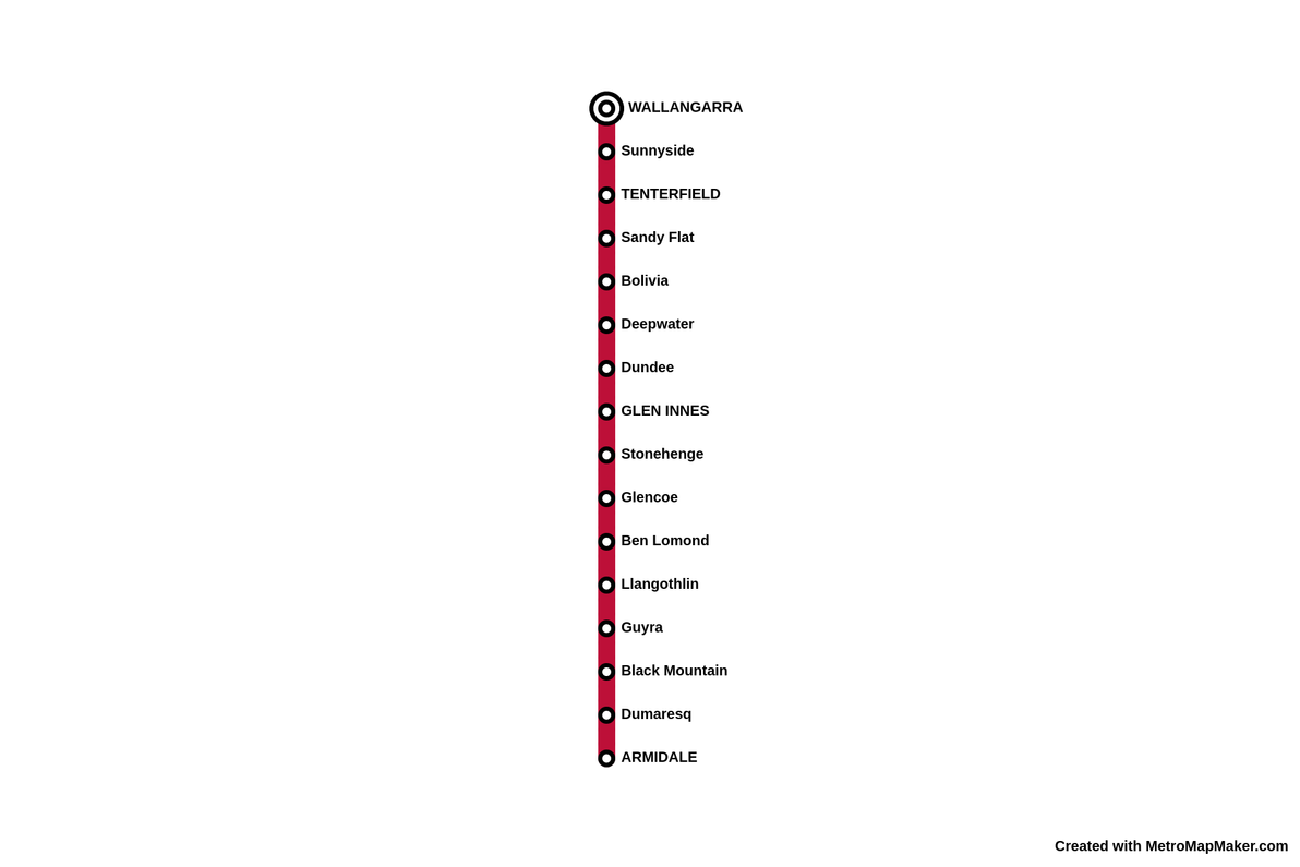
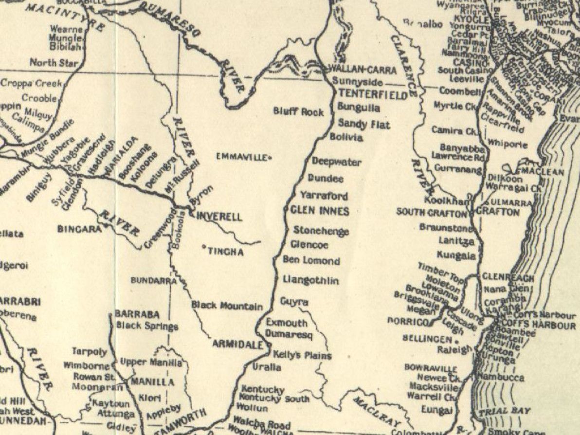
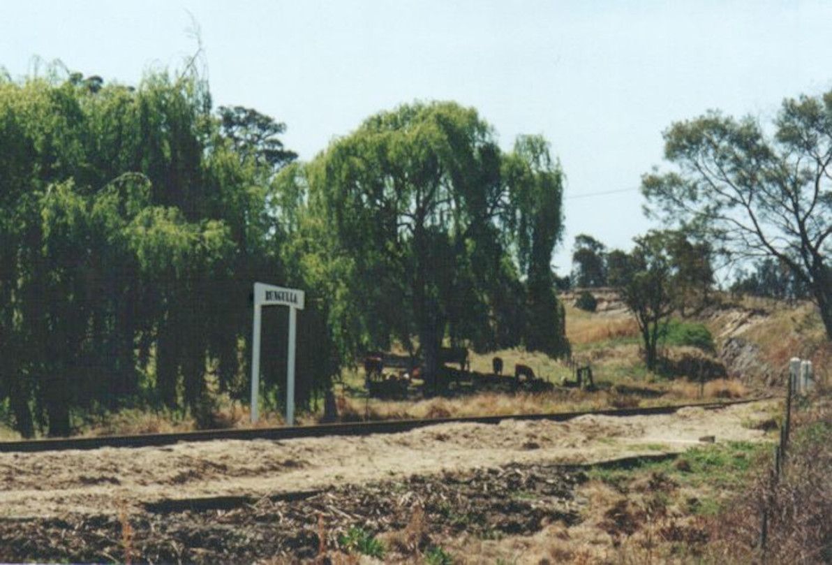
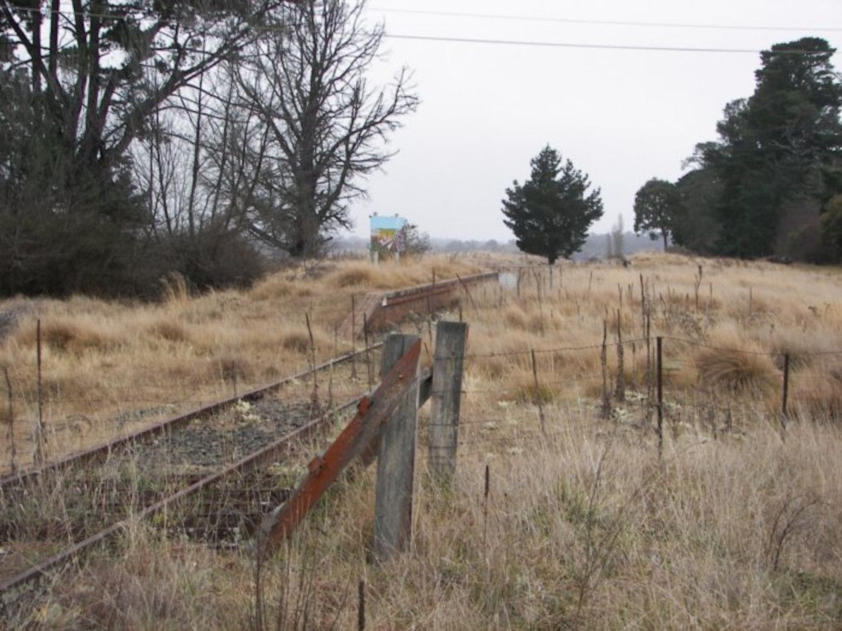
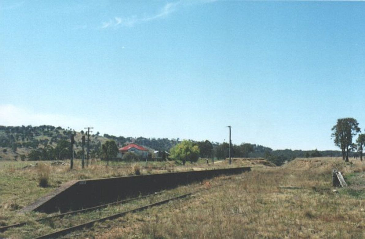
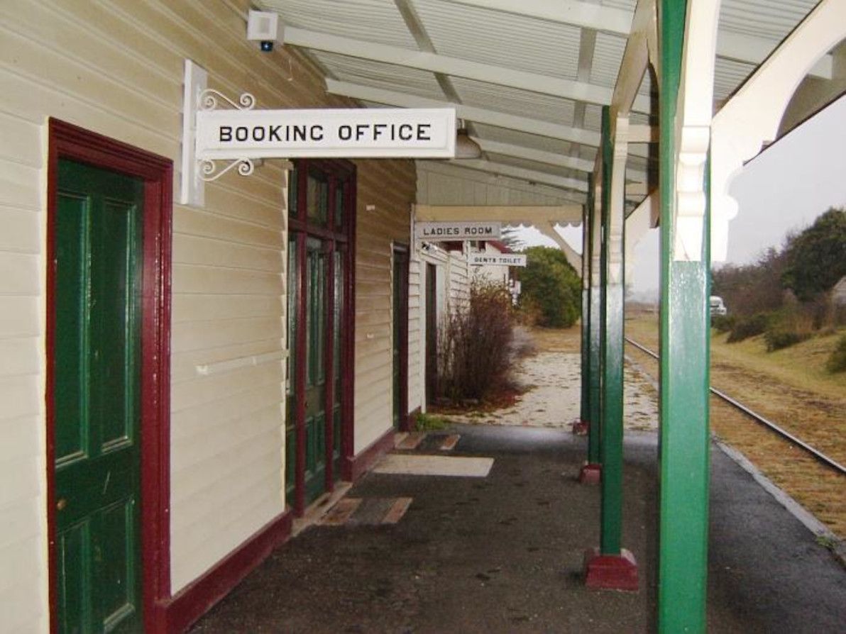
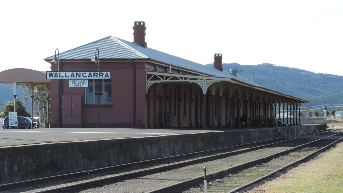
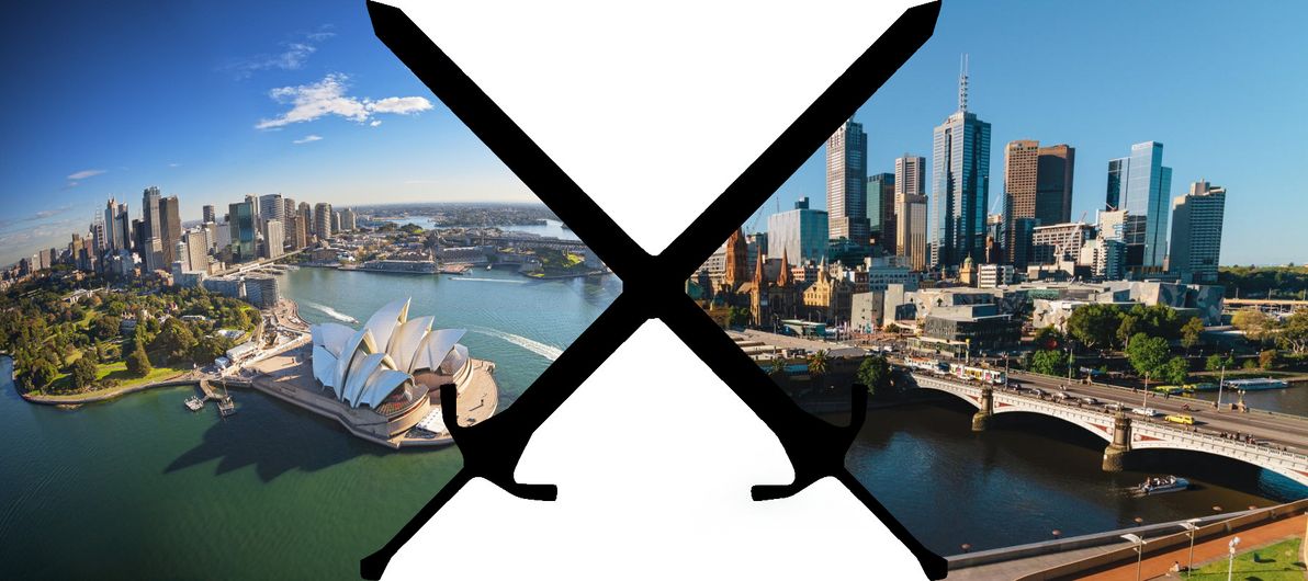

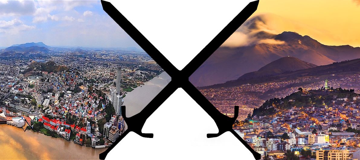
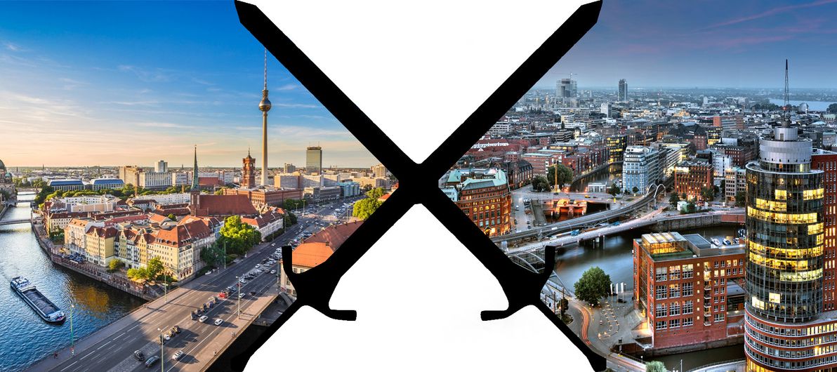

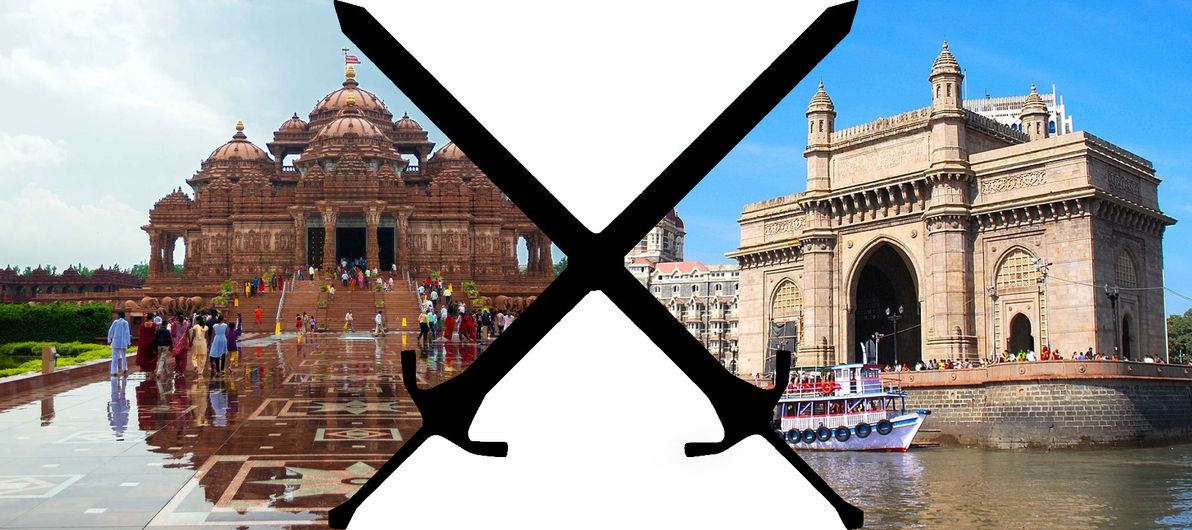
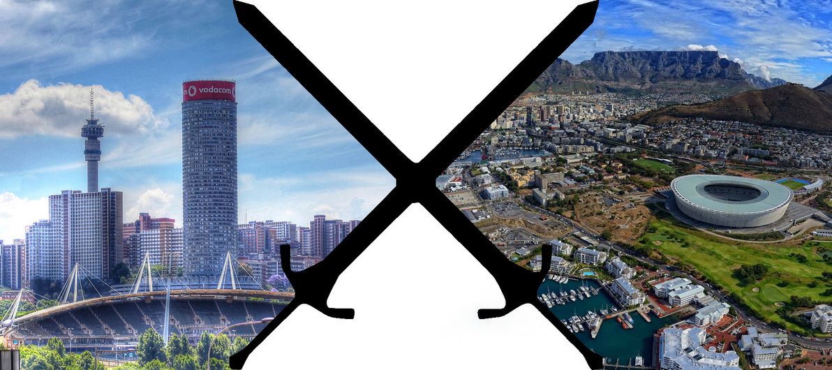


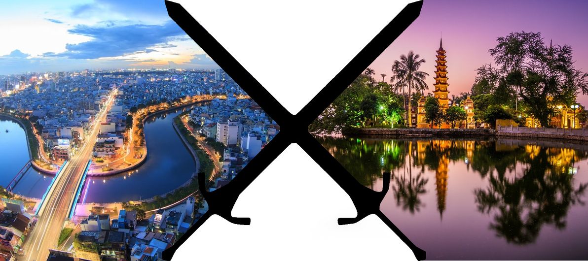
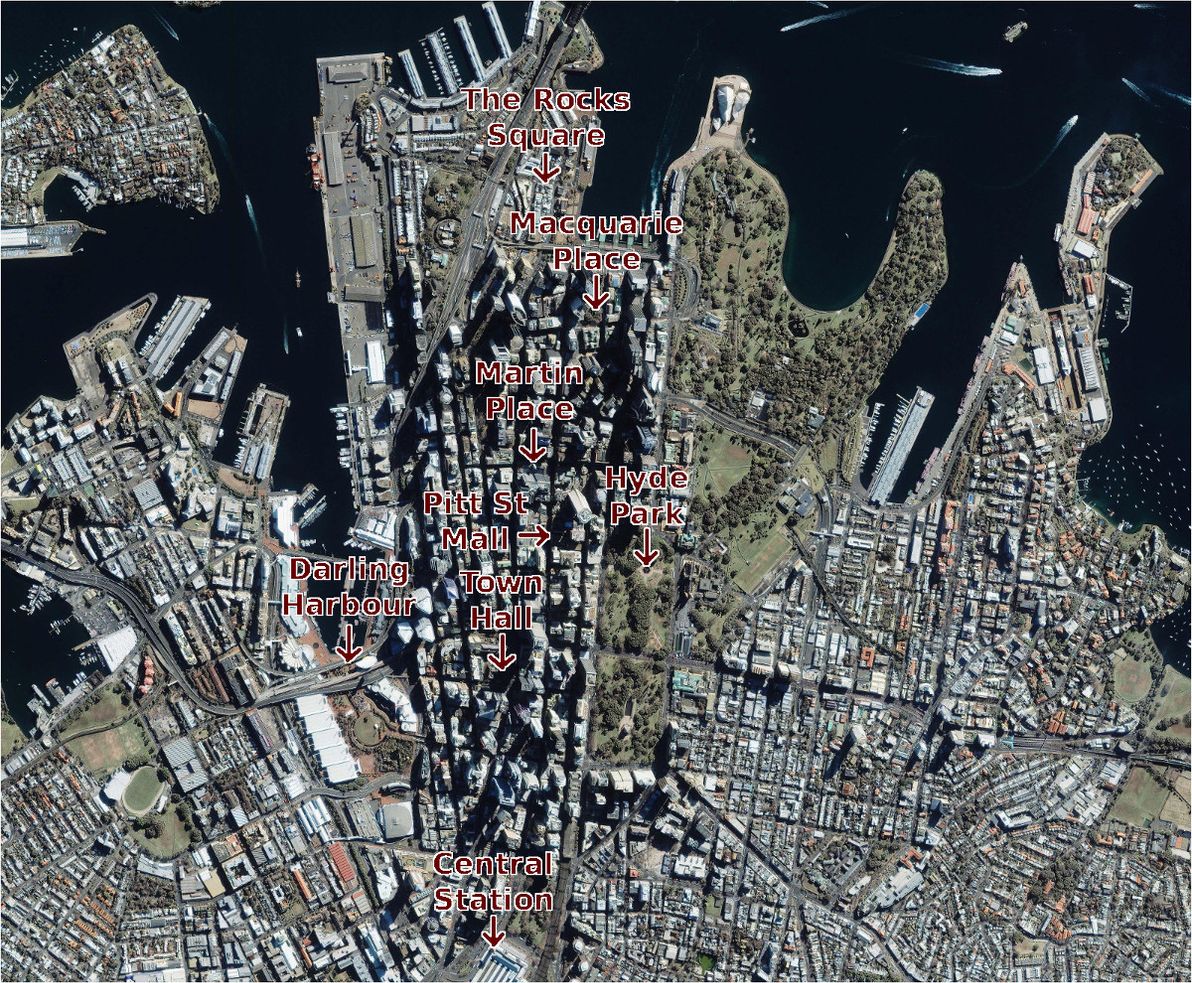
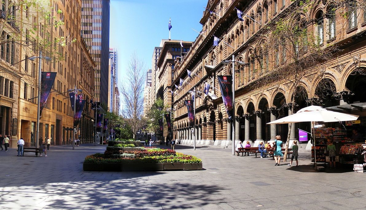
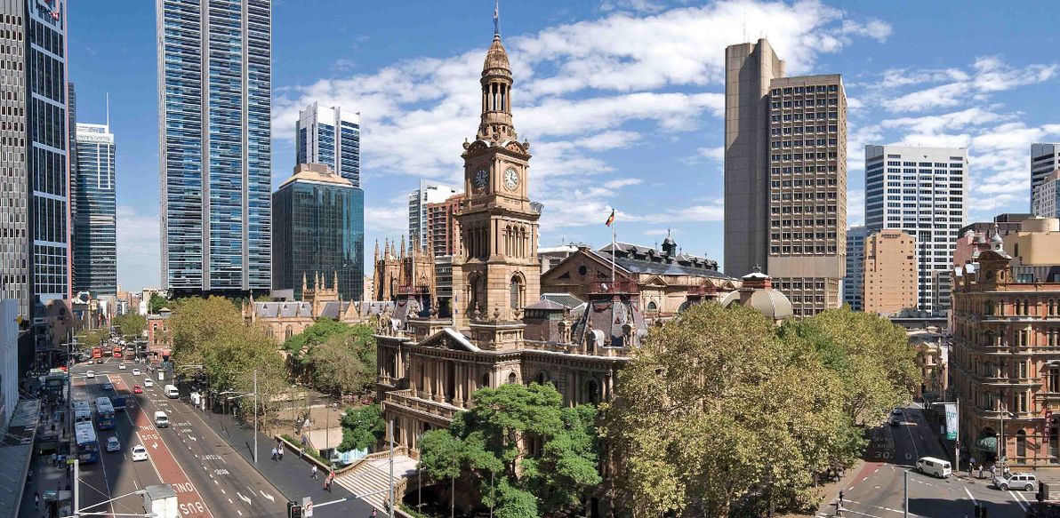
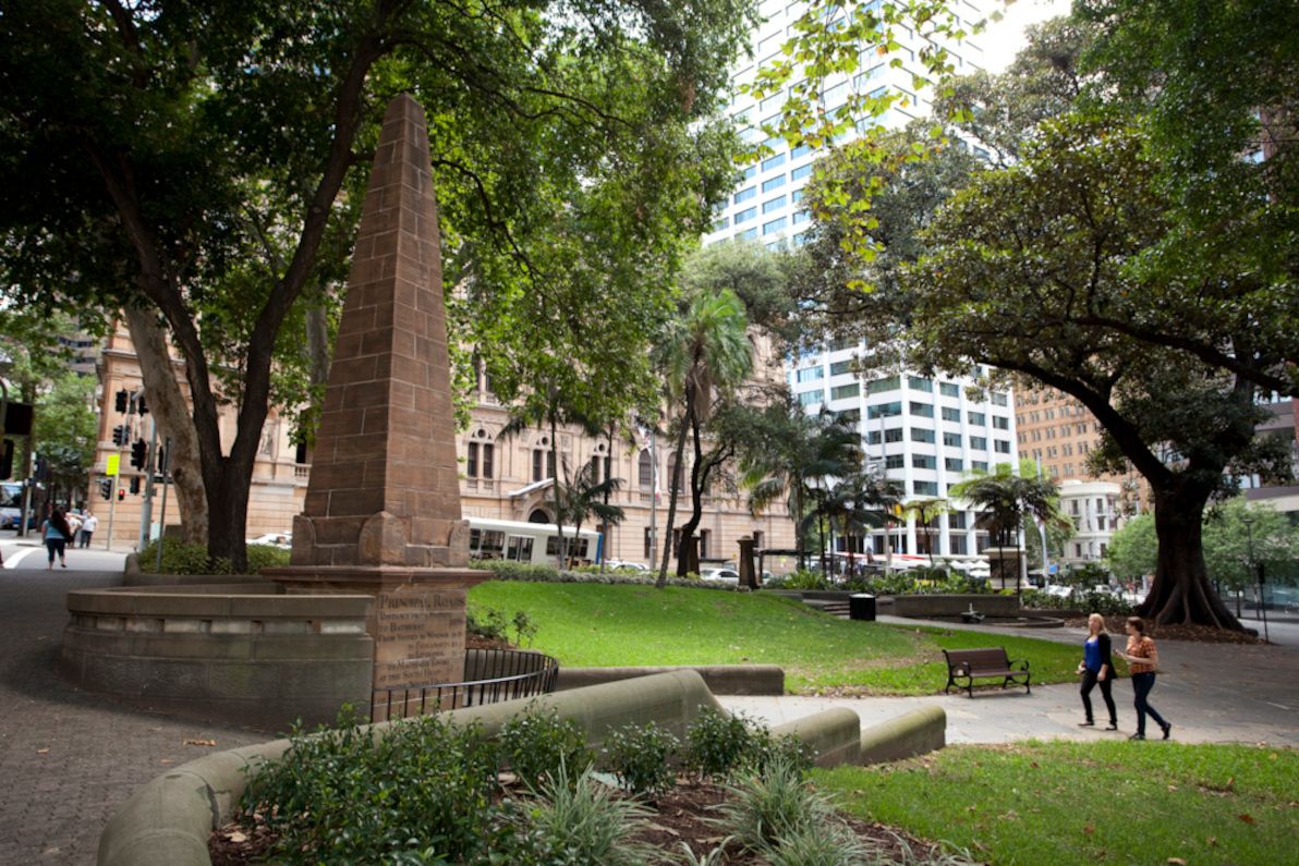
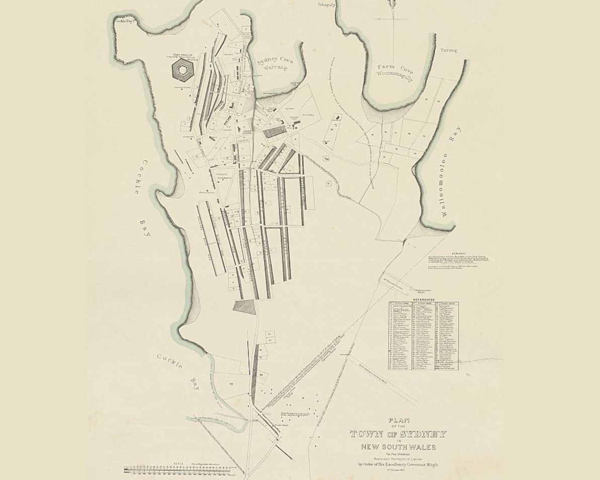
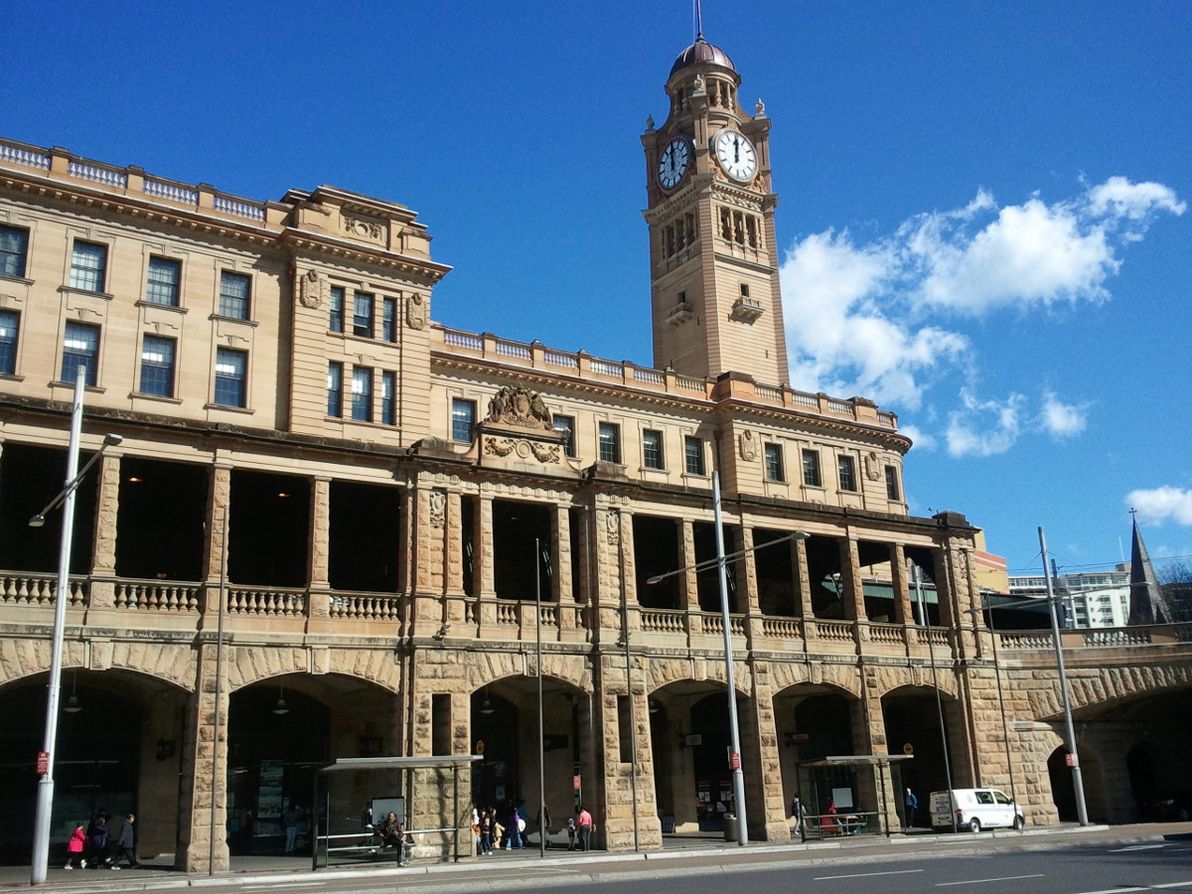
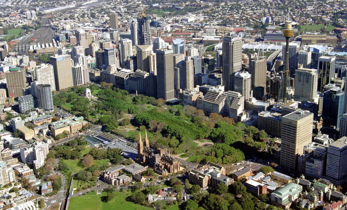
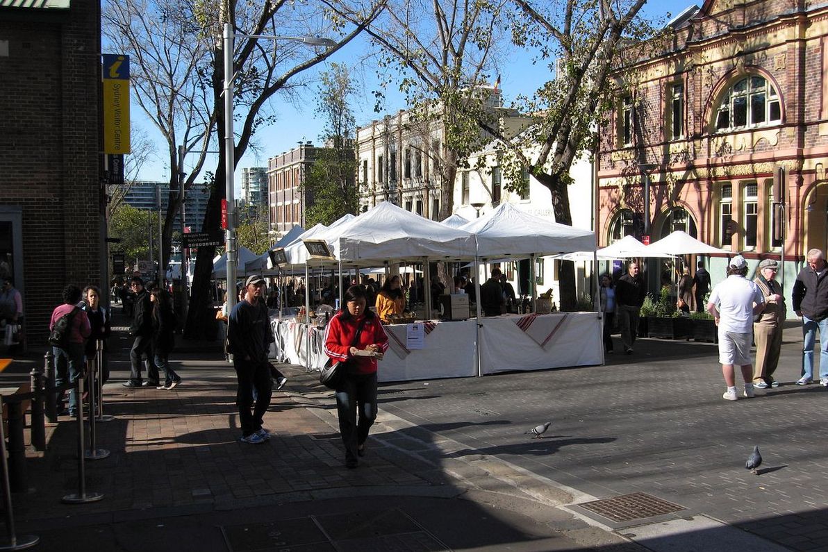
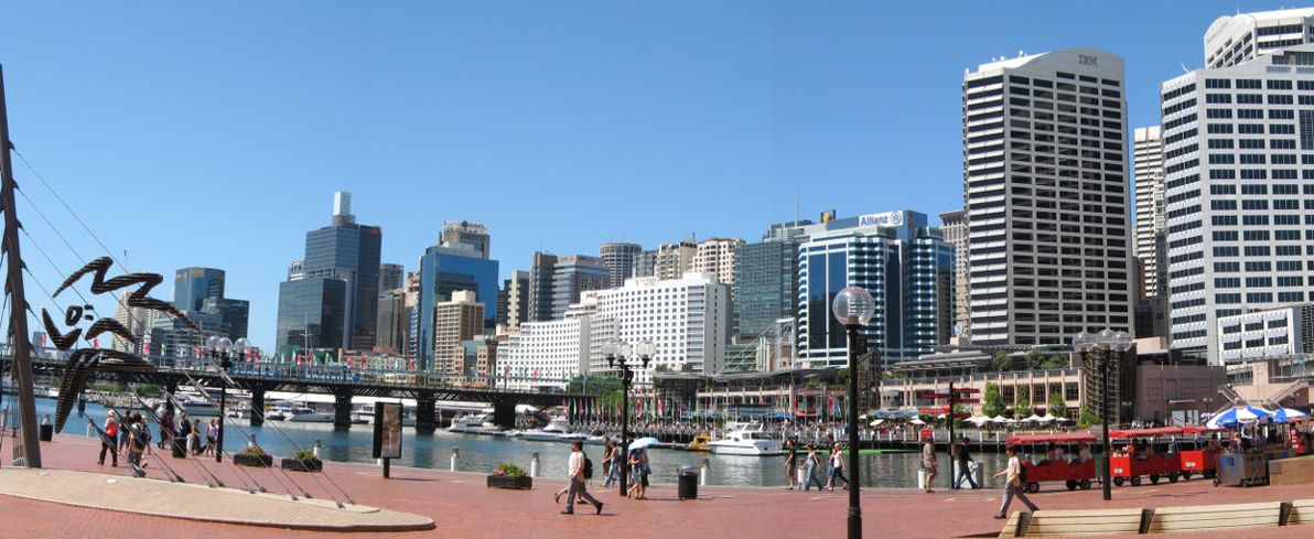
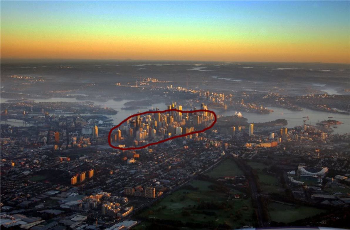
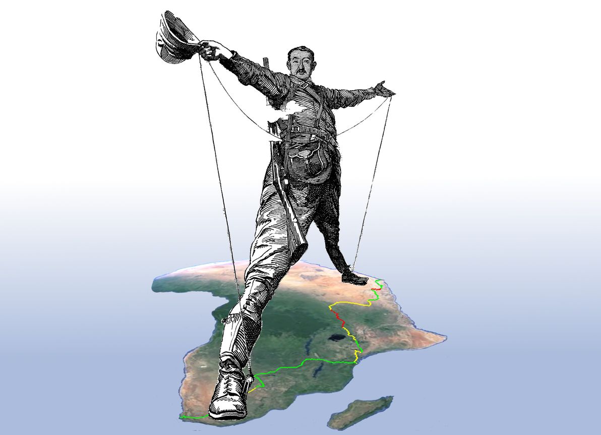
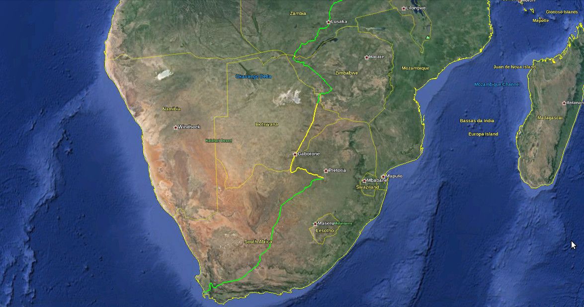
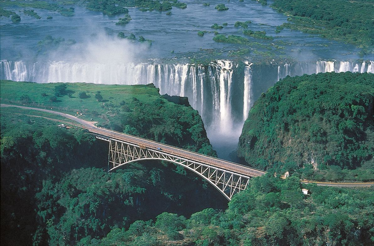
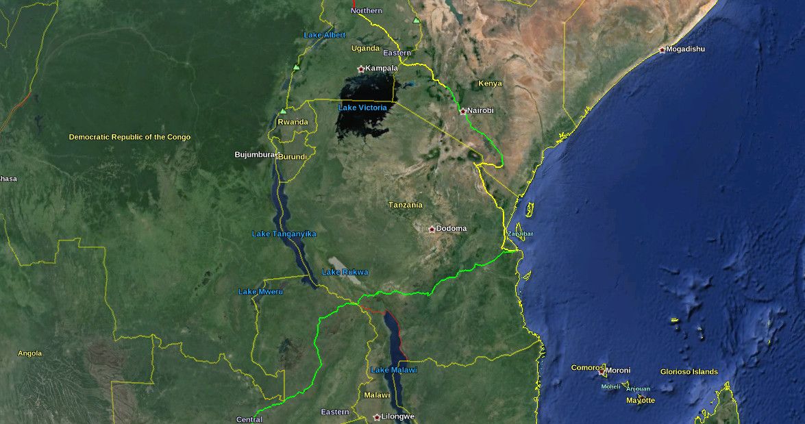
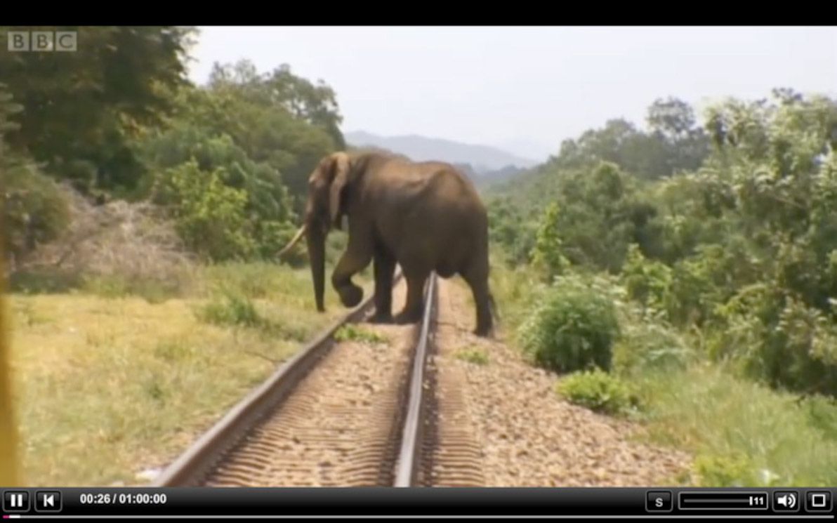
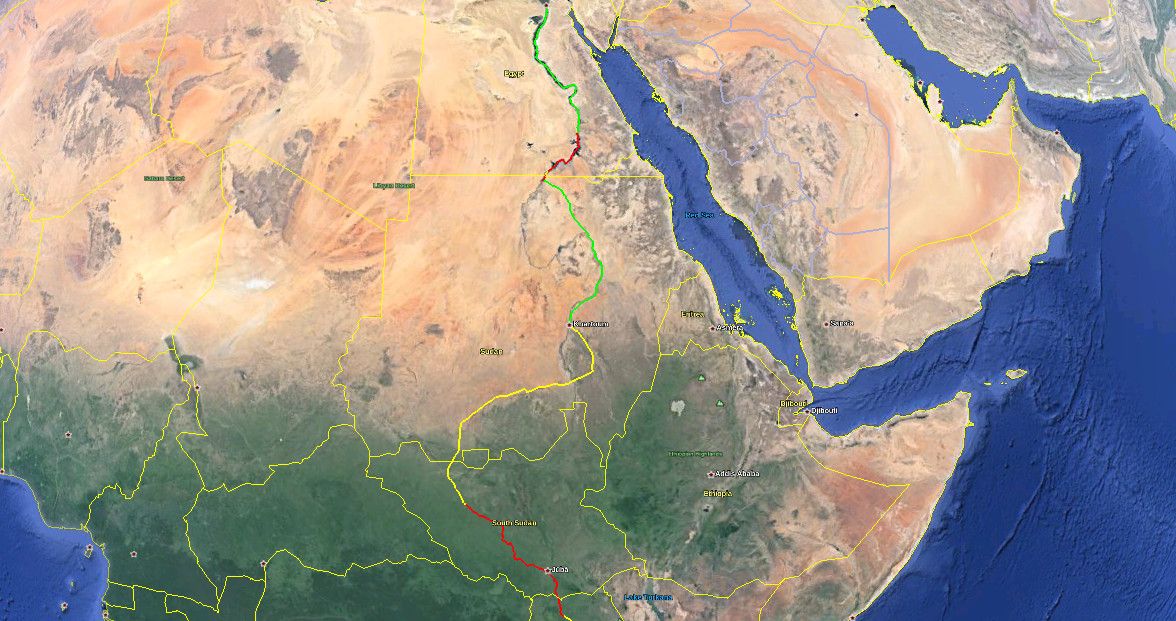
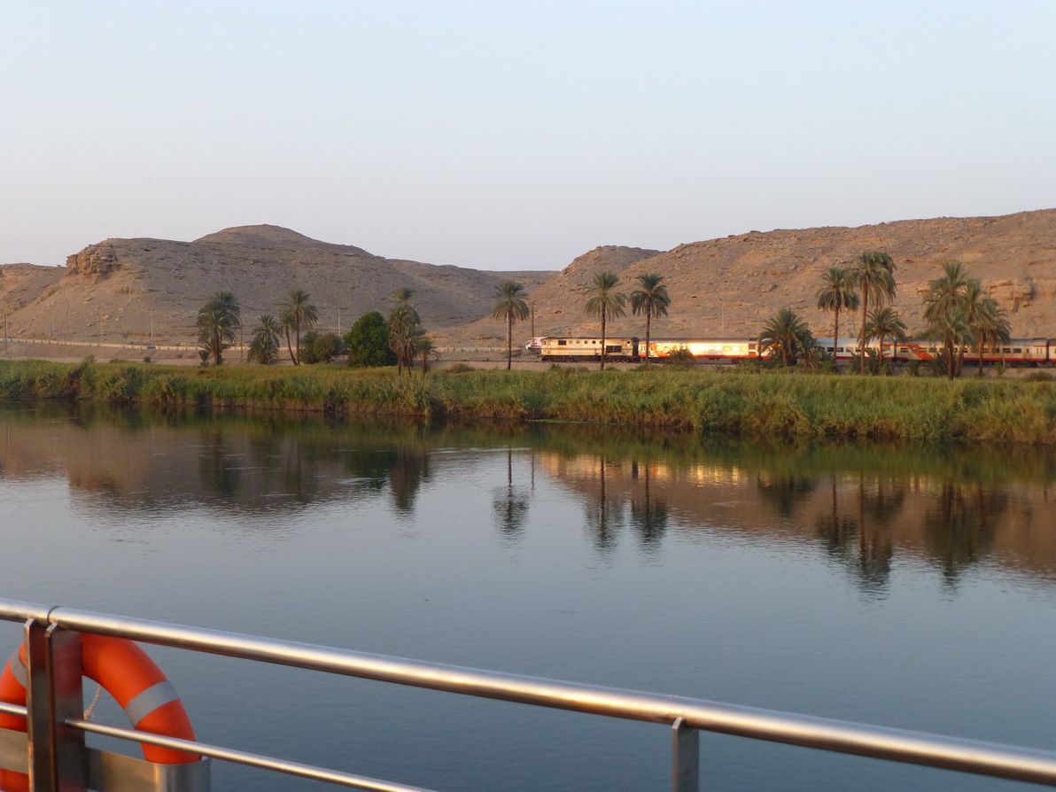
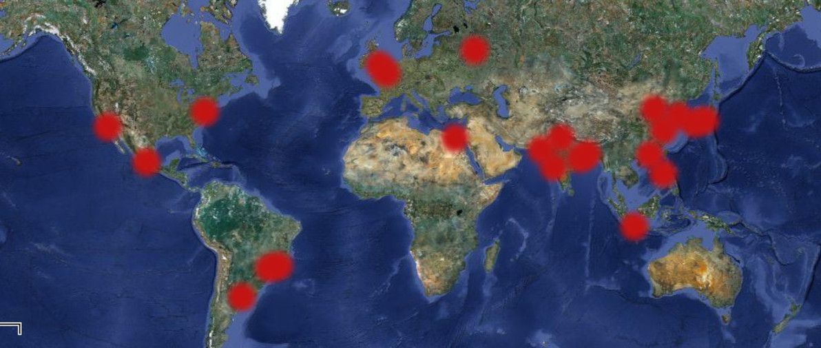
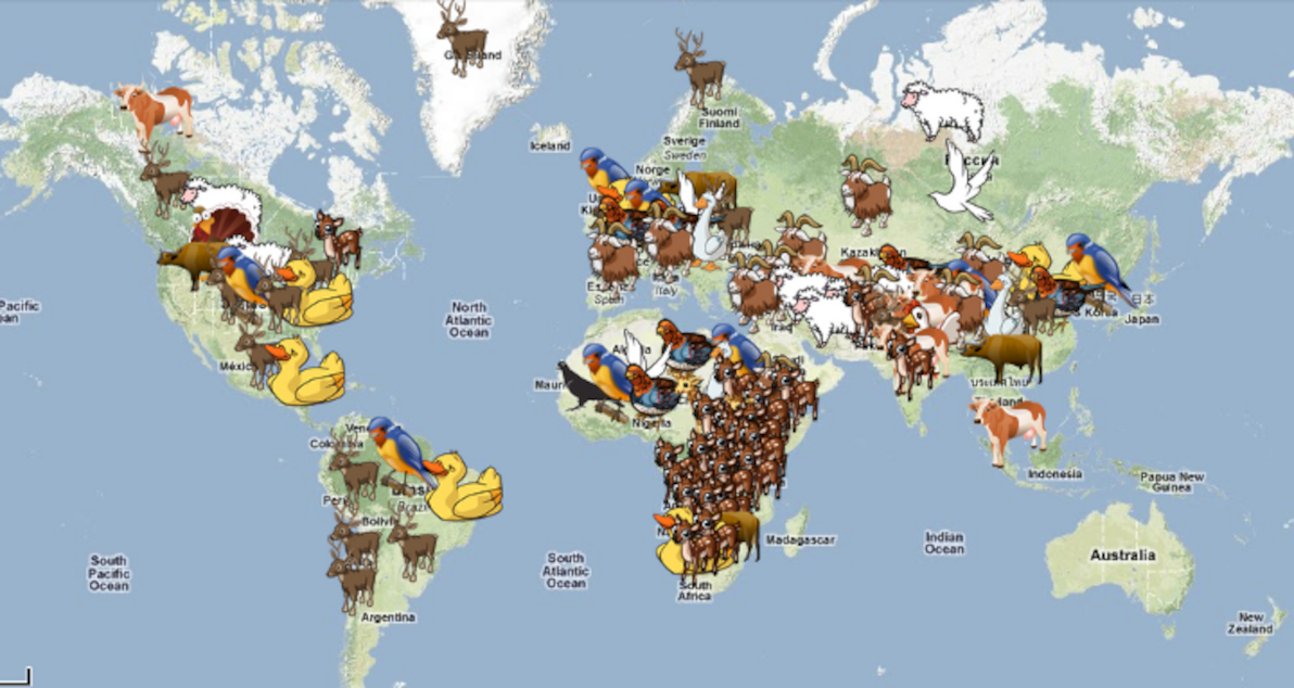
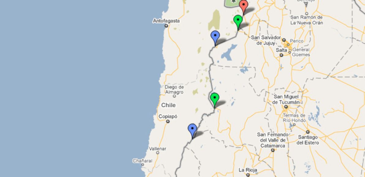
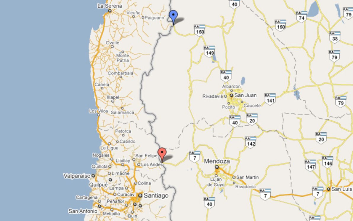
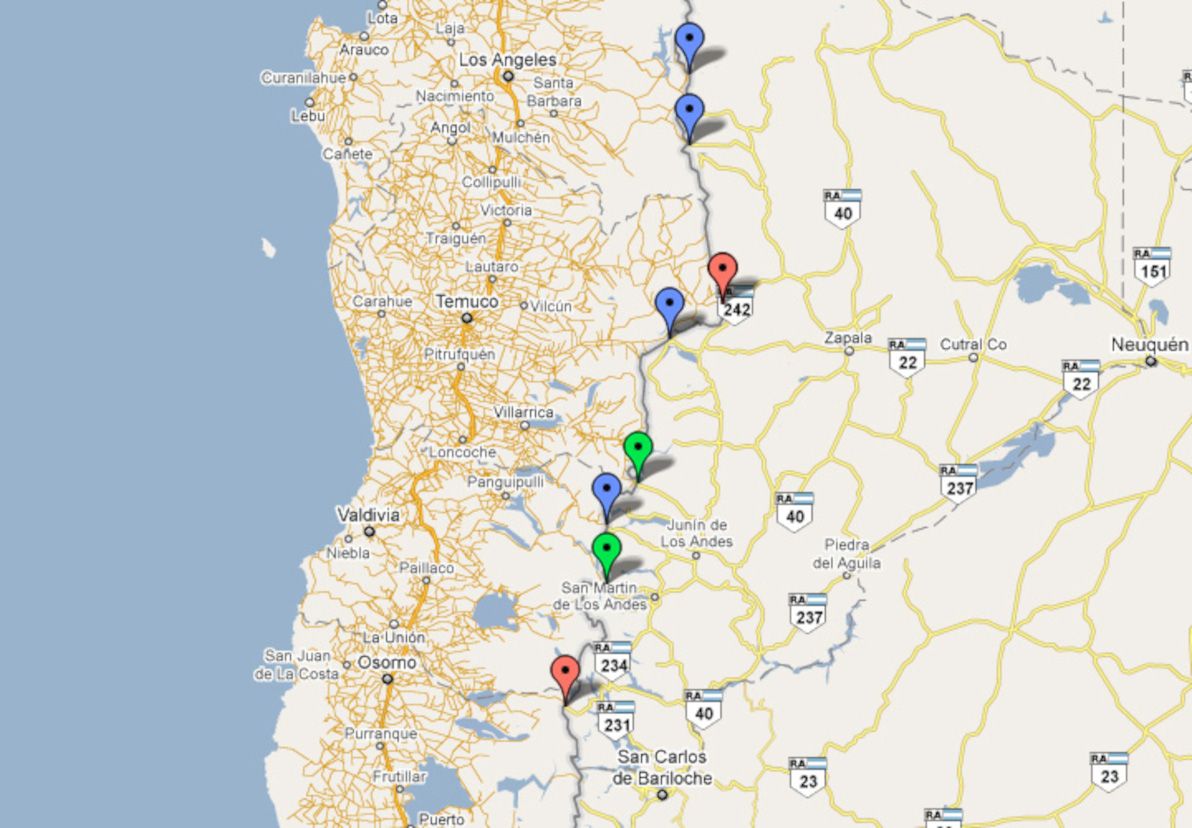
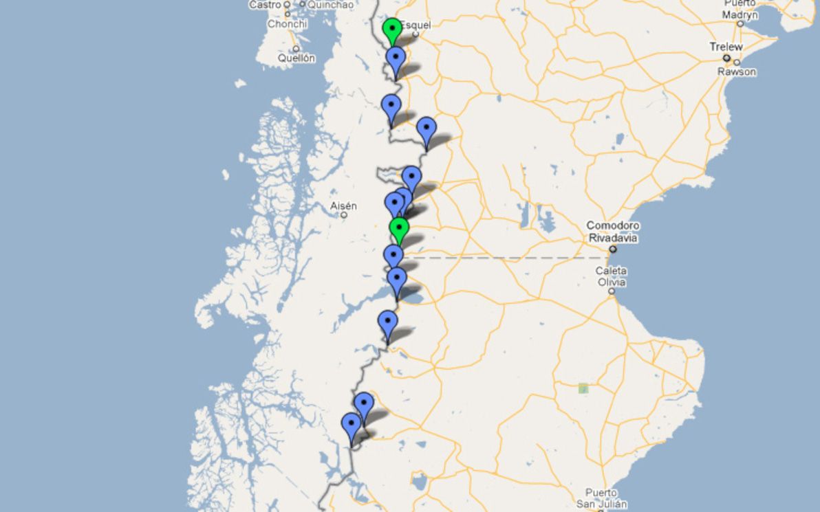
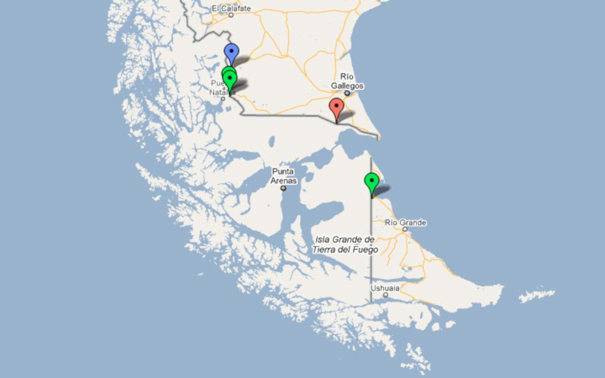