Where is the official centre of Sydney?
There are several different ways of commonly identifying the "official centre point" of a city. However, there's little international consensus as to the definition of such a point, and in many countries and cities the definition is quite vague.
Most reliable and most common, is to declare a Kilometre Zero marker as a city's (and often a region's or even a country's) official centre. Also popular is the use of a central post office for this purpose. Other traditional centre points include a city's cathedral, its main railway station, its main clock tower (which may be atop the post office / cathedral / railway station), its tallest building, its central square, its seat of government, its main park, its most famous tourist landmark, or the historical spot at which the city was founded.
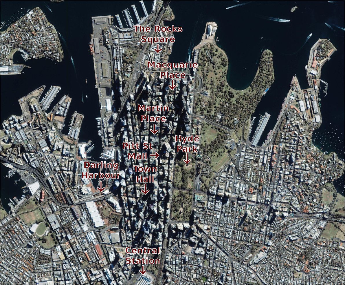
Image source: Satellite Imaging Corp.
My home town of Sydney, Australia, is one of a number of cities worldwide that boasts most of the above landmarks, but all in different locations, and without any mandated rule as to which of them constitutes the official city centre. So, where exactly in Sydney does X mark the spot?
Martin Place
I'll start with the spot that most people – Sydneysiders and visitors alike – commonly consider to be Sydney's central plaza these days: Martin Place. Despite this high esteem that it enjoys, in typical unplanned Sydney fashion, Martin Place was actually never intended to even be a large plaza, let alone the city's focal point.
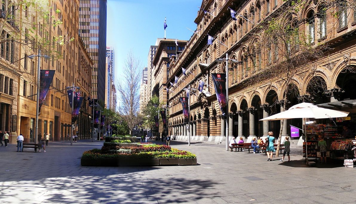
Image source: Wikimedia Commons.
The original "Martin Place" (for much of the 1800s) was a small laneway called Moore St between George and Pitt streets, similar to nearby Angel Place (which remains a laneway to this day). In 1892, just after the completion of the grandiose GPO Building at its doorstep, Martin Place was widened and was given its present name. It wasn't extended to Macquarie St, nor made pedestrian-only, until 1980 (just after the completion of the underground Martin Place Station).
The chief justification for Martin Place being a candidate on this list, is that it's the home of Sydney's central post office. The GPO building also has an impressive clock tower sitting atop it. In addition, Martin Place is home to the Reserve Bank of Australia, and the NSW Parliament and the State Library of NSW are very close to its eastern end. It's also geographically smack-bang in the centre of the "business end" of Sydney's modern CBD, and it's culturally and socially acknowledged as the city's centre.
Town Hall
If you ask someone on the street in Sydney where the city's "central spot" is, and if he/she hesitates for a moment, chances are that said person is tossing up between Martin Place and Town Hall. When saying the name "Town Hall", you could be referring to the underground train station (one of Sydney's busiest), to the Town Hall building itself, to Town Hall Square, or (most likely) to all of the above. Scope aside, Town Hall is one of the top candidates for being called the centre of Sydney.
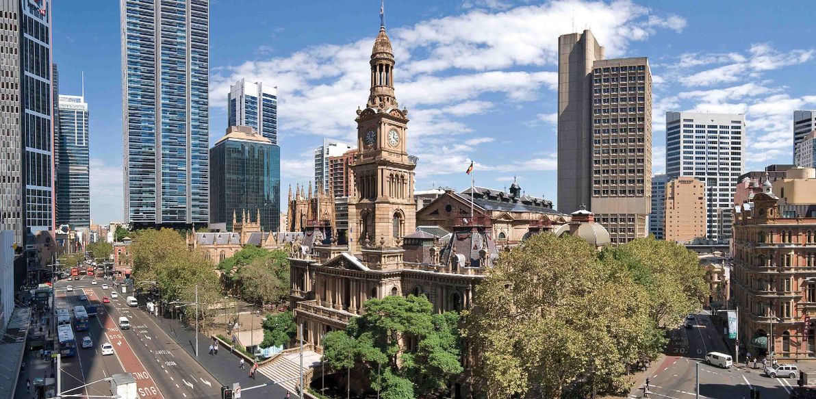
Image source: FM Magazine.
As with Martin Place, Town Hall was never planned to either resemble its current form, nor to be a centric location. Indeed, during the early colonial days, the site in question was on the outskirts of Sydney Town, and was originally a cemetery. The Town Hall building was opened in the 1890s.
In terms of qualifying as the potential centre of Sydney, Town Hall has a lot going for it. As its name suggests, it's home to the building which is the seat of local government for the City of Sydney (the building also has a clock tower). With its sprawling underground train station, with numerous bus stops in and adjacent to it, and with its location at the intersection of major thoroughfares George St and Park / Druitt St, Town Hall is – in practice – Sydney's most important transport hub. It's home to St Andrew's Cathedral, the head of the Anglican church in Sydney. And it's adjacent to the Queen Victoria Building, which – although it has no official role – is considered one of Sydney's most beautiful buildings.
Town Hall is also in an interesting position in terms of urban geography. It's one of the more southerly candidates for "official centre". To its north, where the historic heart of Sydney lies, big businesses and workers in suits dominate. While to its south lies the "other half" of Sydney's CBD: some white-collar business, but more entertainment, restaurants, sleaze, and shopping. It could be said that Town Hall is where these two halves of the city centre meet and mingle.
Macquarie Place
I've now covered the two spots that most people would likely think of as being the centre of Sydney, but which were never historically planned as such, and which "the powers that be" have never clearly proclaimed as such. The next candidate is a spot which was actually planned to be the official city centre (at least, as much as anything has ever been "planned" in Sydney), but which today finds itself at the edge of the CBD, and which few people have even heard of.
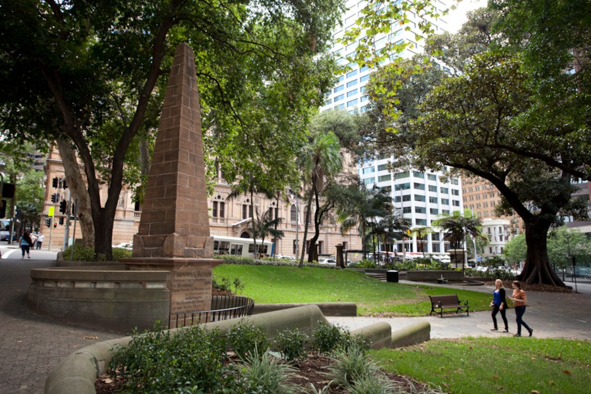
Image source: City Art Sydney.
Macquarie Place is a small, leafy, triangular-shaped plaza on the corner of Bridge and Loftus streets, one block from Circular Quay. Commissioned by Governor Lachlan Macquarie (most famous of all NSW governors, in whose honour ten gazillion things in Sydney and NSW are named), and completed in 1810, it is the oldest public space in Australia. It's also the closest (of the places on this list) to the spot where Sydney was founded, in present-day Loftus St.
At the time, the area of Macquarie Place was the geographic centre of Sydney Town. The original colonial settlement clung to what is today Circular Quay, as all trade and transport with the rest of the world was via the shipping in Sydney Cove. The early town also remained huddled close to the Tank Stream, which ran between Pitt and George streets before discharging into the harbour (today the Tank Stream has been entirely relegated to a stormwater drain), and which was Sydney's sole fresh water supply for many years. The "hypotenuse" edge of Macquarie Place originally ran alongside the Tank Stream; indeed, the plaza's triangular shape was due to the Tank Stream fanning out into a muddy delta (all long gone and below the ground today) as it approached the harbour.
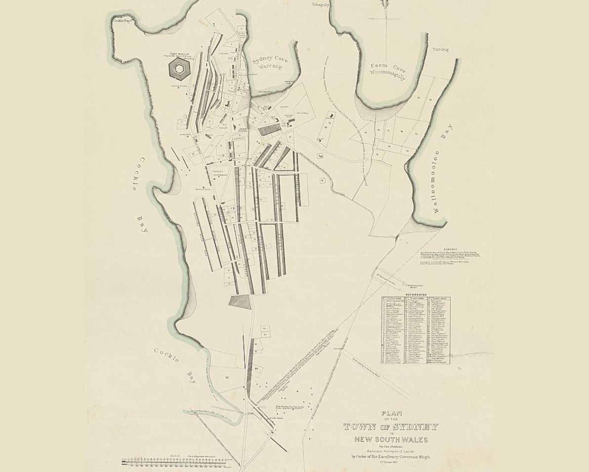
Image source: National Library of Australia.
The most striking and significant feature of Macquarie Place is its large stone obelisk, which was erected in 1818, and which remains the official Kilometre Zero marker of Sydney and of NSW to this day. The obelisk lists the distances, in miles, to various towns in the greater Sydney region. As is inscribed in the stonework, its purpose is:
To record that all the
Public Roads
Leading to the Interior
of the Colony
are Measured from it.
So, if it's of such historical importance, why is Macquarie Place almost unheard-of by Sydney locals and visitors alike? Well, first and foremost, the fact is that it's no longer the geographical, cultural, or commercial heart of the city. That ship sailed south some time ago. Also, apart from its decline in fame, Macquarie Place has also suffered from being literally, physically eroded over the years. The size of the plaza was drastically reduced in the 1840s, when Loftus St was built to link Bridge St to Circular Quay, and the entire eastern half of Macquarie Place was lost. The relatively small space is now also dwarfed by the skyscrapers that loom over it on all sides.
Macquarie Place is today a humble, shady, tranquil park in the CBD's north, frequented by tour groups and by a few nearby office workers. It certainly doesn't feel like the centre of a city of over 4 million people. However, it was declared Sydney's "town square" when it was inaugurated, and no other spot has been declared its successor ever since. So, I'd say that if you ask a Sydney history buff, then he/she would surely have to concede that Macquarie Place remains the official city centre.
Pitt St Mall
With the top three candidates done, I'll now cover the other punters that might contend for centre stage in Sydney. However, I doubt that anyone would seriously considers these other spots to be in the running. I'm just listing them for completeness. First off is Pitt St Mall.
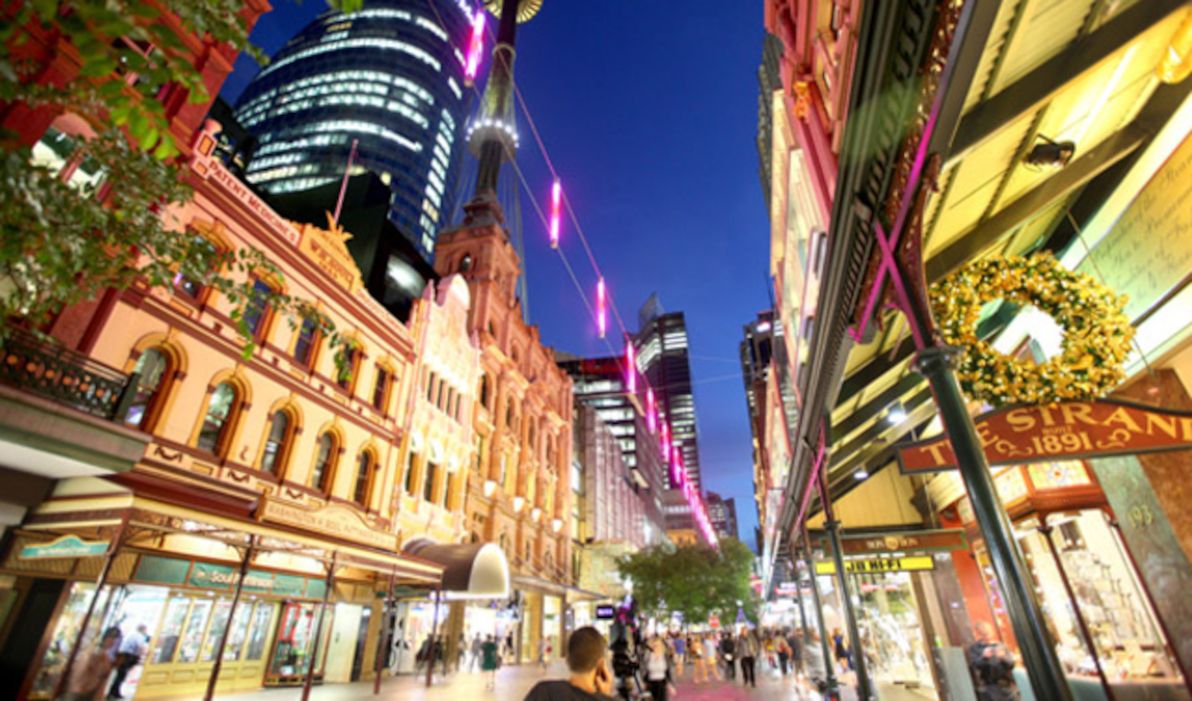
Image source: Structural & Civil Engineers.
Pitt St is one of the oldest streets in Sydney. However, there was never any plan for it to house a plaza. For much of its history (for almost 100 years), one of Sydney's busiest and longest-serving tram lines ran up its entire length. Since at least the late 1800s, the middle section of Pitt St – particularly the now pedestrian-only area between King and Market streets – has been Sydney's prime retail and fashion precinct. Some time in the late 1980s, this area was closed to traffic, and it's been known as Pitt St Mall ever since.
Pitt St Mall does actually tick several boxes as a contender for "official city centre". First and foremost, it is geographically the centre of Sydney's modern CBD, lying exactly in the middle between Martin Place and Town Hall. It's also home to Sydney Tower, the city's tallest structure. Plus, it's where the city's heaviest concentration of shops and of shopping centres can be found. However, the Mall has no real historical, cultural, or social significance. It exists purely to enhance the retail experience of the area.
Central Station
Despite its name, Sydney's Central Railway Station is not in the middle of the city, but rather on the southern fringe of the CBD. Like its more centric cousin Town Hall, the site of Central Station was originally a cemetery (and the station itself was originally just south of its present location). Today, Central is Sydney's busiest passenger station. We Sydneysiders aren't taught in school that it's All Stations To Central for nothing.
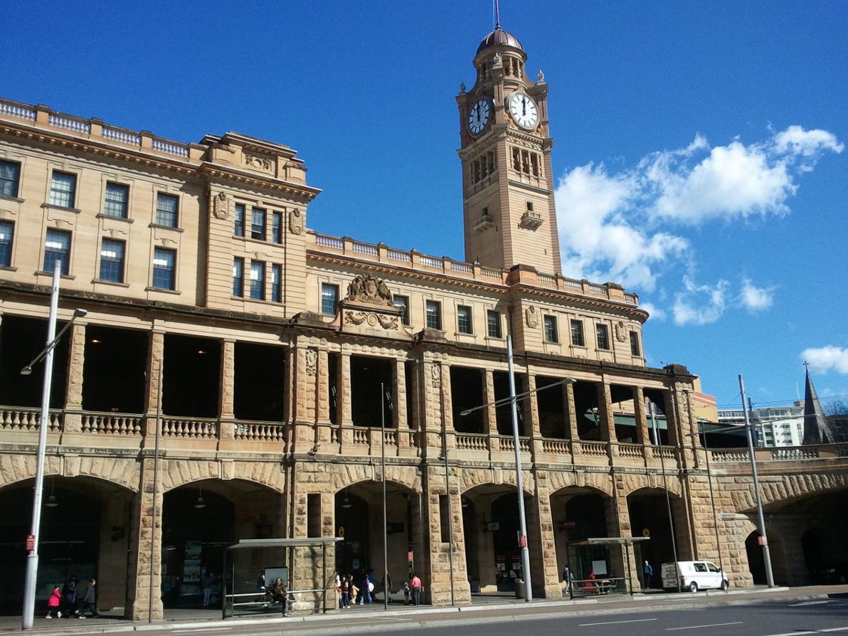
Image source: Weekend Notes.
Central Station is the most geographically far-flung of the candidates listed in this article, and due to this, few people (if any) would seriously vote for it as Sydney's official centre. However, it does have some points in its favour. It is the city's main train station. Its Platform 1 is the official Kilometre Zero point of the NSW train network. And its clock tower dictates the official time of NSW trains (and, by extension, the official civil time in NSW).
Hyde Park
Although it's quite close to Town Hall and Pitt St Mall distance-wise, Hyde Park hugs the eastern edge of the Sydney CBD, rather than commanding centre stage. Inaugurated by Big Mac in 1810, together with Macquarie Place, Hyde Park is Sydney's oldest park, as well as its official main park.
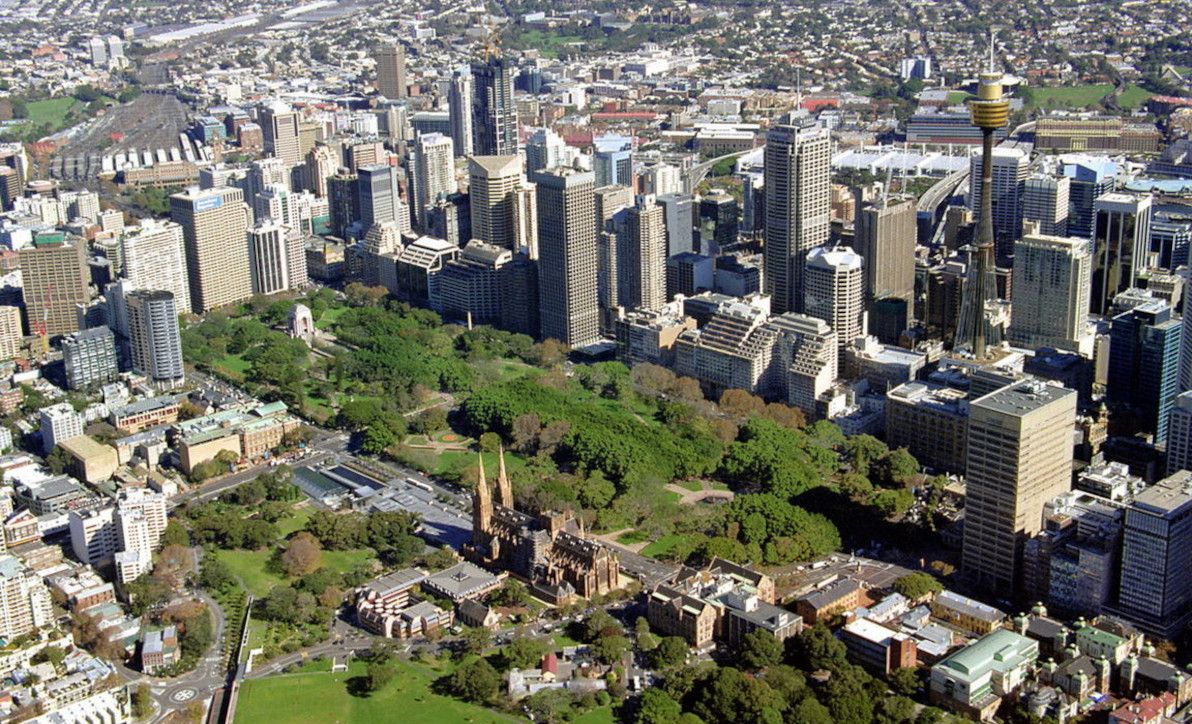
Image source: Floodslicer.
Macquarie's architect, Francis Greenway, envisaged Hyde Park eventually becoming Sydney's town square, however this never eventuated. Despite being Sydney's oldest park, present-day Hyde Park is also quite unrecognisable from its original form, having been completely re-designed and rebuilt several times. The obelisk at the head of Bathurst St, erected in 1857 (it's actually a sewer vent!), is probably the oldest artifact of the park that remains unchanged.
As well as being central Sydney's main green space, Hyde Park is also home to numerous important adjacent buildings, including St Mary's Cathedral (head of the Sydney Catholic Archdiocese), St James Church (the oldest church building in Sydney), the Supreme Court of NSW, and Hyde Park Barracks. Plus, Hyde Park boasts a colourful history, whose many anecdotes comprise an important part of the story of Sydney.
The Rocks Square
The place I'm referring to here doesn't even have a clearly-defined name. As far as I can tell, it's most commonly known as (The) Rocks Square, but it could also be called Clocktower Square (for the tower and shopping arcade adjacent to it), Argyle St Mall, Argyle St Market, or just "in front of The Argyle" (for the adjacent historic building and present-day nightclub). At any rate, I'm talking about the small, pedestrian-only area at the eastern end of Argyle St, in Sydney's oldest precinct, The Rocks.
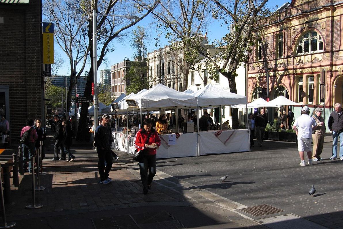
Image source: David Ing.
This spot doesn't have a whole lot going for it. As I said, it's not even named properly, and it's not an official square or park of any sort. However, it's generally considered to be the heart of The Rocks, and in Sydney's earliest days it was the rough location of the city's social and economic centre. Immediately to the west of The Rocks Square, you can walk or drive through the Argyle Cut, which was the first major earth-moving project in Sydney's history. Today, The Rocks Square is a busy pedestrian thoroughfare, especially on weekends when the popular Rocks Markets are in full swing. And one thing that hasn't changed a bit since day one: there's no shortage of pubs, and other watering-holes, in and around this spot.
Darling Harbour
I'm only reluctantly including Darling Harbour on this list (albeit lucky last): clearly off to the west of the CBD proper, it's never been considered the "official centre" of Sydney by anyone. For much of its history, Darling Harbour was home to a collection of dirty, seedy dockyards that comprised the city's busiest port. The area was completely overhauled as the showpiece of Sydney's celebrations for the 1988 Australian Bicentennary celebrations. Since then, it's been one of Sydney's most popular tourist spots.
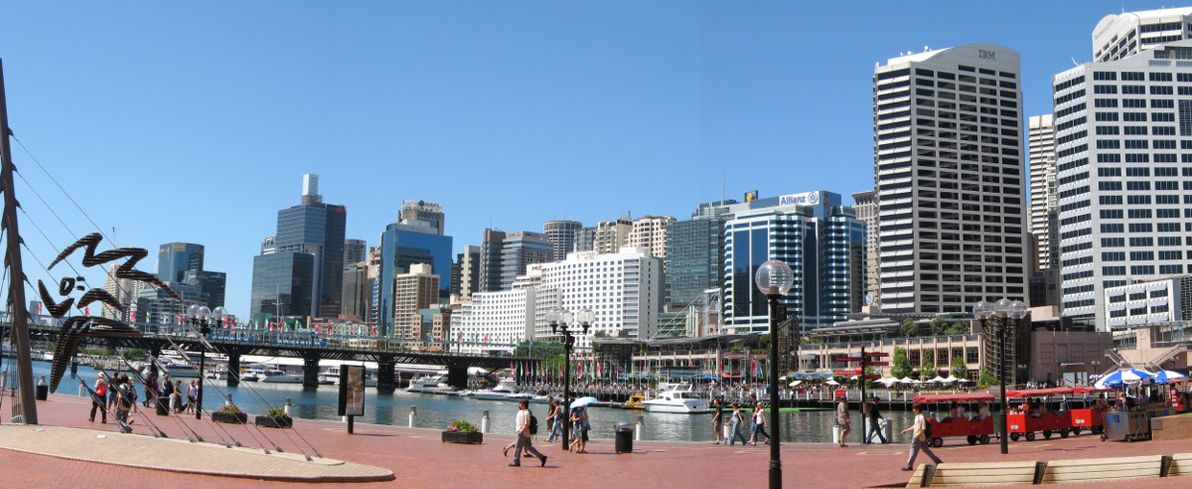
Image source: Wikimedia Commons.
Other than being a tourist trap, Darling Harbour's main claim to entitlement on this list is that it hosts the Sydney Convention Centre (the original centre was recently demolished, and is currently being rebuilt on a massive scale). The key pedestrian thoroughfare of Darling Harbour, just next to the IMAX Theatre (i.e. the spot in question for this list), is unfortunately situated directly below the Western Distributor, a large freeway that forms a roof of imposing concrete.
Final thoughts
Hope you enjoyed this little tour of the contenders for "official centre" of Sydney. Let me know if you feel that any other spots are worthy of being in the race. As for the winner: I selected what I believe are the three finalists, but I'm afraid I can't declare a clear-cut winner from among them. Purists would no doubt pick Macquarie Place, but in my opinion Martin Place and Town Hall present competition that can't be ignored.
Image source: SkyscraperCity.
Who knows? Perhaps the illustrious Powers That Be – in this case, the NSW Government and/or the Sydney City Council – will, in the near future, clarify the case once and for all. Then again, considering the difficulty of choice (as demonstrated in this article), and considering the modus operandi of the guv'ment around here, it will probably remain in the "too hard" basket for many years to come.