Haiti coverage in OpenStreetMap vs Google Maps
I was recently reading about how OpenStreetMap has been helping the Haiti relief effort, in the wake of the devastating earthquake that hit Haiti's capital back in January. Being one of the poorest and least developed countries in the world, Haiti's map coverage is very poor. However, a group of volunteers have radically changed that, and this has directly helped the aid effort on the ground in Haiti.
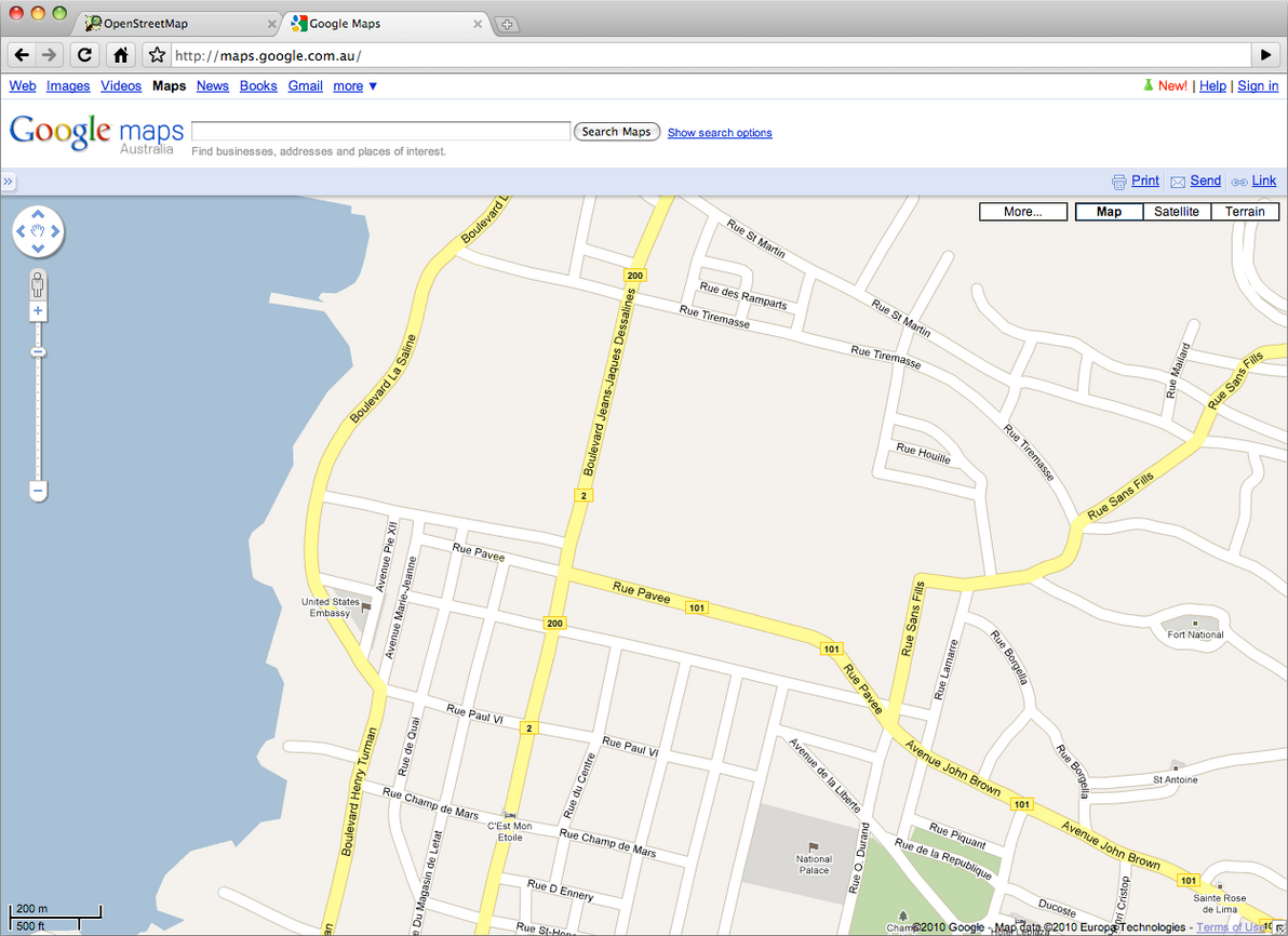
To see just how effective this volunteer mapping effort has been, I decided to do a quick visual comparison experiment. As of today, here's what downtown Port-au-Prince looks like in Google Maps:
And here it is in OpenStreetMap:
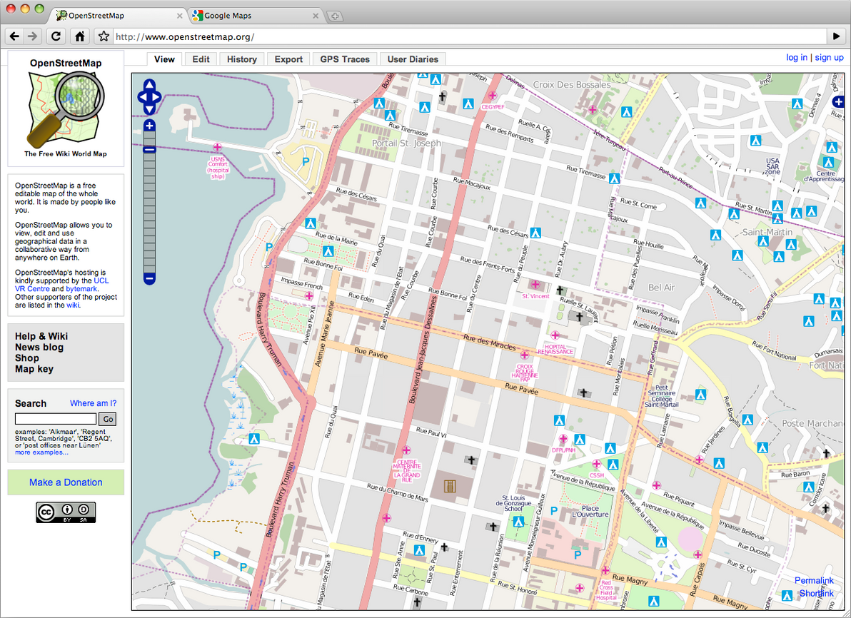
Is that not utterly kick-a$$? Google may be a great company with wonderful ideas, but even the Internet's biggest player (and the current leader in online mapping) simply cannot compete with the speed and the effectiveness that the OSM Haiti crisis project has demonstrated.
For those of you that aren't aware, OpenStreetMap is a map of the world that anyone can contribute to — the Wikipedia of online maps. This Haiti mapping effort is of course a massive help to the aid workers who are picking up the broken pieces of that country. But it's also testament to the concept that free and open data — coupled with a willingness to contribute — is not only feasible, it's also superior to commercial efforts (when push comes to quake).